Cooler, fresher air is edging in from the NW, but it remains warm and muggy for southern Britain. Yesterday's thunderstorms have cleared and Saturday looks fine for most
The thunderstorms have gone, and it is feeling fresher for the northwestern half of the UK. The heat and humidity are still around in the SE, Heathrow reached 32.2C yesterday (90F) which looks to be the peak of the week.
There were cracking thunderstorms about on Thursday, mostly for eastern England. Torrential downpours led to flash flooding; there was decent sized hail and incredible lightning displays. Other areas just waited under threatening skies with that close, humid feeling in the air, yet didn’t receive any rain.
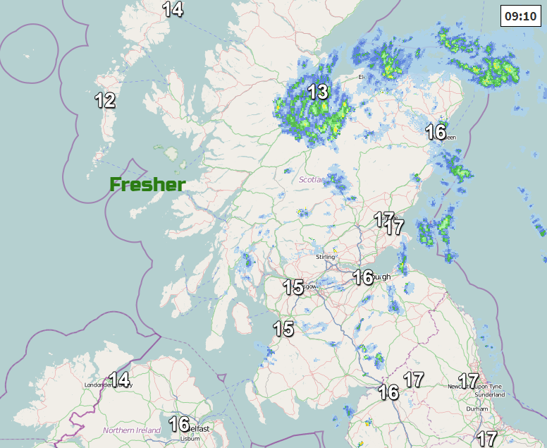
This morning it is already over 20C for London with a lot of sunshine over England. Other parts of the UK have more cloud, and there are showery bits over Scotland. This is a cold front moving down the UK today, which is introducing the cooler, fresher air. It begins to wave as it nears southern Britain, so it remains very warm here, particularly for SE England through the weekend.
In the westerly breeze, Belfast could see 18 or 19C in a sunny spell. Scotland will feel cooler with more cloud at 16 or 17C. Wales could just reach into the 20sC and across England temperatures will be in the 20s but vary in how the air feels. Behind the cold front, it will feel more comfortable with a brisk breeze picking up for northern England. Southern areas could reach 25 to 28C and still feel muggy.
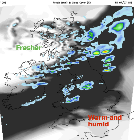
Through the day the band of cloud and showery outbreaks slips downwards over more of England and Wales, but southern England should stay dry and bright with more warm sunshine. Behind the front, there will be clearer skies, bright spells and still a few light showers blown in from the west.
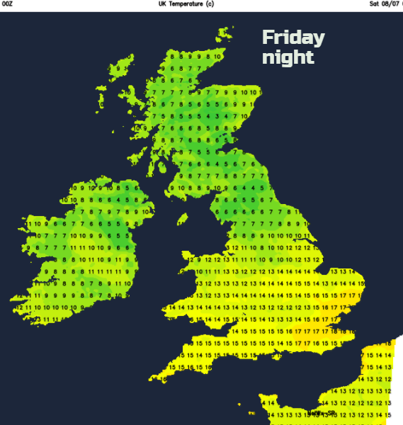
Overnight the winds fall light, and the front will be weak, so just a band of cloud over southern Britain. Temperatures here remain in the mid-teens, but to the north it will be clear and chilly. If you are off camping this weekend, take your wooly hat.
Saturday should start off fine and dry with still a bit more cloud in the south and SW. There will be a few showers over northern Scotland but otherwise a fine day. If all the heat and humidity has been too much for you, Saturday does look more comfortable even in the SE. NW Scotland looks cool with a brisk SW wind as rain sets in.
Northern England looks chilly overnight, as cloud and rain moves over western Scotland and then edges over Northern Ireland and more of Scotland for Sunday. Ahead of that there is still warmth but with a scattering of sharp showers. So, Saturday is the more settled day, Sunday more mixed.
One thing to watch will be these showers Sunday into early Monday. There is the potential for further heavy, slow moving downpours and thunderstorms.