


The heat and humidity returned yesterday, encouraging flying ants and dust devils, while today encouraging the development of thunderstorms for some, but many will stay hot and dry in the south.
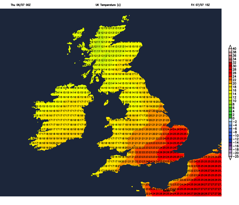
Wednesday saw the heat arrive across southern England, with a top temperature of 29.5C at Heathrow. There was reports of swarms of flying ants in the south yesterday, the hot and humid conditions apparently are ideal for the proliferation as they start breeding. More on this the BBC’s Springwatch here, but here is an excerpt on the phenomenon:
It is believed that the ants pick the day based on the temperature, humidity and day length. The warm and humid conditions make the day perfect for the start of their breeding period, according to Dr Mark Downs from the Society of Biology. Flight is eased by the heat of the air, the humidity makes the ground softer for mated queens to dig nests.
If you though that was unsual, then there was even a dust-devil in the northern Home Counties yesterday
A plume of warm and humid air continues to spread north across England this morning, already it’s 20C in London at 7am and feeling sticky, with the temperature set to reach 30C here this afternoon and the mid to high twenties elsewhere across England and Wales. However, a low moving up from the southwest and cold front in across central areas will trigger some thunderstorms, but not everyone will catch one. The heat and humidity hangs on across southern areas on Friday, though turning cloudier in the north – with some patchy rain. And although fine and warm weather will hang on across the south and southeast on Saturday, the general theme of the weekend and into the start of next week is for cooler, fresher and more changeable conditions to take over, with a risk of showers or longer spells of rain.
For now, SE Wales, southern, central and eastern England have started Thursday mostly on a warm, dry and sunny note – though there is a few thundery showers developing across the northern Home Counties and East Anglia which will track northeast this morning. However, further north it’s a rather different picture, with extensive cloud and outbreaks of rain across north and west Wales, northern England, N. Ireland and Scotland. The rain is heavy across the far north of England and eastern Scotland – with some thunderstorms across NE England at breakfast time.
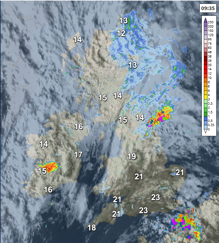
Through the morning and into the afternoon, further scattered heavy and perhaps thundery showers will drift northeast across SE England and East Anglia, but on the whole it should stay mostly dry, sunny and hot today across southern England – though more in the way of cloud than yesterday.
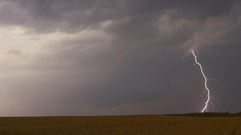
Sunny spells and mostly dry for east Wales, Midlands and eastern England this morning, cloudier for northern England with outbreaks of rain, locally thundery, continuing across the far north. Into the afternoon, we could see some scattered thunderstorms develop across parts of northern England as morning rain clears here, these developing further south across the Midlands and parts of eastern England too after the mostly dry morning, some of which maybe severe – see here for more in depth storm forecast.
Scotland seeing quite cloudy and damp conditions this morning, though persistent rain mostly towards the north and east and tending to turn drier and brighter from the west away from northern Scotland.
Temperatures widely reaching the mid-twenties across England and Wales and as high as 28-29C inland across the Midlands and SE England – perhaps 30C in London, cooler around coasts. Across the far north of England and Scotland – where it's cloudier, cooler and fresher, 15-19C the highs.
Thunderstorms across the East Midlands and eastern England this evening, with a risk of hail and torrential rain leading to flash-flooding, will eventually clear out into the North Sea after dark, to leave a dry night with clearer spells across England and Wales, but quite a warm and uncomfortable night, especially in the south. Across Scotland and Northern Ireland, well here we’ll see cloudier conditions with outbreaks of rain moving in, though eastern Scotland may stay dry.
Friday will start dry and bright for many across England and Wales, though perhaps tending to cloud over across more northern and western areas with a chance of a few showers, while some patchy light rain arrives for Northern Ireland and spreading in to the northwest by evening. Scotland seeing some patchy rain at first but this clearing to sunny spells, though a few scattered showers may develop in the east, while thicker cloud and patchy light rain arrives across southern areas by evening. Still warm across England and Wales with temperatures reaching the low to mid twenties generally, hot across the southeast – where temperatures may reach 26-28C. Cooler and fresher for Scotland and N. Ireland – with 16-18C the highs
A weak and slow-moving weather front straddling central areas to start the weekend will bring a band of thicker cloud and some patchy light rain or drizzle to Wales, the Midlands and northern England on Saturday, mostly dry and sunny across southern England and to the north across Scotland and N. Ireland. Sunday is looking mostly dry and bright or sunny for England and Wales, but cooler and fresher than now, cloudy and breezy with rain across Scotland.


