Cooler conditions set to prevail this weekend with some patchy rain and showers, but with some drier and brighter weather too. Next week sees unsettled weather often dominating.
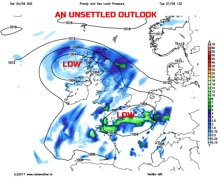
The heat and humidity of the past week are now, for many, a distant memory. The weekend’s weather will see an area of low pressure tracking to the north of the British Isles. Many areas will be markedly cooler and fresher than of late, and while plenty of dry weather is forecast, there will be some rain and showers at times. The further outlook isn’t great either, especially if you’re a fan of the heat and humidity. With plenty of wet weather on the way next week with low pressure dominating.
Today
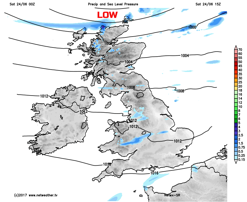
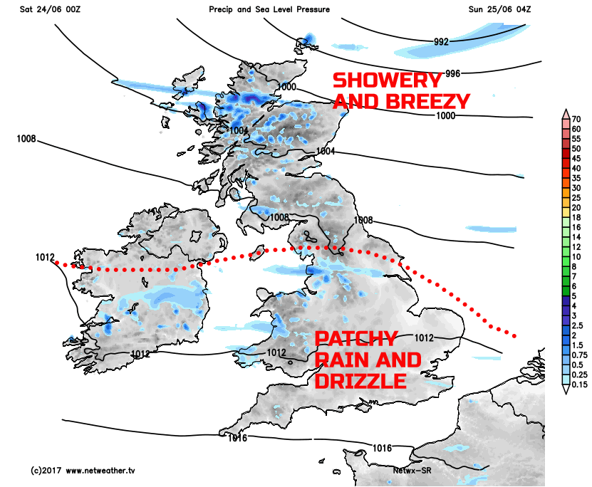
Through the course of Saturday and a relatively weak weather front will be wiggling its way across parts of England and Wales, this feature highlighted well on the weather chart from the Met Office below. This type of weather front is known as a frontal wave, fortunately, however, it won’t bring any widespread heavy rain. Instead some nuisance value patchy light rain and drizzle will affect parts of NW England, Wales, SW England and perhaps some other southern counties of England at times today. There will be some cloud breaks, so some brighter or sunny spells are possible.
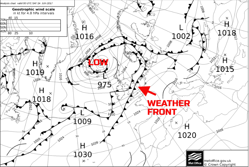
The low pressure slowly passing to the north of Scotland will signal a windy day across the north. Some scattered showers are possible here too, especially across northern and western areas of Scotland. Best of the weather through Saturday will be across more sheltered eastern areas of England where some decent spells of sunshine will develop, and it’ll be mainly dry, same also applies to parts of Ireland.
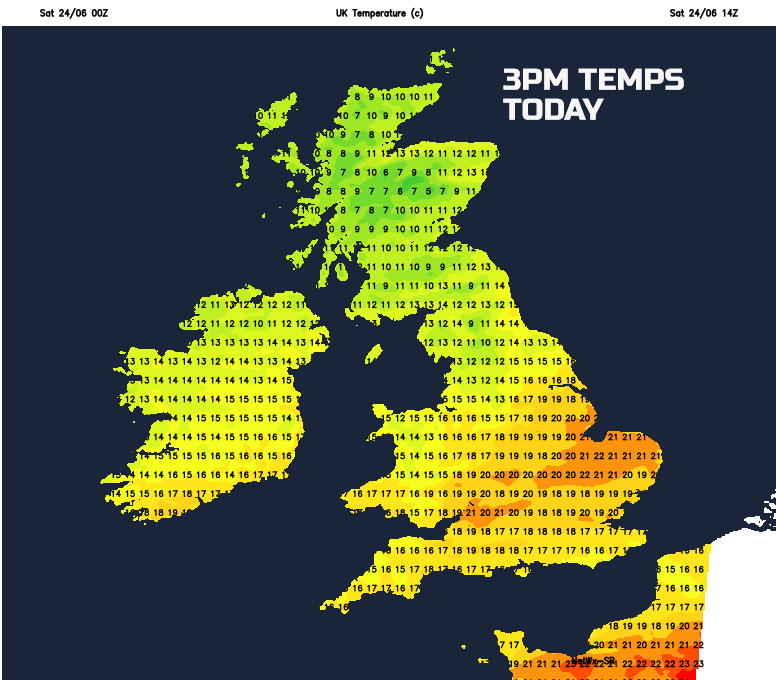
Temperatures through the day will be markedly lower than recently. While still pleasantly warm across parts of England and Wales, it will, for many regions, be a cool and fresh late June day. Maximum temperatures will range between 11C and 18C generally, but locally up to 19C to 21C across sheltered eastern areas of England, perhaps especially across E Anglia.
Tonight
Through into Saturday evening and overnight and our wiggling weather front will continue to maintain a risk of thicker cloud and some patchy light rain and drizzle across parts of England and Wales. Some extensive low cloud and hill fog may well develop too as the night progresses. Many northern areas of the British Isles though will have a mixture of clear spells and scattered showers, while remaining particularly breezy across Scotland too. It will be a cool night, if not rather chilly across rural areas of the north, with minimum temperatures ranging between 7C and 12C, overall, across the UK.
Sunday
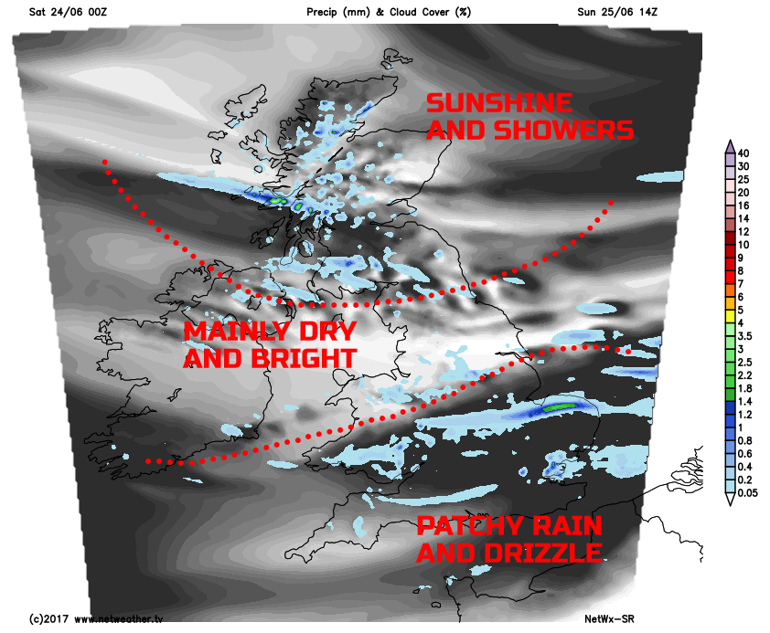
We start Sunday with rather overcast and damp conditions dominating across much of England and Wales. As Sunday progresses, albeit slowly, conditions will gradually improve across England and Wales. The rain and drizzle will eventually clear away to the east and cloud should break to allow for some bright or sunny intervals. But probably not until the latter half of the afternoon and through into the evening. Across Scotland and parts of N England, it will be another bright and breezy day with a mixture of the sunshine and scattered showers. Some of the best conditions through the day will be across parts of N England where plenty of sunshine is likely to develop, but remaining cool.
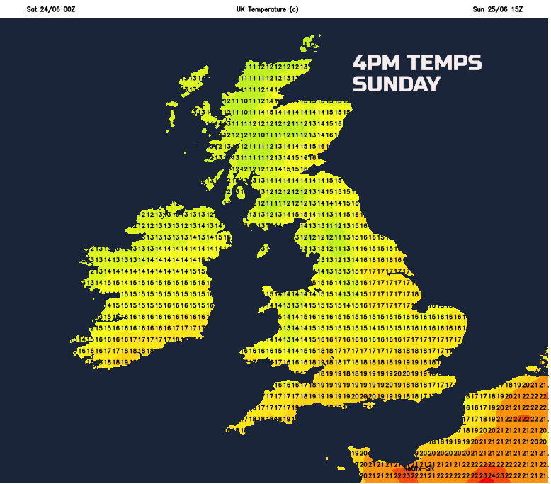
Temperatures on Sunday will be similar to Saturday, but given the cloudier and damp conditions across England and Wales, then temperatures here will likely be a few degrees lower. Feeling unusually cool across the north of the UK as well given a continued W or NW’ly moderate or fresh, locally strong wind.
Looking further ahead into next week and, if you’re hoping for a return of some summer weather, then you’ll likely be disappointed. In what has been a particularly topsy-turvy June, which started wet and cool, followed by the hot weather more recently. It does look as though unsettled conditions will dominate through the final week of the month. Low-pressure systems are set to move into the UK off the N Atlantic early in the week bringing fairly widespread rain and showers. There is high confidence that these unsettled conditions will then prevail throughout. Showers or longer spells of rain, perhaps with some thunderstorms in places, means that some locally large rainfall totals may begin to develop. And temperatures, look to be nothing better than near average.