The real heat and humidity has gone although still some pleasant warmth in the SE today. It will be windy at the weekend and cooler for most, with a bit of rain at times.
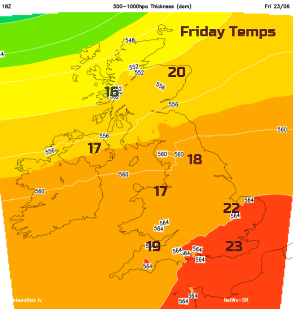
‘Only’ 27.2C yesterday in Kent as the recent heat and humidity gone now from most of the UK. The top temperature today will be lower still, with values typically around 17 to 22C for Friday in a brisk westerly flow off the Atlantic. Several places around London have seen over 33C this week with Heathrow reaching 34.5C on the Solstice (94F).
This weekend will be fresher, cooler than we have experienced recently and so more comfortable. It will be blustery with showers coming in from the west and still strong sunshine coming and going. A bit more like ordinary UK summer conditions rather than heatwave or washout.
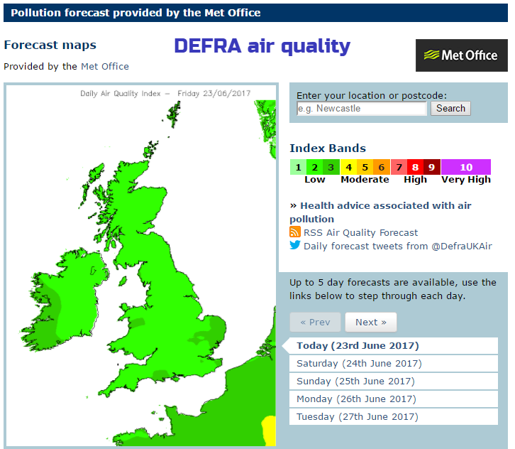
Air pollution levels will fall to low for the next few days, but the pollen levels remain high, even very high in the south. Grass pollen season is in full swing, and there are high levels of fungal spores and weed pollen to add to that.
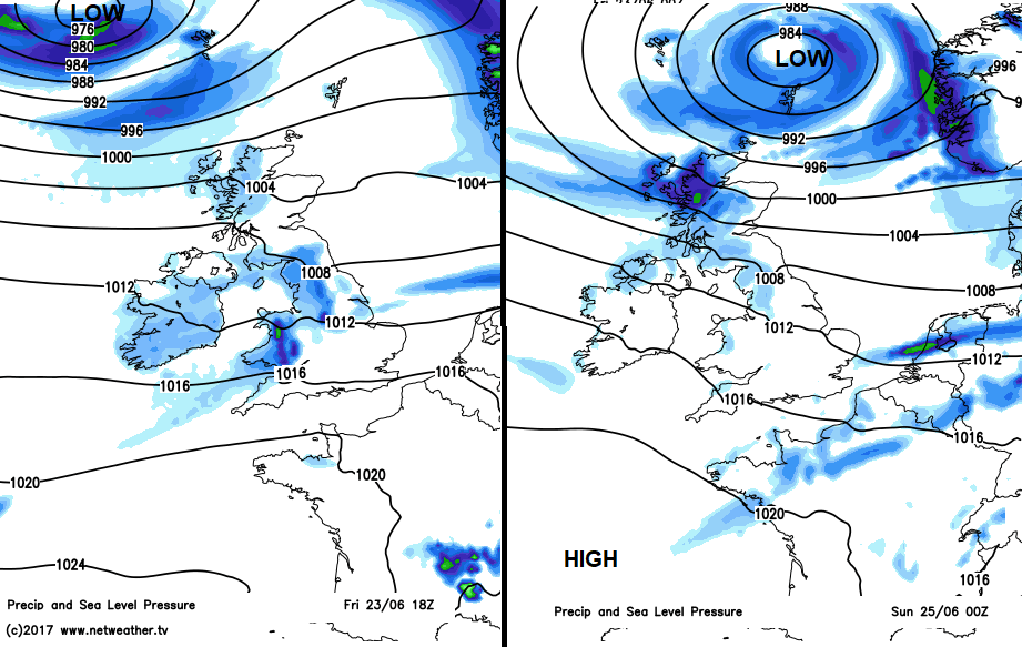
High pressure remains away to the south, but an area of low pressure will skirt past northern Scotland for the start of the weekend. Today it will throw frontal bands across the UK bringing more cloud and outbreaks of rain. Ahead of the front a fresh SW wind, then behind a more westerly wind which will be strong around northern coasts.
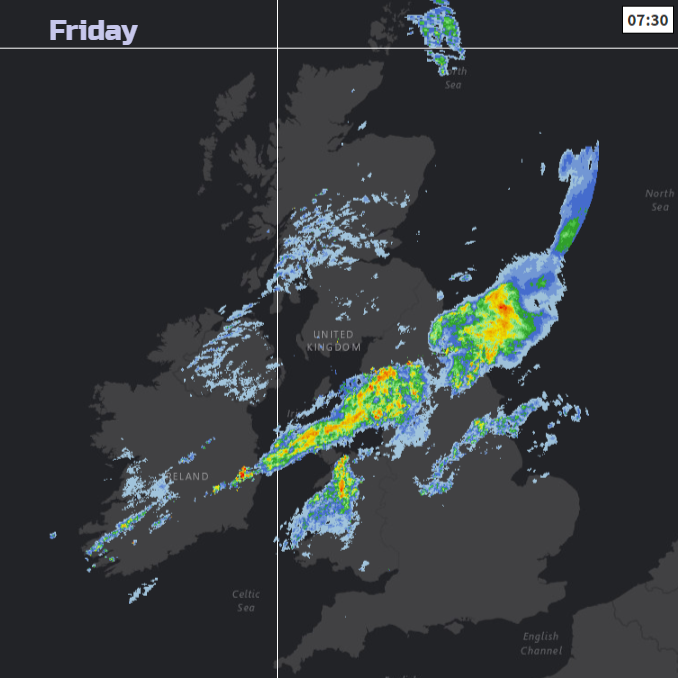
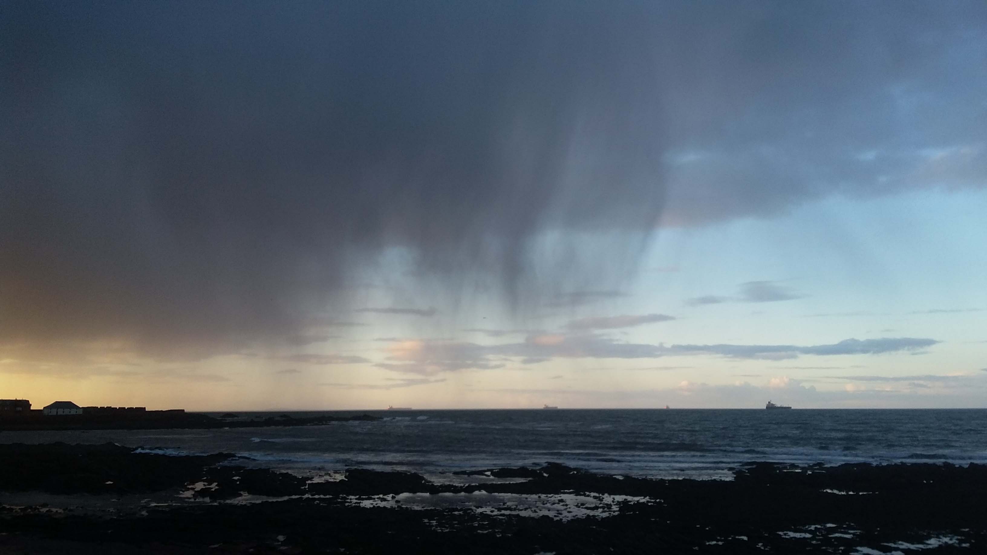
The main area of rain stretching from the Irish Sea to NE England is the main frontal band with other lines over Wales. There are still clear skies and sunshine for SE England at the moment. Behind the front, the cloud gradually turns more broken with patchy rain over Northern Ireland /Scotland and some nice shelter for Aberdeenshire. The rain band struggles a bit today, lurking over Wales, the Midlands and northern England. Scotland brightens up, and southern England, particularly the SW will see more sunshine. Areas to the lee of high ground like Powys and Leeds should see fine weather too.
The Weekend
By Saturday the weak frontal bands will be over southern Britain bringing a real mixture of cloud and light rain but with bright even sunny spells mixed in. Not quite a reliable day but still not a write-off. It will be breezy with temperatures up to 21C (70F). The rest of the UK will see a fair Saturday with bright or sunny spells, a brisk westerly wind and a cooler feel to the air, 15C. The low pressure will be nearer and throw more showers in from the NW. The winds will strengthen across Scotland on Saturday with gales in the far north.
It stays windy for Scotland during Saturday night, and it will be much cooler across the UK. All that muggy close air well and truly gone, you’ll want the duvet back
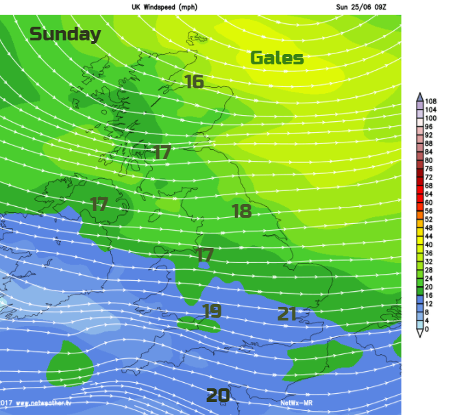
Sunday starts off very windy for NE Scotland and blowy for much of northern and eastern Britain. SE England will feel pleasantly warm at 22C with other parts of the UK cooler in the mid to high teens. There should be a lot of fine weather about with more sunny spells, just a scattering of showers coming in from the far NW.
Next week
More low pressures head towards the UK, bringing blustery winds, outbreaks of rain and an unsettled look to our weather. Brief southerlies may lift the temperatures but not back to the heat and humidity we have been experiencing.