
After the hottest June day since 1976 yesterday, it's turning cooler and fresher from today, though with some thunderstorms across England as this happens. Cooler, breezier and changeable Friday, through the weekend and into early next week.
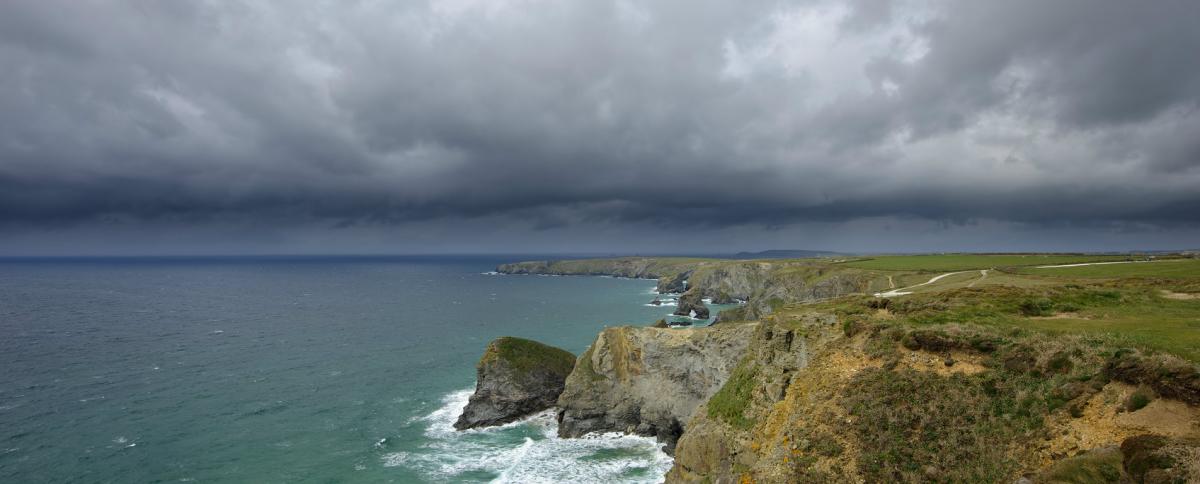
Wednesday saw the hottest June day since 1976, with 34.5C recorded at Heathrow, west London and there was a large contrast in temperatures between a sunny and very hot southern England and Scotland, with temperatures approaching 35C in London, while Inverbervie in eastern Scotland just managed 14c under cloudy skies and rain. However, if you don’t like the heat, the good news is it will turn cooler and fresher across all parts by the afternoon, as cold front clears east. Yesterday it was the northern half of the UK which saw thunderstorms develop, as a breakdown of the heatwave was underway here, this morning it’s the turn of southern Britain to see a thundery breakdown, as cooler and fresher conditions push in from the west.
Tomorrow we see the weather become more unsettled, cooler and windier, as low pressure approaches the north of Scotland, bringing tightening isobars and showers eastward across most parts. Over the weekend, low pressure will move east close to northern Scotland, bringing breezy conditions with sunshine and showers, most of these in the north.
For now, it’s a largely dry start across the UK, though there is some mist and low cloud across northern and western areas, with fog along the south coast of England, a bright but very warm start across eastern England – where temperatures at 6am are 20C in Humberside and 22C in central London.
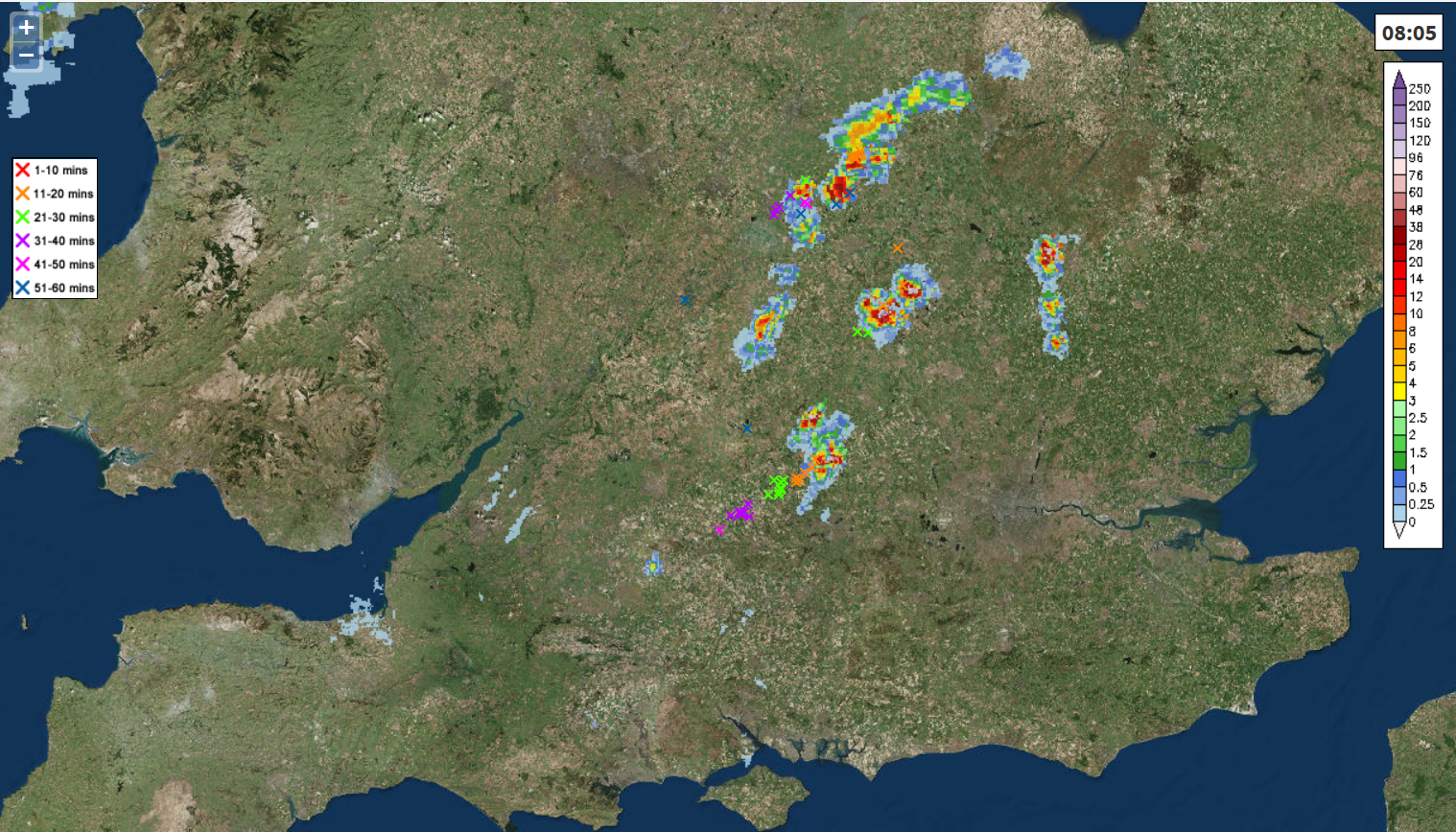
There are some scattered heavy and thundery downpours that have developed in the last few hours across the West Country and are moving quickly northeast into the Midlands and towards Cambridgeshire and Lincolnshire ahead of a cold front moving in from the west. These hit-and-miss thunderstorms or heavy showers will continue to develop and move NE further east across SE England and East Anglia through the morning, before clearing in the afternoon. A risk of flash-flooding, hail, frequent lightning and gusty winds with any of these storms. Drier, brighter and fresher conditions following across Wales, SW England and the Midlands this morning and into the afternoon, though cloudier across western coasts with the chance of the odd light shower. Once the storms clear SE England and East Anglia, a fine, dry and sunny but noticeably fresher evening here after the heat and humidity of recent days.
Further north, we will likely see another batch of heavy showers and thunderstorms develop across north Wales and NW England later this morning, these spreading east towards the North and East Yorkshire coast into this afternoon, again, a risk of flash-flooding, hail and frequent lightning with these storms. After the storms yesterday, much of Scotland and N. Ireland will be dry and bright through today, with light winds and sunny spells developing once early mist, low cloud and patchy light rain clears. However, wet and windy weather will arrive from the Atlantic across western Scotland and N. Ireland through the evening.
After the warm and humid start across eastern England this morning, turning fresher from the west across all parts. Temperatures still reaching 24-25C across SE England and East Anglia, but this is nearly a 10C drop from yesterday’s values for some in these areas. Elsewhere, temperatures reaching 17-20C, so not too bad.
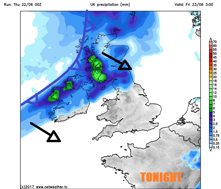
Wet and windy conditions spread east across N. Ireland and Scotland this evening and overnight, as a deep area of low pressure moves northeast between the UK and Iceland, the rain reaching northern England and north Wales by the end of the night. Further south, a drier night with clear spells, much more comfortable for sleeping than recent nights too, as we’ve lost the heat and humidity.
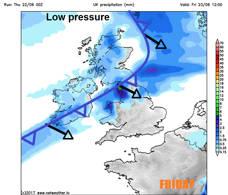
A breezy or windy day on Friday, with cloud and outbreaks of rain continuing to spread southeastwards across southern Scotland, northern England, Wales and into the Midlands. Drier an brighter conditions following across Scotland and N. Ireland into the afternoon. Southern most counties of England probably staying mostly dry though during the day, though the odd shower can’t be ruled out towards SW England. Temperatures reaching 25C across the SE of England, 18-21C elsewhere for England and Wales, 15-18C for Scotland and N. Ireland. Windy across the north.
The start of the weekend is looking quite breezy with a lot of cloud around, unsettled across the north and west on Saturday, with showers. Drier and brighter with the best of the sunshine towards SE England and East Anglia, once overnight cloud and rain clears. Drier and sunnier for most on Sunday, with winds easing in the south, still breezy with blustery showers across Scotland though. Temperatures reaching the mid to high teens generally, perhaps low twenties across SE England and East Anglia, so certainly much cooler this weekend in the south than recently.
Continuing changeable and, at times, unsettled into early next week, as the jet stream which has been north of us sinks south of the UK and low pressure moves in from the Atlantic and becomes slow-moving across Ireland. So after perhaps a bright start in the east on Monday, cloud and rain or showers moves in from the west across most parts, clearing on Tuesday to sunny spells and heavy perhaps thundery showers.


