Another hot and humid day in the south with this heat creeping further north tomorrow. Wednesday could see the peak of the temperatures with 33 or 34C possible. The close, muggy feeling will ease off to end the week.
Did you get a good night’s sleep? There is still a lot of interrupted sleep going on, tossing and turning, ditched duvets, too hot kids, too hot adults. The sunshine and warmth can make the UK quite uplifted by day and appreciative that summer is with us, but by now some people are getting a bit grumpy through lack of sleep. Others don’t like the heat anyway, or can’t cope for health reasons and with high pollen levels, there are also a lot of red puffy eyes about.
These were the kind of minimum temperatures seen last night, you can see it was much cooler for inland northern Scotland and Northern Ireland, down to 3.7C in Co. Down. It won’t be as hot and humid for southern Britain later this week.
The Met Office said yesterday
This hot spell is set to be the first time for over 20 years that somewhere in the UK has reached over 30 °C for 5 consecutive days in June.
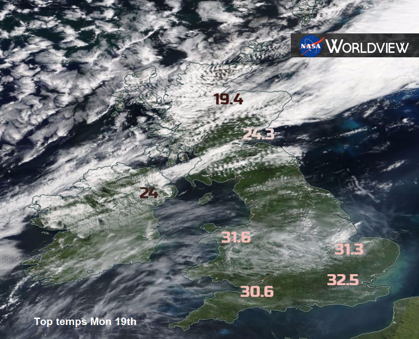
Greater London reached 90F yesterday. Top temperatures on Monday were 32.5C Hampton, 32.4 C for Northolt and also into the 30s Celsius in Wales. It could get a bit hotter today, 33C may be reached with SW Britain likely to see the focus of the heat, around Bristol and Cardiff particularly.
Across Britain it looks like another fine day with plenty of sunshine. Early eastern cloud will break up and there will be dry, bright conditions with much of the UK seeing a glorious summers day. There will be an easterly wind, just cooling off the Thames estuary and eastern England. There will be hardly any breeze for Wales. There is a small chance of a few showers around the West Country and inland Wales, later this afternoon. The potential is there for a hefty, thundery downpour but if any form, they will be isolated, yet come as quite a change. See Nick's Convective Forecast. Northern Ireland will have a lovely day but see more cloud this evening and maybe a few patchy outbreaks of rain.
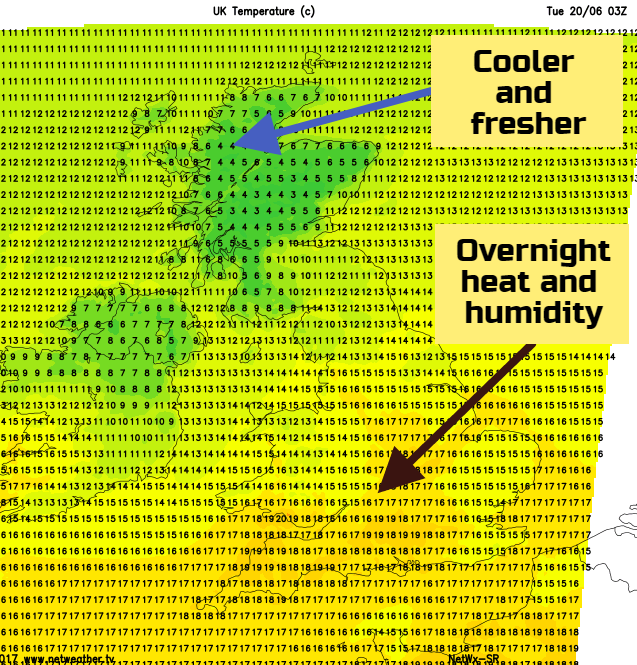
This cloud and rain will then spread over more of Northern Ireland, NW England and Scotland during the night as a warm front pushes in from the Atlantic. This will drag the hot and humid air back further north again. Within this frontal area, there could be some thunderstorms, with the potential for torrential downpours and lightning. We will await developments on the radar later.
Tomorrow
A quite different looking day in the north on Wednesday, with cloud and outbreaks of rain, particularly over Scotland. Again the risk of isolated thundery downpours extending into northern England this time, maybe Wales There will be a brisk SE wind around the northern half of Britain, a brisk southerly up the Irish Sea. Edinburgh could reach 25C again, Northern Ireland too. For much of central and southern Britain, it will be another hot and humid day with temperatures well up into the 20S, even low 30S Celsius. Royal Ascot is on this week and tennis at Queen’s, all bathed in sunshine with high temperatures. This could be the hottest day of this week, maybe 33 or 34C.
Later, Wednesday, a low pressure will have formed over Scotland and the cold front will be pushing in from the west. This will finally bring cooler and fresher air to SW Britain
Thursday
For Thursday, the cold front won’t have made it to SE Britain so still very warm and stuffy here but not quite the intense heat of midweek. There will be showery outbreaks along the cold front as it moves over the Midlands and eastern England on Thursday morning. There will be a westerly wind and a more comfortable feeling for most of the UK, even a bit cool for some western coasts. A dramatic difference for Glastonbury after a starting day near 30C, down to 20C by day, maybe 7C by night. London could still see into the high 20sC.
Another low pressure moves over Scotland for Thursday night bringing rain here and a blustery day for Friday. Showery rain will affect northern and western parts of the UK and again it will be a fresher feeling day everywhere.
Weekend
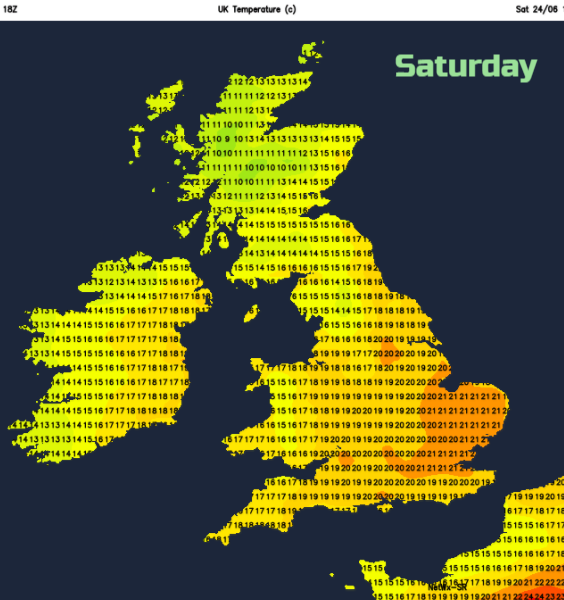
At the moment, it doesn’t look like it will be as hot or humid as last weekend. We keep the westerly wind bringing showers from the west on Saturday and then the chance of more persistent rain from the Atlantic on Sunday. Sunday looks the warmer day and eastern parts could well stay dry.
Remember even with a bit more cloud about, you can still burn.