If you do have some leeway with what time of day you can vote, then it will be worth keeping an eye on the Rain Radar. Vote in our wet/dry poll
After Tuesday's rain and wind, a day when many people were reluctant to venture outside, people and correspondents are now considering Thursday's weather. When would be the best time to vote, if you don't just have to fit it in around work? For those covering the election, filming the key politicians voting and then waiting for the results as they unfold, it is a long day/night. Getting drenched for an outside broadcast as part of the early evening news could result in a long damp wait depending on which seat you are covering.
Update Thurs 8th
Enter our Twitter Poll, did you get wet or not on the way to vote, or did you just postal vote instead. Click here if you are on twitter.
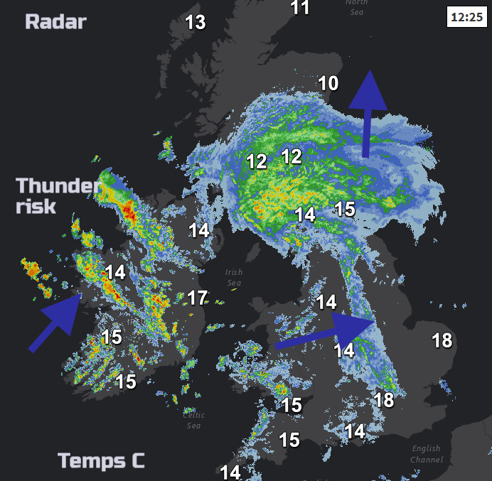
Lunchtime rain and temperatures, SE Britain still doing okay, has been very wet elsewhere. Hefty showers now appearing over Ireland
Weds 7th issue
There is already a Met Office weather warning out for heavy showers and hail, even thunderstorms on Thursday afternoon
The weather is not looking ideal, although SE Britain seems to escape any rain and could feel pleasantly warm, out of the wind.
Early Bird voters
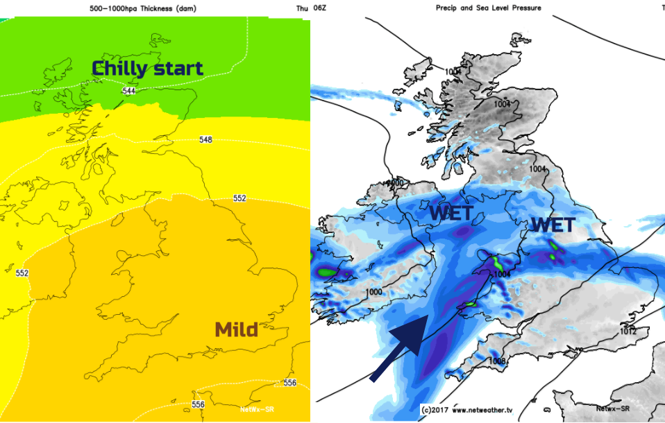
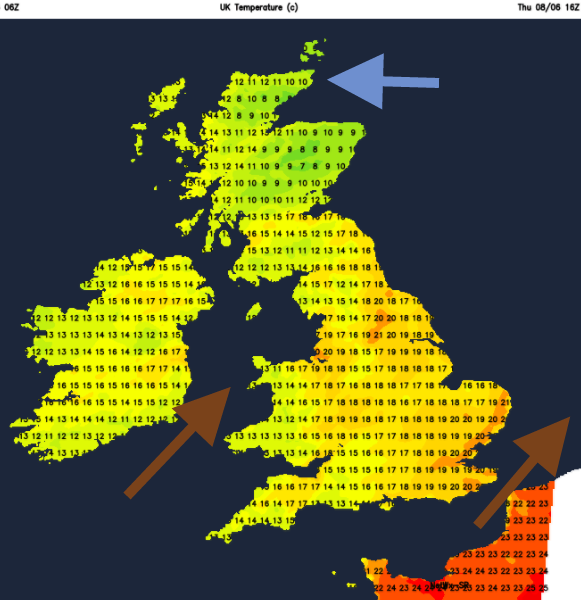
Around 7am it will already be feeling warm for southern Britain but quite chilly for northern Scotland. There will be a brisk SW wind for England and Wales, particularly for SW coasts and through the Irish Sea.
It will be raining with bands of rain expected as shown in the rainfall chart above for 7am. This band may speed up or be in a slightly different position by Thursday morning, but there is rain on the way. This frontal system is moving northwards and will be across northern England and southern Scotland by midday
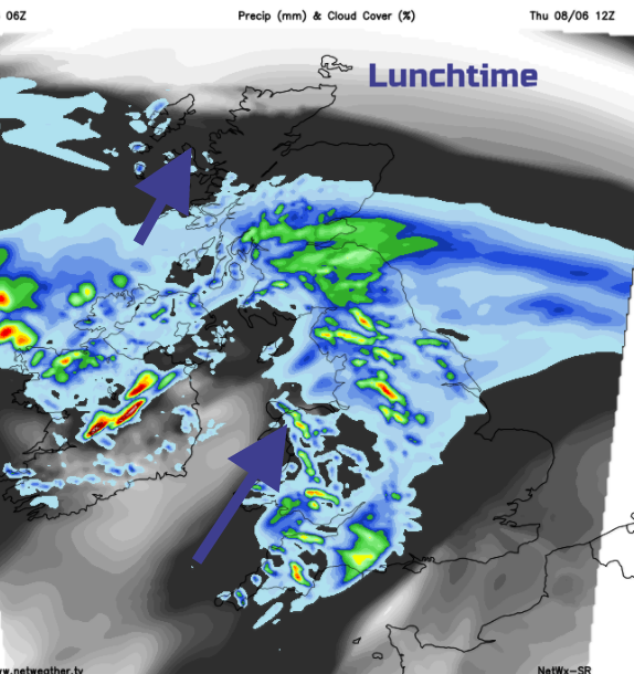
SE England and East Anglia stay dry with some brightness until perhaps late afternoon when the collection of showers over England and Wales could throw a light shower into the SE.
The emphasis is on a lot of dry, fine weather. A different story further west and north. The rain band will set in for central Scotland, reaching up into flood hit Grampian, but not the deluge of Tuesday. Northern Ireland will have to contend with the heavy, thundery showers as mentioned in the Met Office warning. These storms could bring the risk of flash flooding, power outages and travel disruption.
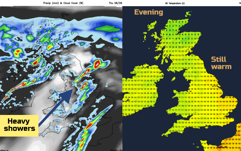
Evening stragglers
For those leaving their voting until later in the day, the weather is looking a bit hit and miss. By this time there will be more hefty showers over parts of England, with a risk for SE England by then. Many places will miss the showers and keep the fine weather but there will be isolated downpours to watch out for. The northern rain band will have reached most of mainland Scotland with a brisk east wind.
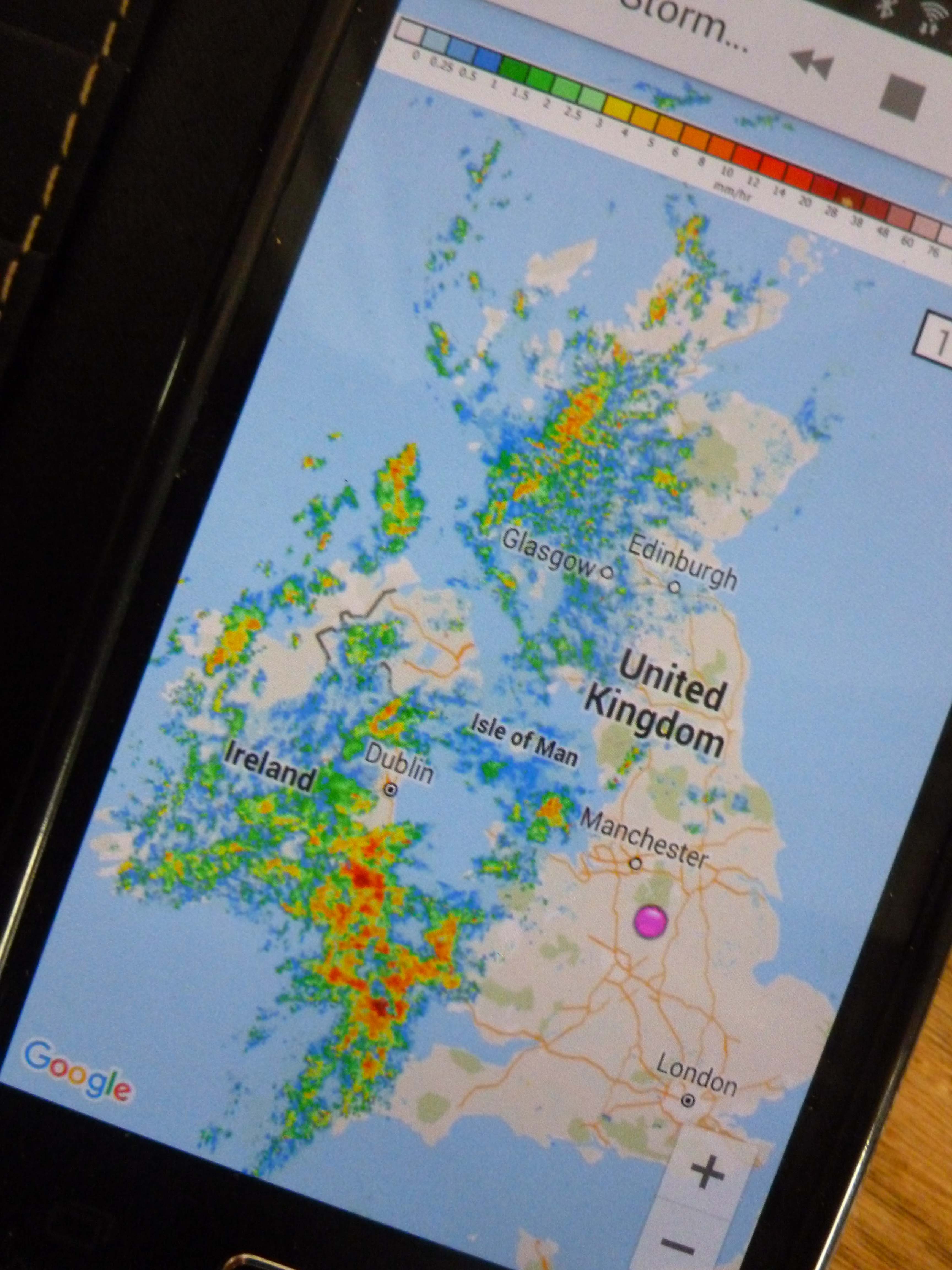
So, a bit of a pickle of a day, with lots going on and the threat of heavy downpours. Best way maybe to keep an eye on the Radar or download the Netweather Storm App and time it right.