


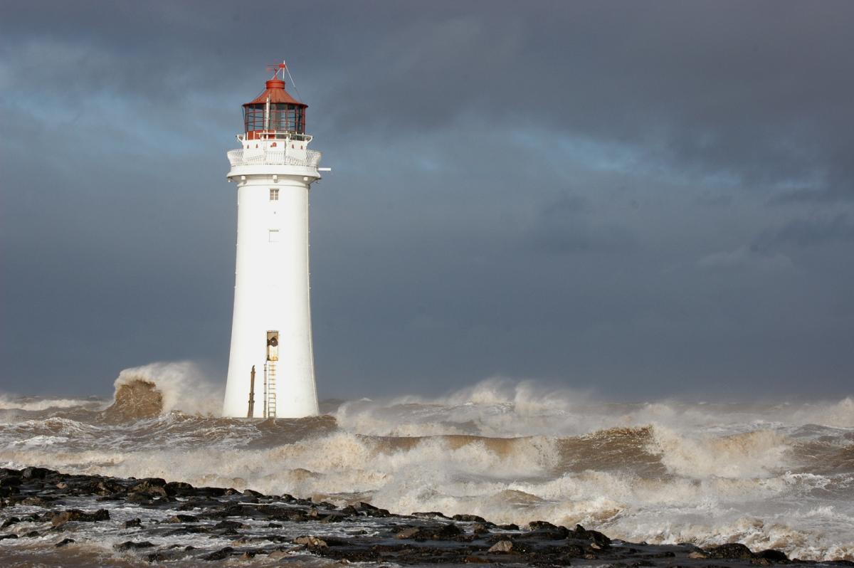
Winds gusting to 50-60mph in the south and up to 80mm of rain in the west. Sound like late autumn? I'm afraid it's early June!
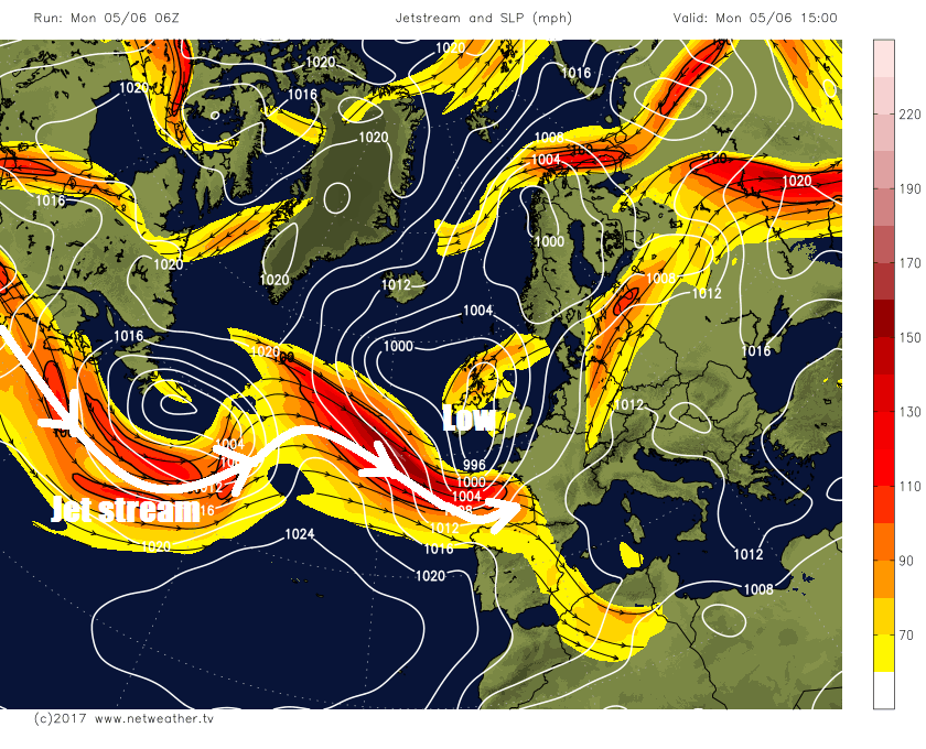
It seems part and parcel of a British Summer, as soon as June arrives low pressure systems queue up to spread wind and rain across our shores, with this first full week of June no exception. What’s bringing the change to these unsettled conditions is the arrival of a strong 100 mph+ jet stream across western Europe from the Atlantic – which is driving a deepening low from the southwest across central Britain tonight, bringing gales to southern Britain along with heavy and persistent rainfall – especially across Wales and NW England.
The rain from the low pressure system crossing the UK tonight will only slowly clear northern and eastern areas tomorrow and although it will turn brighter and showery further west, it will be windy everywhere – with coastal gales. Wednesday looks like bringing a respite with drier and more settled conditions, as a brief ridge of high pressure builds in from the south, before more wind and rain returns off the Atlantic on Thursday across all parts. Friday could be warmer and drier across southern and southeastern counties of England, but for northern and western areas we could see some heavy and thundery downpours develop. More heavy and persistent rain could return for Saturday though.
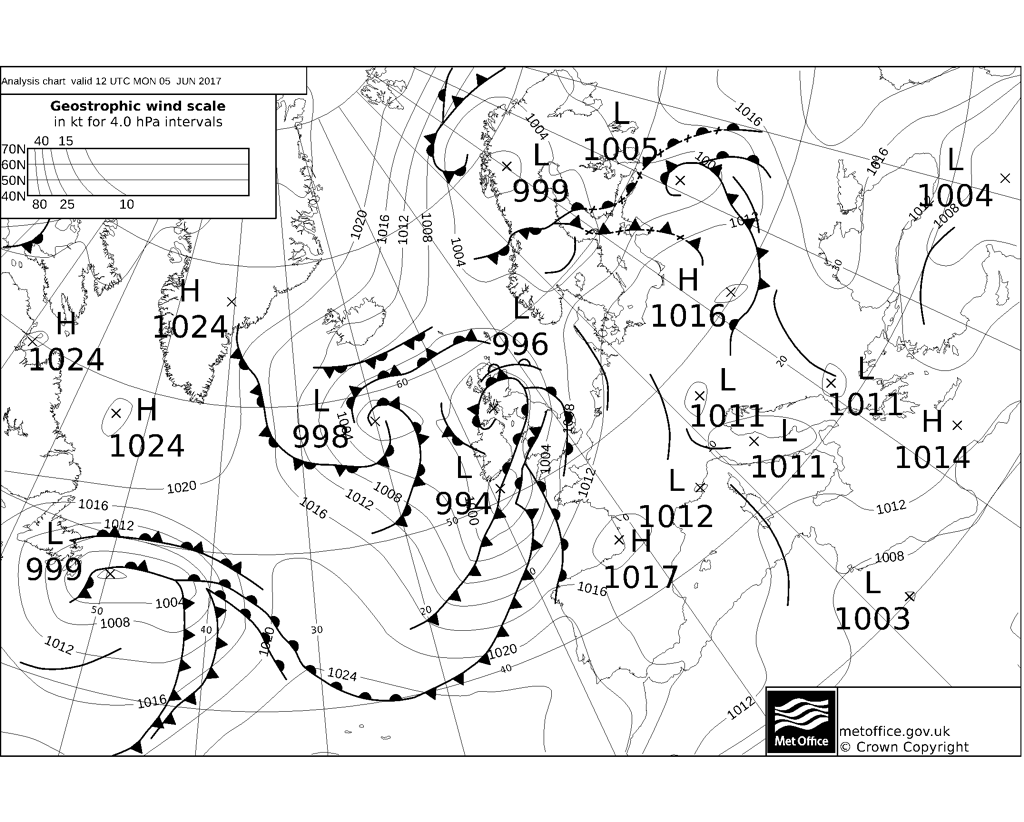
The Met Office have issued a Yellow Weather Warning for heavy rain across parts of Wales and NW England – where they expect 40-60mm widely and perhaps as much as 80mm over areas of higher ground such as Snowdonia and Cumbria.
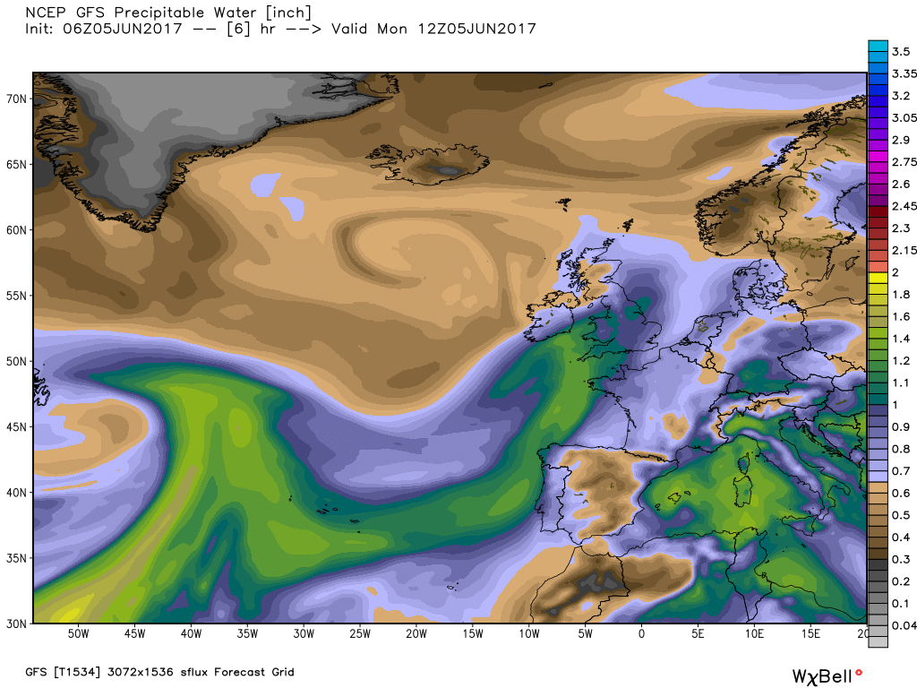
These rather wet conditions, especially across higher parts of the west, are being brought by a conveyor of warm moist air sourced from the sub-tropical Atlantic the other side of the Azores and brought by long southwesterly fetch of winds. The warm moist air forced to rise by a set of fronts associated with a deepening area of low pressure arriving in the SW approaches and lift further accentuated by the mountains of Wales and NW England – where we see higher rainfall rates than lower ground.
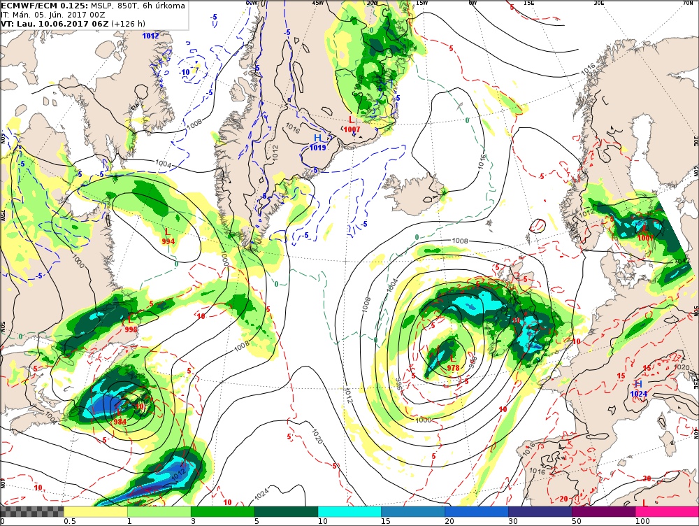
PWAT (Precipitable Water) values - blues to greens higher values
As the low continues to deepen in the southwest approaches, southerly gales are likely around southern coasts of south Wales and southern England – where we could see gusts of 50-60 mph for a time this afternoon and evening, indeed there was gust of 60mph at Plymouth in Devon at 1700hrs.
Winds switch westerly to northwesterly overnight into Tuesday morning, as the low tracks northeast across the UK. But the wind remaining strong with gales locally across Wales and southern and later eastern England, where we could see gusts of 40-50mph. perhaps 50-60mph along exposed coasts during Tuesday.
Some uncertainty over exactly where the low will exit the UK into the North Sea in the morning, with northerly gales perhaps developing further north too. But these wind strengths one would associate with late autumn rather than early summer. But unlike late autumn, with trees in full leaf now, there is a risk with these kind of wind gusts of trees bring brought down and also some disruption to travel, certainly worth protecting delicate plants that are outside too.
So, a windy start, with gales across the east, on Wednesday morning before winds ease, but still remaining rather breezy. A brisk southwesterly wind for the rest of the week, with further rain for all parts on Thursday and then heavy and thundery showers following across northern parts on Friday. Despite the cool start to the week, it should, however, be warmer to end the week, particularly for the south.
Perhaps worth keeping a close eye on Saturday, as another deep low is modelled to wind up and track northeast close to north and west of Ireland, its frontal system lifting another conveyor of warm moist air sourced from sub-tropical Atlantic, capable of bringing a lot of heavy and persistent rain to western areas again.
00z ECMWF high res rainfall for Saturday morning
So, after a dry spring across many areas, why the sudden return of the Atlantic westerlies bringing wind and rain? It’s not that uncommon in June for the return of unsettled westerlies after spells of dry and settled weather in the spring, it probably occurs in at least 70 per cent of years and is likely the result of a changes in the atmospheric circulation in different parts of the world that occur from mid-May to mid-June. One of the most important drivers in these changes is the disappearance of snow and ice from northern Canada and Alaska, the warming up of the north Pacific Ocean in contrast to the NW Atlantic Ocean and also the shift north of the jet stream over Asia from its winter position to its summer position. All of these factors likely explain the re-awakening of the westerlies across the North Atlantic. However, there are tentative signs from the longer range model ensemble guidance of these unsettled westerlies eventually blowing themselves out from mid-month with high pressure more likely to build in bringing drier, warmer and more settled weather, at least for the south.


