Will seem more like autumn to start the new week. Rainy days and blustery winds, not just the off/on showers of the weekend.
More like Autumn Monday into Tuesday
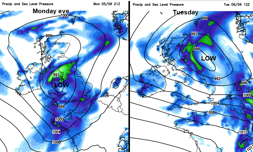
A deep area of low pressure will move over the UK for the start of the new week bringing wet and windy weather.
Usually, over the UK it is northwestern parts which catch the worst of weather from low pressures. This time, Northern Ireland and western Scotland will miss most of it.
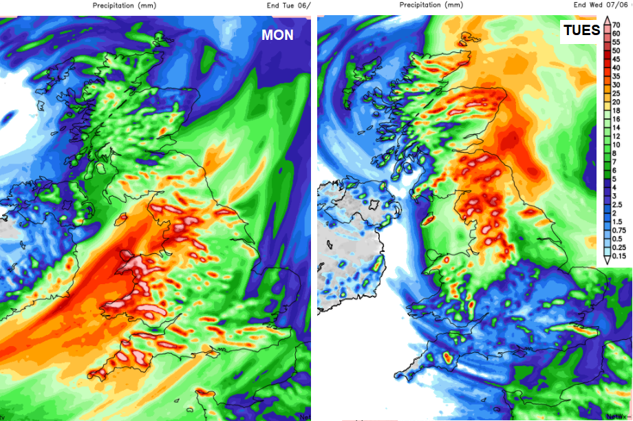
There have been heavy even thundery downpours about over the past few days, but this rain will be heavy and persistent, not just showers.
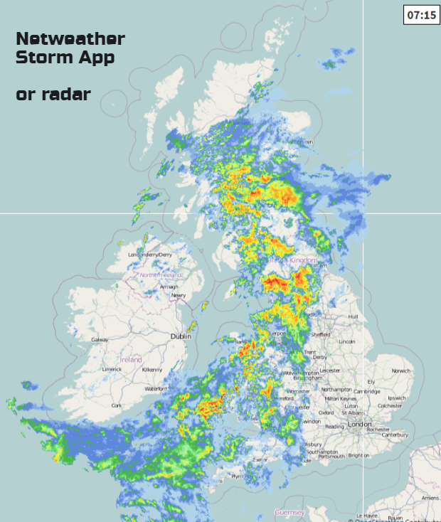
Through today the main area of rain seems to set in for Wales and NW England, and then affecting more of northern England, eastern Scotland and SW England into Tuesday, NE Scotland by Wednesday. The Met Office have issued a Yellow Be Aware weather warning for rain
After half term for some schools in England and Wales, the roads will be busier anyway and so this miserable weather could add to the rush hour blues. At least this little lot did miss the school holidays, might catch a few Sports Days for Scotland and Northern Ireland though.
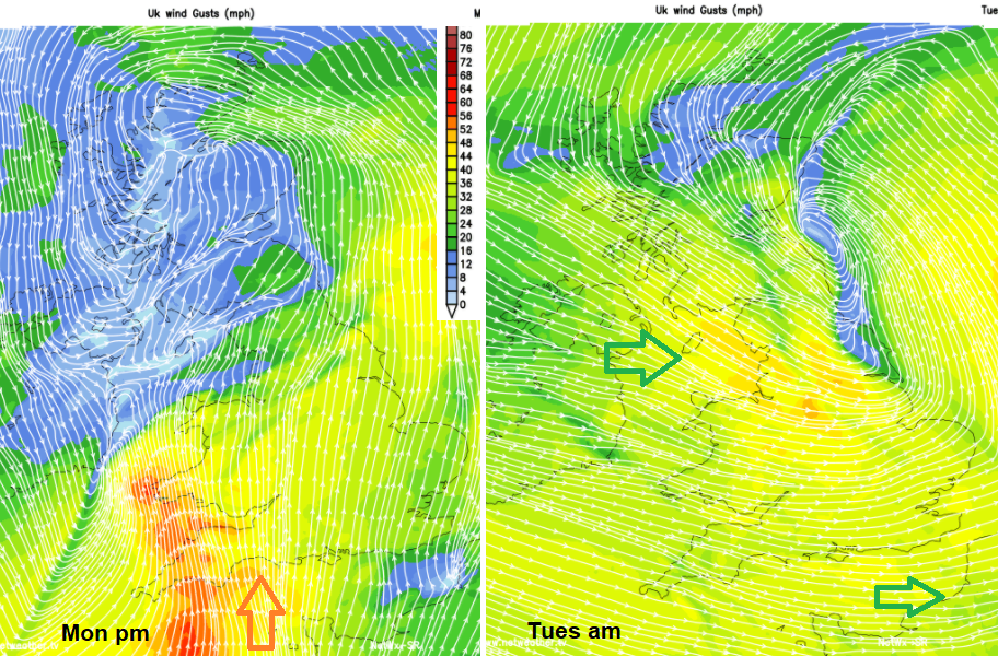
It will also be windy at times. The winds will swirl around the low, so starting S to SW on Monday morning, with southerly gales around the coasts and hills of SW Britain by late afternoon. Strong southerly winds for the West Country and along the Channel coasts to the Isle of Wight during Monday evening, before the winds veer to a west or NW wind. By Tuesday morning there will be strong westerly winds for northern and eastern England.
Check the forecast for your location here Next 7 days
This morning on the Netweather radar 0715am