


Humid with risk of storms in the SE today, but cold front with rain moving in from the west introduces cooler and fresher conditions for all this weekend, with a mix of sunshine and showers. Unsettled next week, with wind and rain at times.

Thursday brought a pleasantly warm, dry and sunny first day of summer across much of England and Wales with the temperature reaching 25.5C at Heathrow. However, cooler conditions with cloud and rain moved in across Scotland and Northern Ireland. A fragmenting band of rain along a cold front will continue slowly east across England and Wales today, with a few thunderstorms developing ahead of it across SE England this afternoon – as it turns hot and humid here. Fresher conditions will follow across the north and west today behind the cold front, then all parts over the weekend, there will also be a scattering of showers though, some heavy, but with some sunny spells too. The showers will be most prevalent across the north and west during the weekend, with eastern England perhaps escaping with drier and sunnier weather.
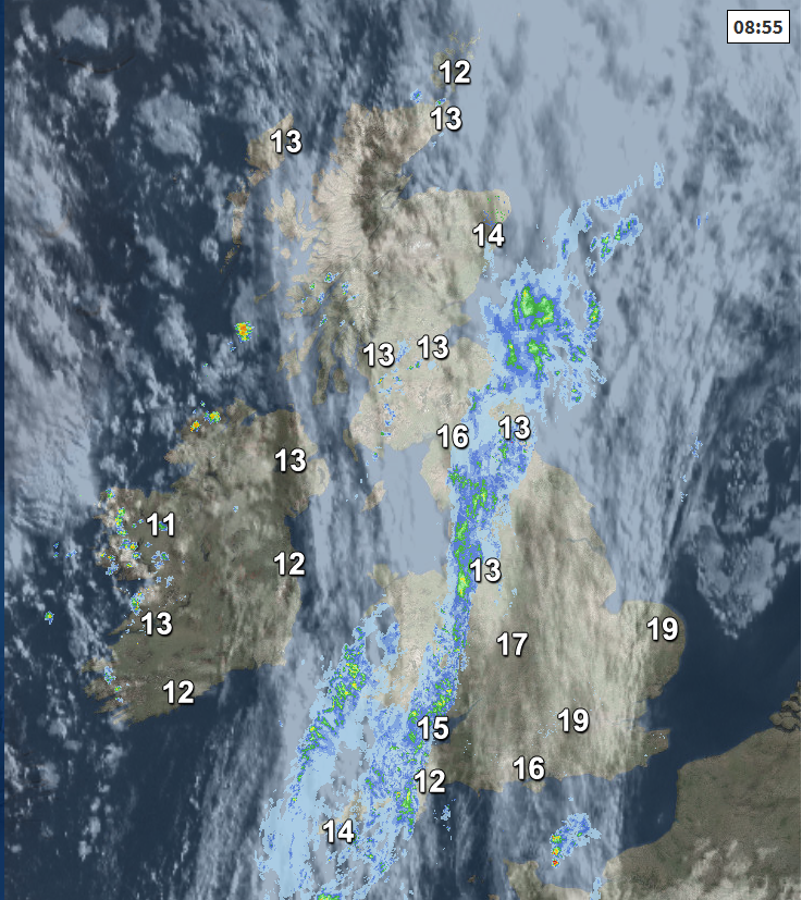
For now, it’s a wet morning commute for those not on a half-term break across SE Scotland, parts of northern England, Wales, Devon and Cornwall. This is a band of rain along a cold front – which will gradually move eastwards across England and Wales through the day, tending to break up and turning more showery in nature as it does so. Tending to stay rather cloudy through much of the day across east Wales, NE England, The Midlands and SW England, with some showery rain, thanks to the front becoming slow-moving.
Ahead of this frontal showery rain, where the sun comes out across SE England and East Anglia it will turn very warm or hot and humid – this could trigger a few heavy downpours or thunderstorms – see the Netweather Storm Forecast. Further north and west behind the rain along the cold front clearing east, it will be brighter and fresher with sunny spells but also a few scattered showers developing across Scotland, Northern Ireland, west Wales and the far SW of England.
Temperatures reaching 14-17C across Scotland and Northern Ireland, across England and Wales reaching 16-20C generally, 23-25C across SE England and East Anglia, locally 26-28C where the sun stays out longest. Winds generally light from the southwest.
Heavy showers and a few storms at first across SE England and East Anglia, before easing and becoming confined to eastern coasts in the early hours, as the cold front clears eastwards over the North Sea. Cooler, fresher and drier conditions following from the west across all parts by the end of the night, with temperatures dropping to 9-12C generally by dawn.
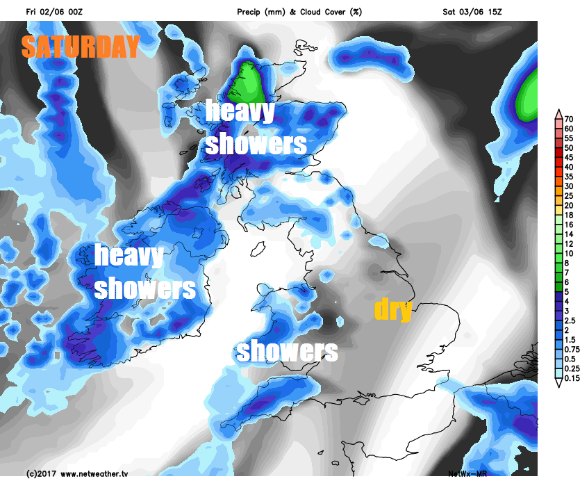
Saturday may start cloudy with a few showers at first during the morning across East Anglia and far SE of England, but generally for many areas it will be or become a mostly dry day with sunny spells. Some heavy showers developing across Scotland and Northern Ireland though, with a few well scattered but lighter showers across Wales and western parts of England. A fresher day for southeastern areas compared to the very warm and humid weather today. Temperatures reaching 13-17C across Scotland and Northern Ireland, 17-20C across England and Wales.
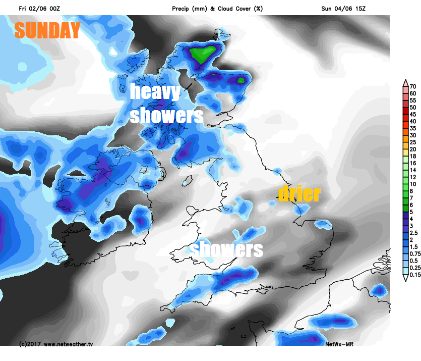
As we head through Sunday, the weather continues to come in from the Atlantic - bringing fresh and breezy conditions but also some showers – primarily to SW England, Wales, Northern Ireland and Scotland – drier and sunnier further east across central and eastern England. Temperatures nothing to write home about, reaching 15-18C, but pleasant enough in the sun out of the breeze.
Into next week and it’s looking rather changeable and unsettled, as areas of low pressure begin to move in off the Atlantic across the UK. Monday looks like seeing wet and windy conditions arriving across western areas, dry and bright across the east. Wind and rain clearing northern and eastern areas Tuesday morning to brighter but showery conditions from the west. More spells of rain spreading northeast across all areas for the rest of the week.


