A lively night in the SE and enough heat and humidity today to set off more thunderstorms. A change midweek to something fresher from the west.
A warm and thundery night
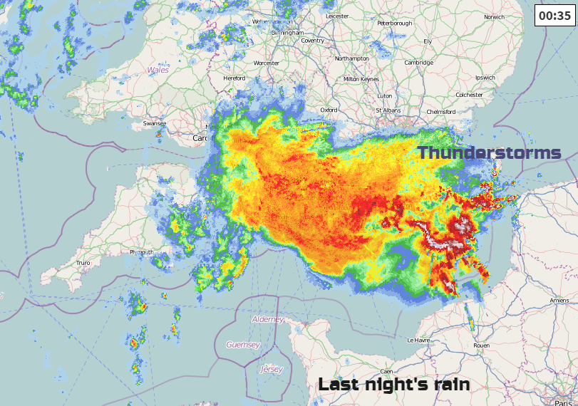
Plenty of action for the Storm thread in the Netweather Community forum last night, even if it did get quite late as the spectacular lightning show reached SE England. Or maybe it just woke you up.
This week there is still warm, close air about with showery bursts interrupting the fine weather. High pressure builds mid-week bringing steadier conditions before a band of rain tries to push in from the Atlantic. Tuesday night looks cooler, if you are struggling with the heat and by day temperatures sit in the high teens and low to mid 20sC.
Today we have a messy set of fronts across the UK bringing a lot of cloud and outbreaks of rain. It’s been a warm night for Wales, the Midlands and the West Country and there were cracking thunderstorms over southern England which moved up from France. There could be more thunder and lightning today.
The main area of rain this morning is moving northwards, particularly over N.Ireland, N.Wales, NW England and into southern Scotland. So many parts stay dull, grey and damp. The image below shows the progress of the rain by midday.
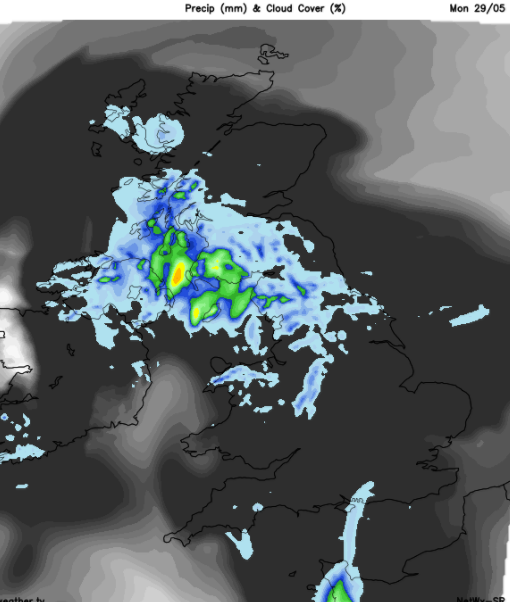
Behind this main area of rain, a few thunderstorms could build up for the Midlands and eastern England runs the risk of heavier, thundery showers too.Where breaks appear in the cloud, the sun will make temperatures leap up 25 to 27C possible. For most there won;t be the heat of last week but it will feel muggy and warm. This also gives the extra energy in the warm, humid atmosphere to make set off a storm.
Likelihood of thunderstorms this evening

The frontal patchy rain spreads north over more of Scotland this evening as any thunderstorms over central Britain head towards the North Sea, giving parts of eastern England a show of thunder and lightning. Will it Thunder?
If you are watching developments over France again tonight, it looks like the thundery cells moving up stay away from SE England this time.
Tonight will feel cooler for Scotland and Northern Ireland but SE Britain remains at 14 or 15C.
Tomorrow
Monday's easterly breeze is replaced by a SW or westerly one. Tuesday will start off quite mixed with brighter skies, even sunshine for some, areas of low cloud and lingering dampness for others. A frontal band of rain will move across Northern Ireland in the morning from the west, with a moderate SW wind. This wet weather then moves over Scotland and clipping N.Wales at lunchtime with a fresh westerly wind. Ahead of the frontal band it will be cloudy and feel close and muggy, behind there will be clearer skies, brightness and a fresher feel. So, there will be outbreaks of rain over northern Britain during the afternoon as the front heads towards the North Sea but it could all be rather patchy for NE England.
The heavier bursts of rain clear the Northern Isles by Tuesday evening after a windy afternoon for mainland Scotland. The whole of the UK will then be clearer and fresher, a welcome relief for some.
Midweek
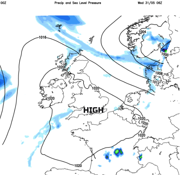
By Wednesday, high pressure will be over the UK bringing a more settled, fine spell. Winds will be light with temperatures in the mid to high teens, maybe 20/21C. A large low pressure system nudges in from the Atlantic, struggling up against the high. Northern Ireland becomes blustery with a band fo rain for Thursday which could spill over western Scotland too. Britain sits in a southerly airflow and warms up a bit.
End of the week
There will be more fine, bright often sunny weather with showers blowing in from the west, So not totally settled but not bad. There is still little proper rain in the forecast away from NW UK.