


Mostly dry, bright and warm but fresher for Sunday, however, thundery downpours arriving in the south later, before spreading north for Bank Holiday Monday. Turning more settled by the middle of the week.

Saturday saw the heat build once again across eastern Scotland and eastern England, with Kinloss, Hull and Weybourne in Norfolk reaching 27C. However, this heat and humidity sparked some nasty thunderstorms in the afternoon across northern England – which then moved up across Scotland in the evening. The storms brought frequent thunder and lightning, heavy rain and even some large hail in places.
As the heavy rain and storms cleared away, it turned cooler and fresher overnight compared to recent nights. So most places are starting Sunday on a dry note, with some brightness, though there is extensive low cloud and mist too across many parts. There will be some patchy rain at first across northern Scotland, but this should clear away by mid-morning.
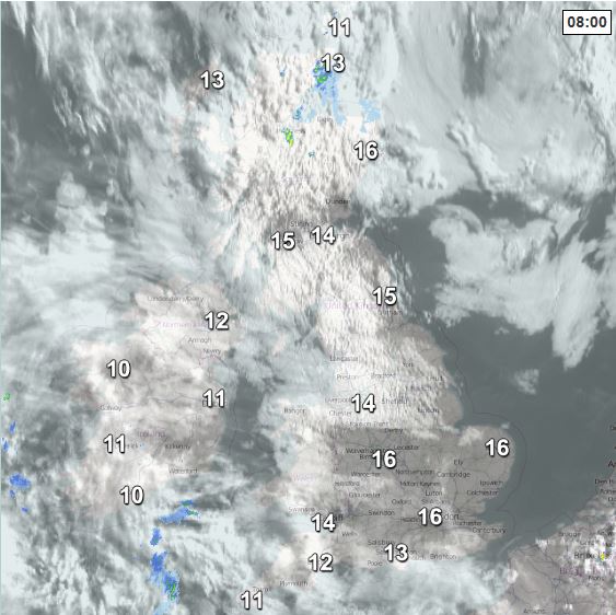
Otherwise, most areas should see a dry day, with some warm sunshine breaking through after the murky start in places, though it will be fresher than of late for many. However, we will see cloud increase across south Wales, Midlands and southern England – with outbreaks of thundery rain and thunderstorms moving in from the south across SW England, south Wales and parts of central southern England this afternoon. SE England and East Anglia should stay dry until later in the day.
Temperatures this afternoon reaching 15-19C generally, 20-25C across the Midlands, southern and eastern England. Winds generally lighter than yesterday too, so despite it being fresher it will feel warm in the sunshine.
Heavy and thundery downpours, with locally torrential rain leading to flooding and frequent lightning in places, will spread north across England and Wales this evening and overnight, reaching southern Scotland and N. Ireland by the end of the night. Turning warm and humid across the south too, where temperatures will fall no lower than 15-16C, elsewhere 8-12C.
Monday likely to be a mostly cloudy day across northern areas, as areas of thundery rain continue to spread north across northern England, N. Ireland and Scotland. Further south, it may brighten up with warm sunshine across Wales, central, southern and eastern England, but as it will be humid, further thunderstorms are likely to develop in places, especially towards SE England and East Anglia. Temperatures reaching 12-14C across Scotland and N. Ireland, 16-20C generally across England and Wales, 22-25C across SE England and East Anglia - locally maybe up to 28C.
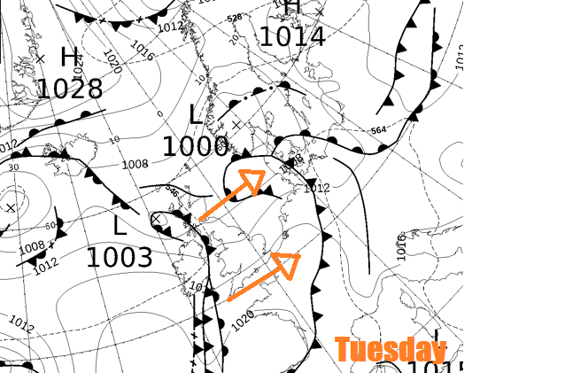
We lose the warm and humid conditions across SE UK on Tuesday, as a weather fronts sweeps through from the west, bringing a weakening band of rain eastwards, with windier conditions behind – especially across Scotland.
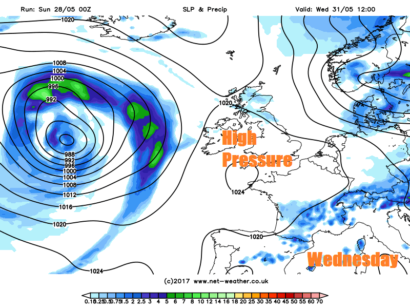
Then by the middle part of the week, the weather quietening down as high pressure builds in from the south, bringing mostly fine, dry and settled weather with warm sunshine on Wednesday and Thursday.
Perhaps some rain arriving across the northwest later on Thursday, before sweeping east across most areas early Friday, followed by showers, cooler and breezier conditions from the west.


