Another hot and humid day, with another sultry night to come. Changes afoot for the weekend but still very warm
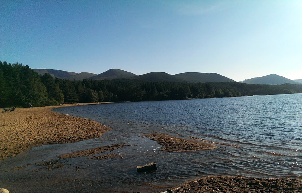
Another glorious morning for most of the UK. Sunny, warm with blue skies and the promise of summer-like conditions. That may put a spring in your step and sunglasses on your head ready, or have you heading for extra hayfever meds, despair at your too-warm wardrobe or just the knowledge it will be a day of not coping in this heat. "Isn't it warm?"
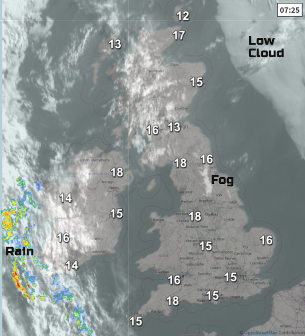
There are a few pockets of fog which have formed overnight, for Shetland and a white area of thick fog in the Vale of York can be seen on the visible satellite image above. This will soon be burned off by the sun. Just note an area of low cloud out in the North Sea. That will head towards eastern Britain this weekend and at times bring the haar or seafret to coastal parts. Away to the SW of the UK is a frontal band of cloud and showery rain. Currently, we have a steady high pressure over us giving the fine weather and light winds. This struggles to make progress eastwards as it butts up against the high, but things will change during Saturday.
Yesterday the top temperature was 28C for Aberdeenshire, northern Scotland might reach 30C today. The May record for Scotland is 30.9C. Merseyside and Clwyd reached 27.6C and 25.8C for Londonderry.
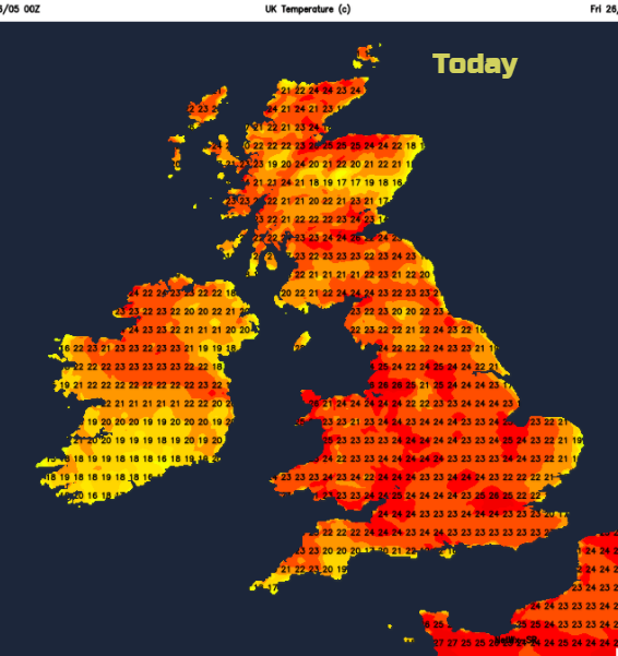
Today- Hot and sunny
It will be hot and sunny and dry. The SE breeze will pickup during the day becoming fresh in parts by this afternoon. Co Fermanagh and Co Tyrone will see cloud increasing but the threat of a few showers in the far west. It does look dry today but you might feel that rain is nearby as the frontal band twists over the far west of Ireland. High UV values today, take care in the sun.
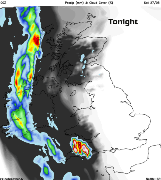
Tonight - Humid
Most places will have a dry, muggy and warm night, uncomfortably so for some. The frontal band out west could reach Barra and Uist, fringe into western counties of Northern Ireland and clip Cornwall. Thundery showers will begin to feed up over SW Britain with lightning.
Saturday- hot with thunderstorms
Another hot and humid day, particularly across northern and eastern parts. Further west there will be more cloud and outbreaks fo rain as the frontal band develops a little low pressure and spins northwards, This will throw clusters of heavy and thundery showers over the UK. Exact positions are tricky but Wales, Northern Ireland, SW England, NW England and SW Scotland look very prone, Another cluster seems to move off over through the Midlands to eastern England in the middle of the day, bringing the risk of torrential downpours and cracking thunderstorms with the heat and humidity. The other bands move over Scotland, and all of this will clear the air a bit, making western parts less hot, a bit more comfortable but still warm. There will be a brisk SE breeze for North Sea coasts also bringing a fresher feel, but inland temperatures will be in the mid to high 20sC with the chance of 30C for London.

Saturday Night
SE Britain will have a sultry evening, gorgeous warmth once the heat of the day has faded. Further north, a NW wind takes hold and brings in cooler, fresher air over Scotland, N.Ireland and NW England. The hefty showers slowly clear from the far north of Scotland and it will be a dry night.
Sunday
High pressure takes hold again on Sunday bringing a lot of fine, bright and sunny weather, It looks warm for most with still heat over southern Britain and temperatures in the mid 20s. For northern Britain and N.Ireland high teens, maybe 21C. Southern England could see a few hefty showers break out but these will be well scattered. More heavy, thundery showers move up from the Channel overnight.
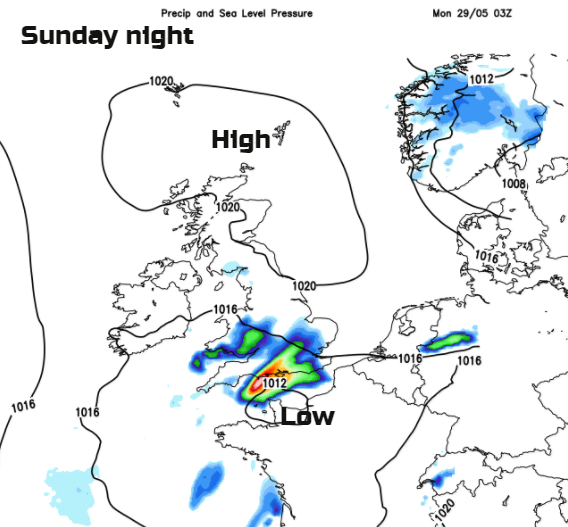
Bank Holiday Monday
Monday looks to have more cloud and an easterly wind. There will be scattered hefty showers, mainly for England and Wales. Western parts will be warm, high teens low 20s C but some eastern parts will be cool where the low cloud sticks.
Enjoy your long weekend if you do have some time off.
Forecast for your location here.