Dry with sunshine for most to see the week out, hotter today and tomorrow, Scotland could see the highest temperatures. Thundery breakdown from the west on Saturday, with fresher and cooler conditions on Sunday and Bank Holiday Monday.

The temperature reached 26.6C at Pershore in Worcestershire on Wednesday – making it the warmest day of the year so far. And each country of the UK saw its warmest day of the year so far yesterday too.
Temperatures are likely to reach higher still over the next few days, before we see a thundery breakdown from the west to cooler conditions over the weekend. Scotland’s heat looks like peaking on Friday where we could see 29-30C, cooler conditions arriving from the west on Saturday across northern and western areas, with thundery showers, but across SE England and East Anglia we could see highs of 28C. Fresher but still warm on Sunday and Bank Holiday Monday, though a risk of further thundery showers across southern, central and eastern England.
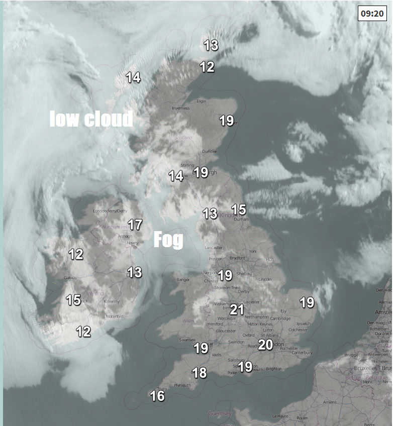
It’s been rather warm and muggy overnight, with temperatures falling no lower than 14-15C in many spots and at 9am temperatures are already reaching the low 20s in the south. Many areas have started Thursday with clear skies and sunshine, though there is sea fog or low cloud affecting some coastal areas across northwestern areas. Any early fog this morning should burn back to the coasts, with most areas largely dry and sunny today, becoming very warm and hot again too, though cooler than yesterday near southern and eastern coasts where we will have an onshore breeze.
A lot more sunshine across Scotland than yesterday and so we could see temperatures reach 28C across the western Highlands, otherwise 23-25C typical inland, though a cooler 18-20C along coasts. Further south, temperatures this afternoon eaching 25-28C inland across England and Wales, a cooler 22-23C along coasts.
Overnight, little change with clear skies across most areas, rather warm and sticky too, with overnight lows of 14-17C typical in towns and cities, a little cooler in the countryside.
This will lead us into another dry, sunny and very warm or hot day on Friday, as high pressure remains in control. The only difference to today will be more in the way of cloud across EIRE and N. Ireland, which could bring some thundery showers in the afternoon. Otherwise, a hotter day still, with a southeasterly flow off the near continent, temperatures perhaps reaching 29-30C across northwest Scotland, elsewhere across the UK temperatures reaching 24-28C.
On Saturday, we still have hot air coming in from the near continent, but a cold front will begin to push in from the west across western areas and as this bumps into the hot and humid air further east it will spark some thunderstorms as it moves through on Saturday across northern, central and western parts of Britain. Fresher conditions arriving across the west by the evening, but across SE England and East Anglia probably remaining dry and hot – with temperatures reaching 25-28C.
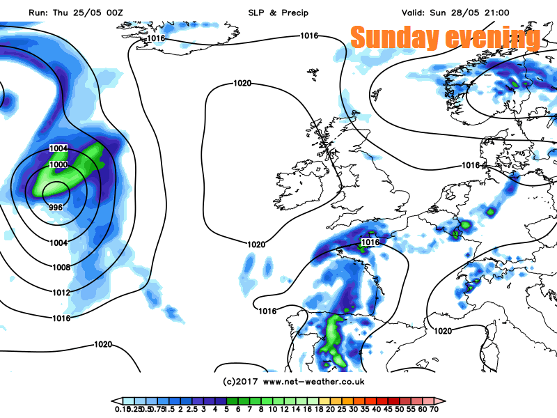
A fresher day on Sunday and drier too, once overnight thundery rain clears north from Scotland first thing. For many it will be a sunny day, cooler across the north with temperatures reaching 16-19C, across the south 20-25C. Some thundery showers arriving across the south later in the day.
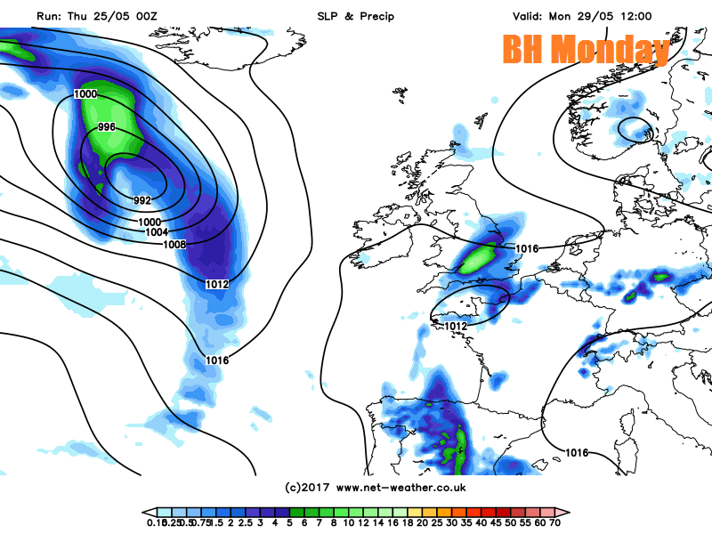
Heavy showers or perhaps thunderstorms spreading northeast across southern, central and eastern areas of England Sunday night and through Bank Holiday Monday, drier and sunnier further north and west on Monday. Temperatures in the mid-high teens generally, perhaps low 20s across SE England.