It's warm already and the heat will build. Cloud cover will break up and with more sunshine over the next two days it will feel hot and humid. The holiday weekend looks more mixed.
Many parts of the UK saw glorious sunshine to start the week. Again, there are sunny skies this morning, but some parts now have a covering of grey as cloud moved in overnight. Manchester had glorious blue skies for the street vigil yesterday, but this morning there is a lot of cloud over NW England, also SW England, N.Ireland and western Scotland.
So mixed cloud over but pressure is building bringing more settled, dry weather. And hotting up!
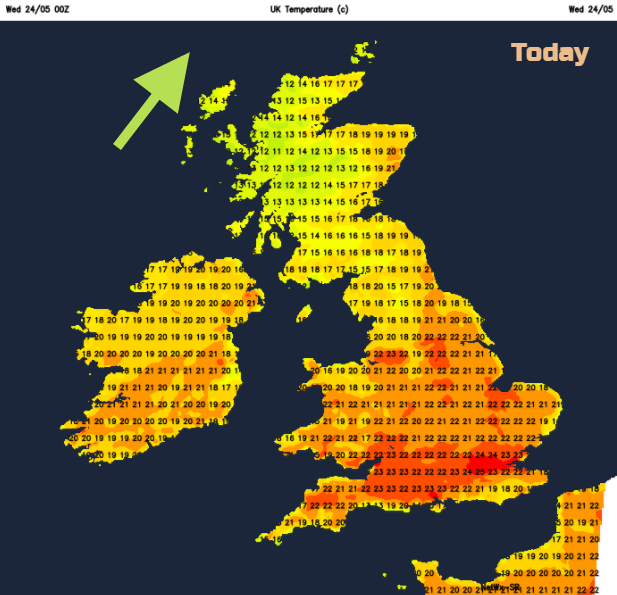
It is a mild start this morning, with the sun warming things up nicely. The low cloud over SW Britain will thin and break so some improvement for inland Devon and Cornwall and across Wales. NW Britain will keep more cloud, even feel a bit damp in the air over the higher ground and along the coast 13C. There will be a moderate SW breeze. Northern Ireland will brighten up slowly and see temperatures of 18 to 20C. Across the rest of Britain temperatures will range from 17 to 26C with very light winds. 26C is around London. Most places will remain dry all day with patchy light rain brushing the Scottish Islands before clearing away eastwards this evening from Shetland.
Tonight, will be close and muggy but dry.
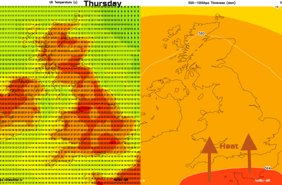
We then see two or three hot days. Thursday looks hotter for most with up to 27 or 28C likely. You can see the wide spread of the higher temperatures on the image above. Around the Thames estuary will feel fresher with an E breeze off the sea. Southern Cornwall and Co. Down will catch a SE breeze too.
It will be another warm night, although slightly fresher for the east coast. Friday looks hot again but with a brisk SE wind picking up. Scotland could see up into the mid 20sC as could GT Manchester, Merseyside and west Wales. There will be lots more sunshine and that humid feel.
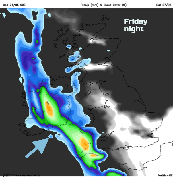
Signs of change begin to appear later Friday. From the hot, humid, sunny, dry weather to the threat of heavy rain even thunder. During Saturday, there is still heat about. Currently, SE Britain and NW Britain look to keep the high temperatures and humidity. Eastern Britain has a fresher, cooler breeze off the North Sea and southwestern areas begin to see rain.
It looks like a band of heavy and thundery showers will move NE’wards across the UK. This means some areas will stay dry and other will see hefty downpours. It will freshen the air slightly. The current forecast shows the risk of rain over eastern and northern Britain by Saturday evening.
By Sunday, the high pressure is back with more sunshine, warmth and fine weather, just a cluster of showers in the far north of Scotland.
For Bank holiday Monday, a lot of uncertainty so worth checking back with the forecast. There could be showers moving up into southern Britain, eastern areas look cooler with a breeze off the sea and western parts will be quite warm and brighter.