Rising temperatures and hot, summery weather set to arrive as the week progresses.
The new working week will start with plenty of dry and fine weather across England and Wales, where it will also be a warm day, but this is nothing compared to what is on the way later in the week. Today won’t be dry everywhere, with some showery weather forecast to move across Scotland this afternoon, more on that shortly.
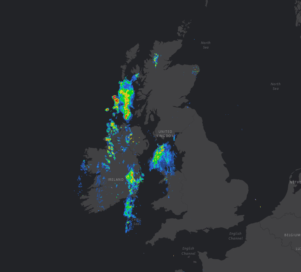
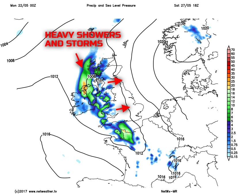
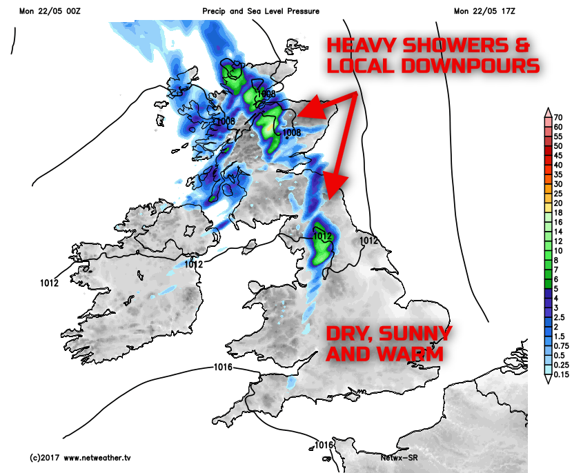
Through the rest of Monday and the dry and sunny weather across much of England and Wales will carry on. Despite variable cloud, perhaps mainly medium and high cloud, there will be plenty of sunshine, and it will be warm this afternoon. Yet, across Scotland and the far north of England, showers and longer spells of rain will move eastwards, this associated with a weather front. Some central, northern and eastern areas of Scotland, in particular, could have some lively downpours this afternoon with thunder possible. Some of these perhaps developing across parts of N England, but they will be more scattered here.
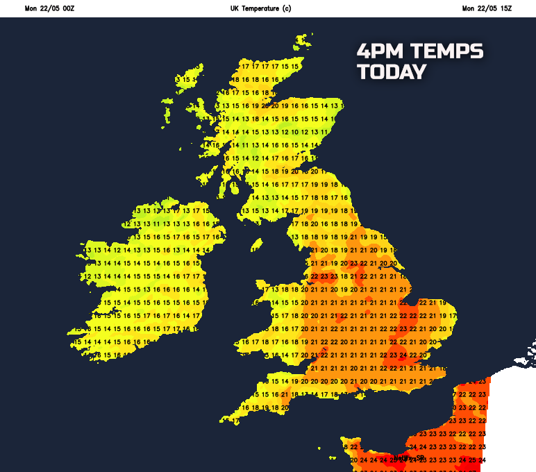
Temperatures today will rise to near 20C to 23C across many inland areas of England and Wales, as ever cooler around the coast. Not quite as warm across Scotland and Ireland, given the more unsettled conditions, temperatures will still be near the late May average.
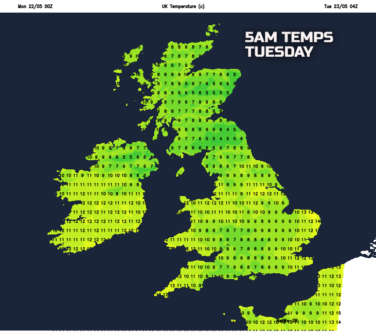
Into Monday night and any wet weather across Scotland will clear. Some low cloud, perhaps with patchy light rain or drizzle, may develop across some parts of Ireland, Wales and SW England. But, overall, the emphasis is on a lot of dry weather.
A cooler and fresher air mass will also mean a chilly night, locally at least across the north of the UK. Something some of us may well be craving for by the end of the week!
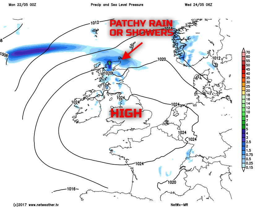
As we look ahead into Tuesday and Wednesday, high pressure will begin to build into the UK from the west and south-west. Mainly dry and settled conditions will then dominate, but with perhaps some patchy rain or showers around the periphery of the high. Some northern and western areas of Scotland especially could have some damp weather. But both days will be dry for much of the British Isles with bright or sunny spells. Pleasantly warm in the sunshine too, but it will be after Wednesday when the heat begins to build. Our medium range weather model highlights the potential damp weather in the far north, but otherwise, it's settled for most.
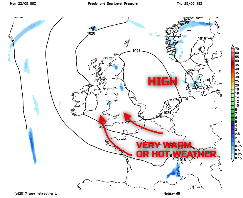
It is from mid-week when the heat builds. The high pressure is forecast to drift to the east of the UK slightly, and this will allow for some very warm, if not hot air to drift northwards out of the near Continent. It is likely that both Thursday and Friday will be dry with bright or sunny spells, some of these could well be prolonged at times too.
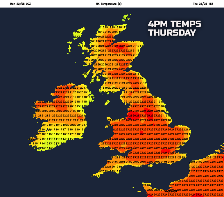
Many inland areas of the UK will see temperatures comfortably rise to between 20C and 23C. However, temperatures more locally are likely to rise to 23C to 26C. With some potential for temperatures to perhaps near 27C to 29C across more urban areas to end the week. Undoubtedly this will become the warmest spell of weather so far this year for all of the British Isles. It will become increasingly uncomfortable by night too with some very high minimum temperatures.
The heat and humidity will continue to build through into the start of the Bank Holiday weekend as well. But, for now, at least, it looks as though the weekend will signal a breakdown of the heat to more unsettled conditions. As is often the case, this could well come in the form of some thundery weather. So if you’re not a fan of the heat and humidity then somewhat cooler and more unsettled conditions are likely to spread from the west as the holiday weekend progresses.