Rain today in the east, plenty of showers from the west into Saturday. Then warmth from the south for Sunday and the start of next week.
We have an unusual setup at the moment with a low pressure to the NW and a developing low pressure in the southern North Sea. The two interact and swing around each other (dumb-bell). The NW one loses its identity, but the one to the SE deepens for a time bringing more rain and moves up the North Sea coast of Britain before swinging west over northern Scotland. Usually, low pressures swing in from the Atlantic and move eastwards over northern Britain. This synoptic pattern means eastern England is seeing some decent rain, Scotland will get rain at the weekend and throughout there will be showers feeding in from the west to add to the unsettled picture.
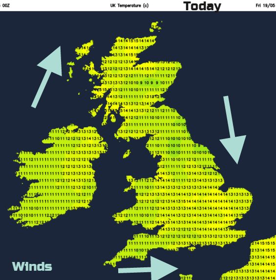
It’s also quite cool at the moment. The flow off the Atlantic has resulted in lower overnight temperatures and a more subdued, fresher feel by day. Warmer air begins to arrive by Sunday and will last into next week.
Today
There is lovely sunshine for western Britain and much of Northern Ireland and a good deal of Scotland with some high cloud here. There are a few showers over Cornwall and the Bristol Channel with more skirting Co. Fermanagh.
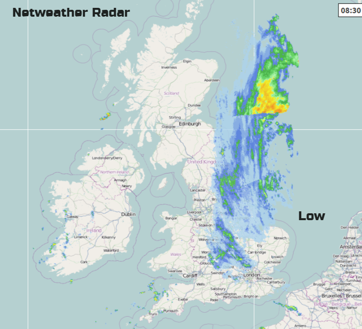
The eastern rain moves slowly northwards today bringing more cloud and wet weather into eastern and NE Scotland. Eastern England has more grey wet weather but eventually, SE England and East Anglia will dry up and the cloud cover will lift a bit. Along eastern coasts, it will be cool especially in the northerly breeze. Northern Ireland, particularly western counties and the far west coast of Scotland will see showers again today with bright spells. More showers begin to appear over SW Britain through the day with some heavy even thundery downpours likely. In between as always there will be sunny spells. This risk extends over London and southern England, also Wales by this afternoon, up into the southern Midlands this evening. Elsewhere, it is a mixed picture with the risk of showers and bright even sunny conditions.
Overnight the low pressure whirls near to NE Scotland bringing a lot of low cloud and outbreaks of rain. Most of the daytime showers fade, but a line moves over SW Britain before dawn so it could turn wet here briefly and then move on. This line, this weakness then moves over central Britain
Saturday
Tomorrow looks cool and breezy, blustery at times. The wind veers from S to W with fresh winds for coastal parts and strong winds possible around the Moray Firth as the low moves round. The line of showers moves over Wales into the Midlands and northern England, and as the warmth of the day peaks, heavier showers will be set off with the risk of hail and thunder. Again, the air will be cool especially in the fresh SW breeze but watch the sun can still burn. Gradually the risk of showers fades, diminishing from the SW first, across most parts in the evening. Rain will linger in the far NE of Scotland with more cloud, but for most of the UK it become clear and cool into Sunday.
Sunday
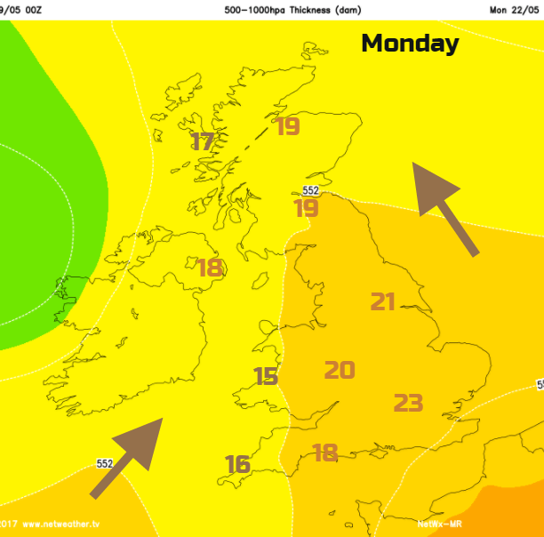
A warm front spills cloud and outbreaks of rain over Northern Ireland and western Scotland during Sunday. A warmer southerly flow takes hold, and within the wide, warm sector it will begin to feel less fresh. Temperatures will head into the high teens especially for eastern parts.
This warmth then lasts into the new week with temperatures into the low twenties looking likely for England, high teens elsewhere.