A pretty typical mix of weather for the bank holiday weekend, some dry and fine periods, but also some rain at times.
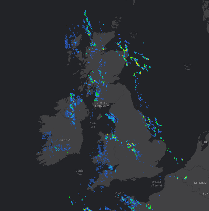
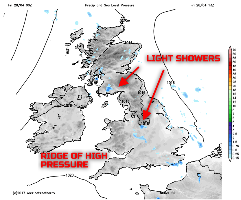
The working week is coming to an end with some reasonably fine and settled conditions as a little ridge of high pressure builds across the British Isles. There are, however, some light showers or some patchy rain in places this morning, particularly across some eastern coastal areas and also across some western areas of England and Wales too, as our recent rainfall radar highlights. Some clear skies overnight have allowed temperatures to drop away, with some local frost, but the emphasis is on a lot of dry weather this morning, and that trend will continue into the start of the Bank Holiday weekend.
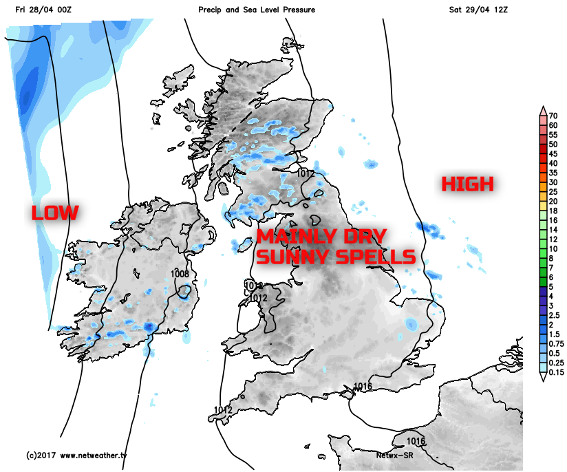
Through the remainder of Friday, it is the ridge of high pressure that will ensure a lot of dry weather continues across the UK in what will be a good day of weather, especially when compared to the weather earlier in the week. Some light showers are possible, these perhaps most likely across some parts of Wales and western areas of England. For most, though, a fair weather day is on the way, and with some sunshine and light winds then it will certainly feel milder than earlier in the week.
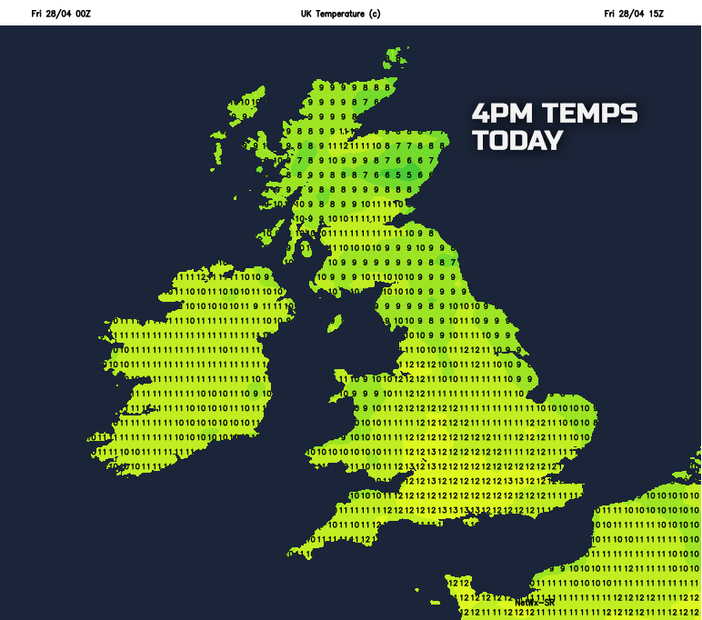
Temperatures this afternoon will still fall short of average for late April with maximum temperatures around 7C to 11C across Scotland and Ireland, and around 9C to 13C across most of England and Wales.
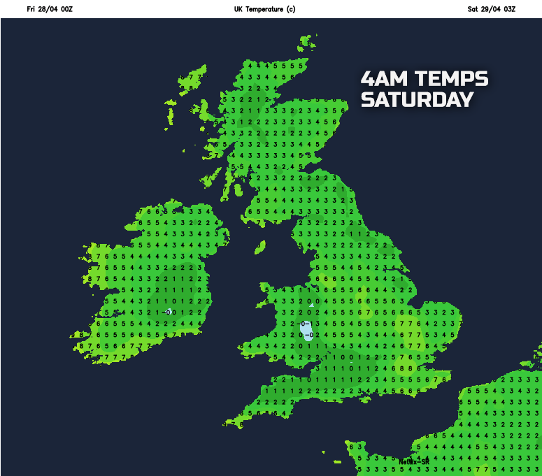
So, we move into Friday night, and it will be a dry night across many areas of the UK with little in the way of any significant weather, with a mix of clear spells and variable cloud. It will be another chilly night, especially rurally with a touch of frost, but compared with earlier in the week then it won’t be quite as a cold.
The Bank Holiday weekend will start dry across many areas, after the chilly start. Many parts of the UK will maintain a lot of dry weather through the course of Saturday as high pressure continues to be influential. Low pressure will approach from the west and south-west during the day, but this won’t be a feature of the weather until we move into Sunday. So, plenty of bright or sunny spells will develop, despite variable amounts of cloud. It will be pleasant enough in some sunshine too, but there will be an increasingly moderate or fresh S or SE’ly breeze developing through the day.
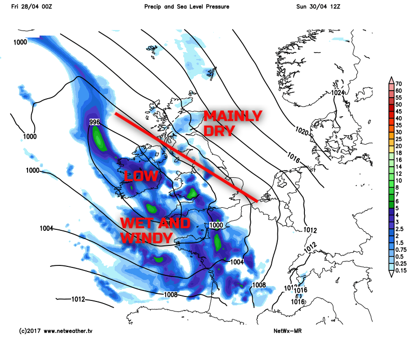
As the weekend progresses, more unsettled conditions are forecast to arrive. Low pressure will become dominant across Ireland, Wales and SW England overnight on Saturday and then more particularly into Sunday. The low pressure will then introduce far more unsettled conditions across more southern and western regions of the British Isles with rain and showers, some heavy rain too perhaps as Sunday progresses. A fresh or strong SE’ly wind will also be a feature of the weather, but there will still be a lot of dry weather across Scotland and N England through Sunday with some bright or sunny spells. There are still some uncertainties over the details as we move into Bank Holiday Monday as to whether the wet weather will move further north and east, to affect Scotland and N England, which is possible. However, the further north and east you are, then, overall, the greater chance of dry weather persisting throughout the weekend, while further south and west it will become increasingly wet as our medium range weather model highlights for Sunday afternoon.
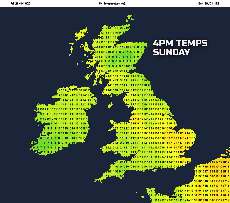
Temperatures over the weekend will steadily rise, this primarily due to the change in wind direction to more of a south or south-easterly off the near Continent. There will still be some regional variations; particularly when any wet weather develops it will be quite chilly. In contrast, further north and east then temperatures may well rise to 15C or 16C, and this will feel much milder than compared with of late, despite the windy conditions.
So, a case of making the most of the decent weather within the short term, if you live in more southern and western areas of the British Isles, as it will become increasingly unsettled as the weekend progresses. However, for more northern and eastern parts of the British Isles, then a lot of dry weather will continue in the coming days in what will be a rather typical mix of Bank Holiday weekend weather.