A chilly start today in the south but after showers today there will be a fair spell of weather Fri/Sat. Later in the Bank Holiday weekend looks more unsettled but still with warm sunshine.
High pressure is still out in the Atlantic with weather fronts toppling in from the north. This is bringing more cloud and showery outbreaks of rain over the northern 2/3rds of the UK, but this is quite patchy. The warm front is over northern England and north Wales, there are breaks in the cloud making up the warm sector with its milder air and then the cold front is arriving in the far north of Britain.
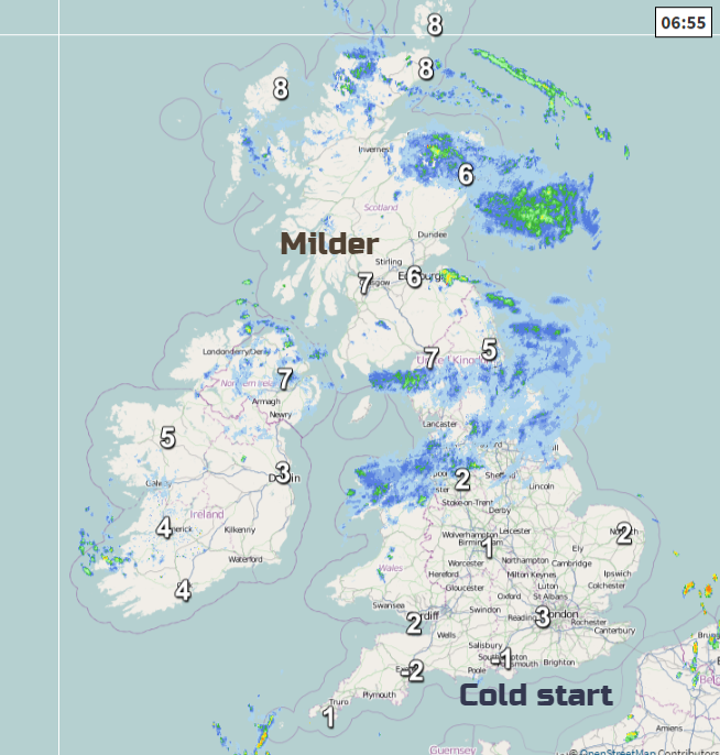
In the south, it is clear and sunny but cold. There has been a frost with temperatures down as low as -5C. The weather is beginning to settle down and become less cold. As the high builds nearer to the UK, we will see more dry and bright weather with lighter winds on Friday.
Today a cool brisk NW wind will pick up and just add a bit of a nip to the air for exposed or shaded spots. In the sunshine, again it will feel pleasant enough but only around 10 to 13C. Midlothian and Falkirk might get a few degrees higher.
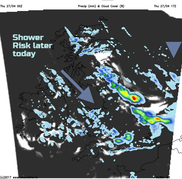
Through the day as the cold front begins to trail down eastern Britain and the sunshine gets going, there will be heavier showers breaking out. As always with showers it will be a hit and miss affair but there is the scope for downpours over eastern England, SE England and a few more over Wales heading into southern England this evening pushed on by the NW winds.
Overnight we are still in the cool N/NW flow and there will be clearing skies with temperatures dipping near to freezing for a few inland parts of the north, not as cold as last night in the south. The heavier showers will have faded but there will still be some areas of cloud with the odd light shower about.
Friday
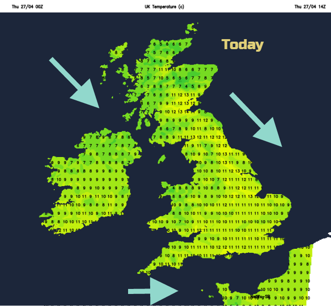
Tomorrow will be a fair day with bright skies, much lighter winds and variable cloud. Again, there will be a few light showers but the emphasis is on a lot of okay weather with temperatures of 10 to 13, maybe 14/15 in the far south. The UK will be in a col, a be-calmed area (in-between 2 highs and 2 lows) and these can attract a fair amount of cloud.
By the end of the day the winds will be from the south. This different airflow will bring the potential for temperatures to reach into the high teens by Sunday or Monday. However, a Bank Holiday full of sunshine is not on the cards at the moment and so cloud and rain could keep the temperatures lower. At least it’s not a snow bringing northerly.
Saturday looks like another fair day with sunny spells, but blustery winds for Northern Ireland and western fringes of Britain and the far north of Scotland. The wins will be from the SE and a few sheltered spots could see 14 or 15C in the sunshine and feel lovely. It will be a mostly dry and bright day but just a scattering of showers from the west.
Sunday into Monday
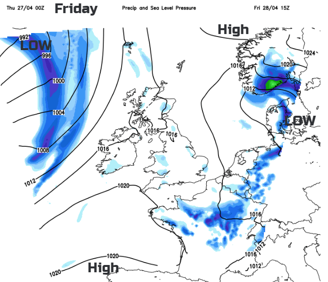
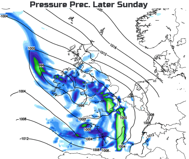
An area of low pressure begins to develop over SW Ireland early on Sunday. A brisk east wind picks up but there will be some fine weather over Britain early on. Cloud begins to increase from the SW and showery outbreaks of rain spill over Northern Ireland, Wales and SW Britain. The low pressure moves over the UK during Sunday night bringing more rain and nudges northwards into Monday. There is low confidence about timings and exact position of the rain bands, so this part of the forecast needs to be treated as a trend. That there will be a spell of unsettled, blustery weather with showers and heavy showers. In between will be warm sunny spells to enjoy but it’s all a bit unreliable at this stage.
Tuesday looks better and warmer, but then it would as most will be back to work or school.
Forecast for your location here.