
Cold northerly wind easing today, showers mostly across England. Cloud and rain spreading south over Scotland today, then England and Wales tomorrow. Warmer Bank Holiday Weekend, but some rain arriving later on Sunday.

Tuesday saw a return to winter, yesterday’s top temperature was 12.4C in Cardiff, but for many it felt a lot colder than this out of the sun and exposed to the cold and blustery northerly wind, feeling more like winter than late Spring. Places as far south as Norwich saw snow falling from showers, there was a good covering of snow across the Highlands and a dusting as far south as the NW Midlands first thing, there was even thundersnow across the north. Some places saw hail, graupel and thunder from showers too. For more on what graupel is, see Jo Farrow's Blog here
For those who don’t like the cold conditions, thankfully temperatures are set to slowly increase by the Bank Holiday Weekend, as the northerly wind fades and a southerly flow develops by Saturday. On Sunday, we could see temperatures reach 16-17C across SE England – which is more akin to late April.
Yesterday saw a widespread peppering of showers, but overnight the showers became confined coastal areas of eastern England, which allowed lengthy clear spells to develop across southern Scotland, NW England and Wales, which combined with lighter winds, has led to a frost to develop in these areas. Temperatures by dawn fell to -4C at Sennybridge in Powys, Wales and -3C at Drumalbin, southern Scotland. Elsewhere, it’s a cold start too, with temperatures widely at dawn a couple of degrees above freezing at best.

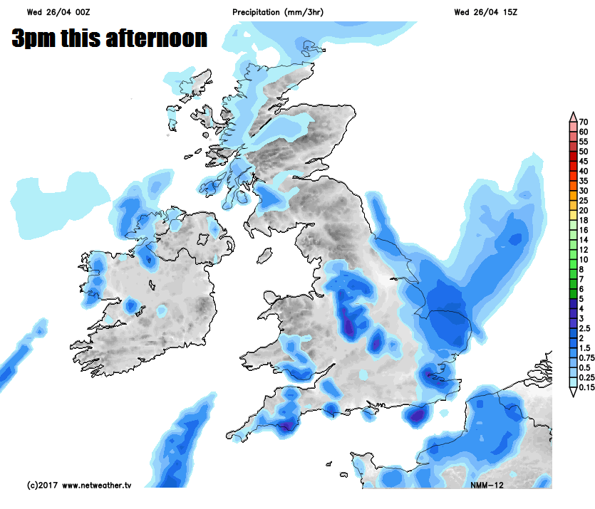
Thicker cloud and some rain along a warm front is drifting southeast across northern Scotland and Northern Ireland so far this morning, raising temperatures. This cloud with patchy rain will slowly encroach further south across Scotland and N. Ireland through the day, though southern Scotland should stay dry. Across England, showers towards the east coast of England this morning will develop more widely this afternoon, heaviest and most frequent towards eastern England – where they will be accompanied by hail and thunder. A few passing showers for Wales and SW England, but for many it should remain dry and bright or sunny after the cold start.
Feeling cold again today out the sunshine, especially towards the east coast of England – where there will be a blustery northerly wind. Turning milder across the far northwest. Temperatures down the east coast reaching 7-9C at best, otherwise 9-12C.
Showers tending to fade as we head through tonight, allowing skies to clear across southern areas leading to a patchy frost. Cloud and patchy rain spreading south across Scotland, N. Ireland and northern England during the night, meaning it will stay frost-free here.
Then on Thursday, after a cold, bright and frosty start across southern areas, cloud and patchy rain will move down from the north through the day, this marks a warm front – which will introduce milder but brighter conditions from the Midlands northwards by late afternoon, though with a few showers too. Temperatures reaching 9-12C generally, perhaps 13C across western Scotland.
Friday is looking mostly dry and bright, as ridge of high pressure builds in from the west, though there could be a few showers at first and perhaps isolated showers developing in the afternoon across the far south. Temperatures reaching 10-13C widely, perhaps 14C in London.
Largely dry and bright or sunny on Saturday, then on Sunday another mostly dry day – but high pressure will be retreating to allow frontal systems to make inroads from the southwest, some uncertainty how far the rain will make it, for now Ireland, south Wales and southern England by evening. Feeling pleasant in any sunshine, perhaps reaching 16C in the south before the rain arrives. Band of cloud and outbreaks of rain spreading northeast across the UK on Monday, brighter skies with scattered showers following on behind from the southwest.


