Staying fine, mostly dry, with some pleasant spring sunshine this weekend, but change is on the way for next week.
For many areas of the UK, the dry weather continues, there is, however, a lot of cloud across the country to start the day, even across southern England where there has been a lot of sunshine recently. Through the course of the next few days high pressure, which has been maintaining a lot of dry weather of late, will continue, so a fine weekend awaits. However, it is beyond the weekend when the weather will become far more active and interesting after a very benign period of weather of late.
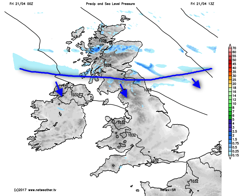
During Friday an increasingly weak weather front, a cold front will very slowly move southwards across the UK. As it does so, any rain associated with it will, essentially, fizzle out with a band of cloud reaching central and southern areas of England this evening and overnight. Within the short term though, the front is bringing some wet weather to central and northern Scotland as our rainfall radar highlighted earlier.
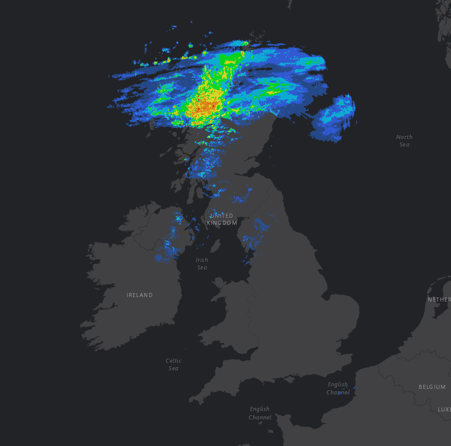
Through the rest of Friday morning and through into the afternoon the more persistent rain will ease with just a region of light and patchy, rain and drizzle, moving down across the rest of Scotland, N Ireland and N England. Ahead of this though and for most of England and Wales it will be another pleasant day as the cloud breaks with some bright or sunny spells likely to develop.
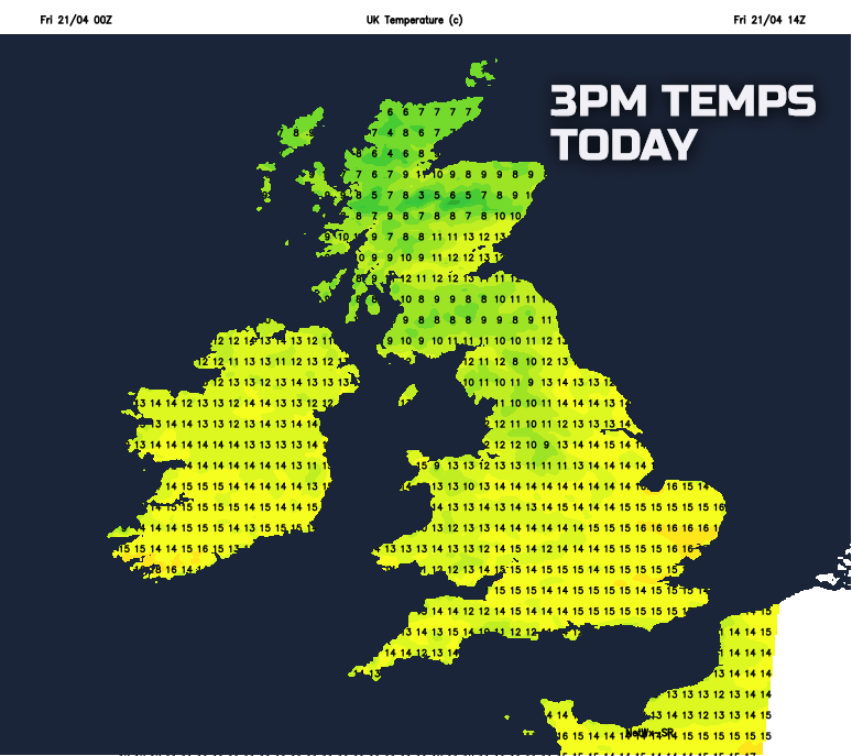
Temperatures this afternoon will widely reach 13C to 16C across England and Wales, but locally up to 17C or 18C is certainly possible across some southern and eastern counties of England. However, as the name implies, the cold front will introduce colder air to more northern areas as the day progresses. As a result parts of Scotland, N Ireland and N England will, if anything, see a drop in temperature through the afternoon and into the evening. This distinct difference in temperature between the north and south of the UK is highlighted well towards mid-afternoon.
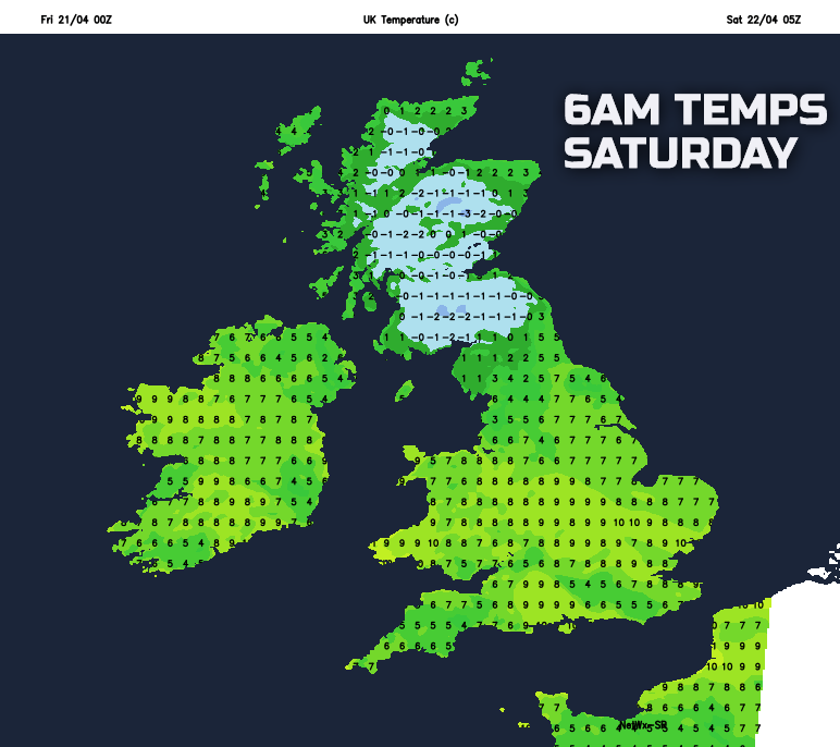
Into Friday night and overnight Saturday and it will be a colder night than the last few nights across more northern regions of the UK. The weak weather front will continue to very slowly move southwards across central and southern England, by this time it’ll be nothing more than a region of cloud, which will help to keep temperatures well above freezing across the southern third of the UK. Some frost is certainly possible though across Scotland and parts of N England, so gardeners and growers beware.
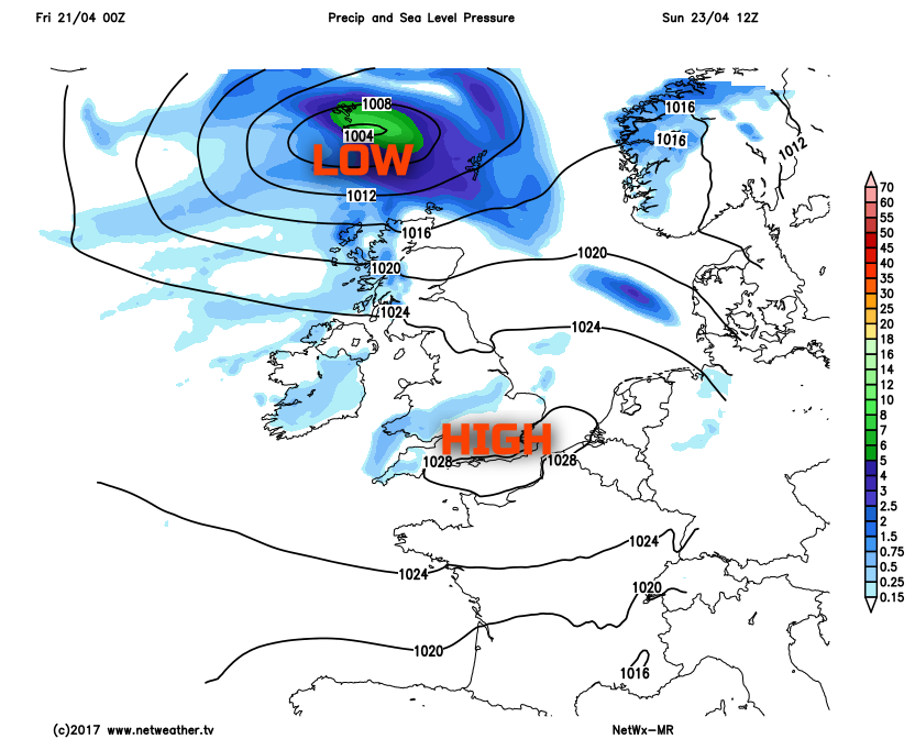
Looking at the weekend and, overall, it will be a continue to be quiet for many of us. The weak front across southern England will soon clear on Saturday morning, and then much of the UK will have a dry day with bright or sunny spells. High pressure will be situated just to the west of the British Isles, and this will be the most influential feature, maintaining a dry and settled theme. Best of the sunshine through the day is likely to be across parts of Wales, the Midlands, southern and south-western areas of England and pleasant enough in some sunshine. A few showers are possible across Scotland though, these perhaps wintry on hills, but otherwise a fair weather day for many areas on Saturday. Temperatures are expected to range between 7C and 13C, highest across the areas mentioned above where most of the sunshine will be.
Into Sunday and we then begin to see signs of change, after another chilly night, with frost again possible quite widely across inland areas of the UK. While most of England and Wales will have yet another fine and settled day, due to further higher pressure, low pressure will be approaching Scotland from the north-west. This will, as a result, signal a progression towards more unsettled weather across the north of the UK through the day with an increasing fresh or strong westerly wind and with, eventually, some rain and showers moving into Scotland.
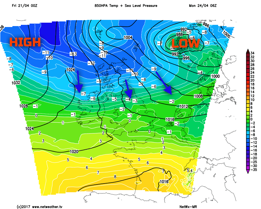
A pronounced change in the weather is then expected to take place during the start of next week. The low pressure that will develop to the north of Scotland through Sunday will clear away to the north-east of the UK. This low pressure will then combine with higher pressure to the west and north-west of the UK to allow for a direct feed of cold arctic air down over the country. A cold front will move southwards on Monday, perhaps finally bring some rain to southern England which has been very dry for some weeks now. It is behind this weather front that the arctic air mass will arrive, as shown by the blue shadings on the weather chart for early Monday.
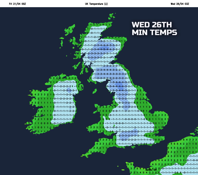
While the details remain uncertain at this stage, there is increasing confidence for wintry showers to become increasingly widespread through the latter part of Monday and on into Tuesday and Wednesday. Initially, the showers are expected across the north of the UK and around windward coasts, but also developing inland during the day, given the time of year. Some snow accumulations are possible, especially across higher ground of the north, while hail and sleet are perhaps even possible across southern regions. It’ll feel particularly cold in a fresh, or strong northerly wind and some widespread, harsh frosts for late April are possible too.
So, after the recent benign spell of weather, a marked change in the weather is on the way into next week. Stay tuned for all the usual updates in the coming days and most certainly a case of don’t put the winter woollies away just yet!