A chilly start today, but plenty of sunshine on the way through the day. Overall, it's then a quite quiet. benign weather of weather to come with high pressure closeby.
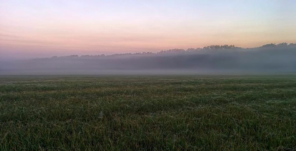
It has been a particularly cold start to the day across many central and northern areas of the UK in particular. The combination of clear skies, light winds, and a particularly cold air mass for the time of year has allowed temperatures to fall sub-zero. Overnight minimum temperatures have reached -2C at Glasgow, -3C Eskdalemuir, -4C at Shap, -5C at Tulloch Bridge and even -7C in the Cairngorms. While temperatures haven’t fallen quite as low across more central and southern areas, it is still a chilly start with some frost.
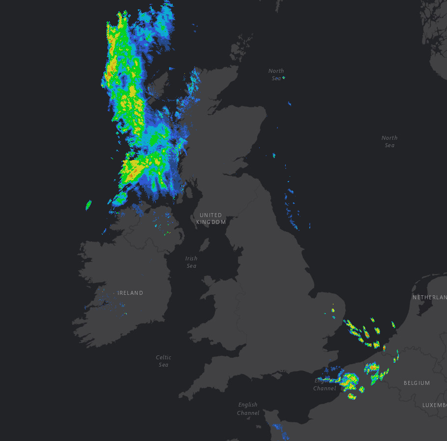
Despite this, it is a fine start to Tuesday across many parts of the UK with plenty of spring sunshine this morning. There is a weather system though approaching parts of W Scotland and N Ireland which will signal a cloudier and damp morning with some patchy rain and drizzle, this wet weather evident on recent rainfall radar imagery.
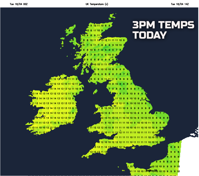
Through the rest of Tuesday and high pressure will, overall, continue to be the dominant feature of the weather for most of the UK and this will maintain fine and settled conditions. Best of the sunshine today will be across England and Wales where just fair weather cloud will likely develop, but this won’t stop some prolonged spells of spring sunshine. Despite quite depressed maximum temperatures, the combination of the increasingly ‘strong’ April sunshine and light winds will lead to a pleasant afternoon. It will, however, generally become cloudier across most of Scotland, Ireland and, eventually, N England with medium and upper-level cloud making the sunshine rather hazy here. Some further nuisance-value light rain and drizzle will continue to affect western areas of Scotland and Ireland too this afternoon.
Temperatures will be quite low for the middle of April, below average in fact, with maximum temperatures ranging between 7C and 12C across the UK, but again it won’t feel too bad given the April sunshine. Temperatures may reach 13C or 14C though across parts of Ireland, but this will be the exception.
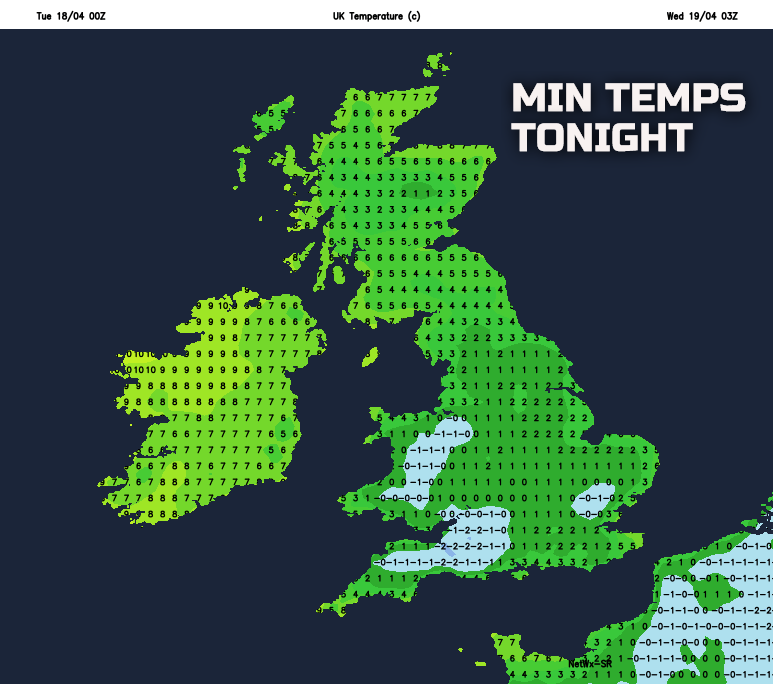
Into Tuesday evening and overnight and a general north and west, south and east split in conditions will develop. Across most of Scotland, Ireland, and N England it will remain mostly cloudy, albeit predominantly dry. Weak weather fronts will, however, continue to maintain a risk of some patchy light rain and drizzle across parts of W Scotland and N Ireland. Across many central and southern areas of England and Wales, Tuesday night will produce another opportunity for a cold night with clear skies and light winds allowing temperatures to quickly fall this evening. As a result, a colder night is likely across the southern half of the UK tonight than compared with further north, and this is highlighted well on the minimum temperatures for overnight. Grass frost is likely to be quite widespread, with local air frost too, so another night for gardeners and growers to be aware of some low minimum temperatures.
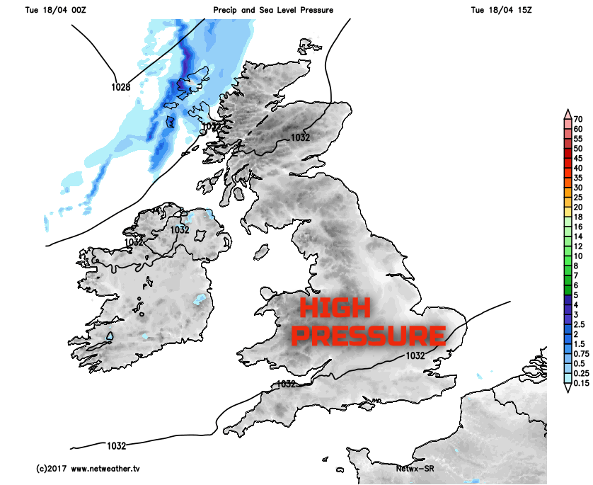
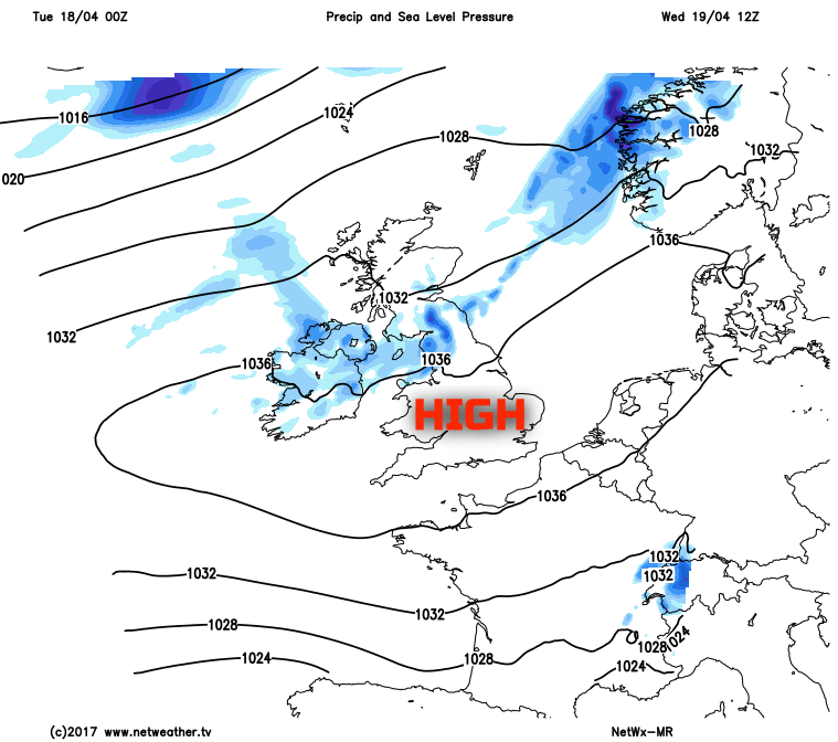
Looking ahead through the rest of the working week and the weather, overall, really will remain particularly quiet and benign across many areas of the UK due to high pressure. The main location of the high pressure will be as such that it is across more central and southern England where the best of any cloud breaks will be and, hence, it is here that most of the sunshine will be too. Across more northern areas of the UK, so across Scotland, Ireland and N England, perhaps N Wales and the N Midlands at times too, it will be cloudier, if not overcast, with some nuisance-value patchy light rain and drizzle. This general north and south divide is highlighted well on the chart for Wednesday, with some precipitation signalled across more central and northern areas.
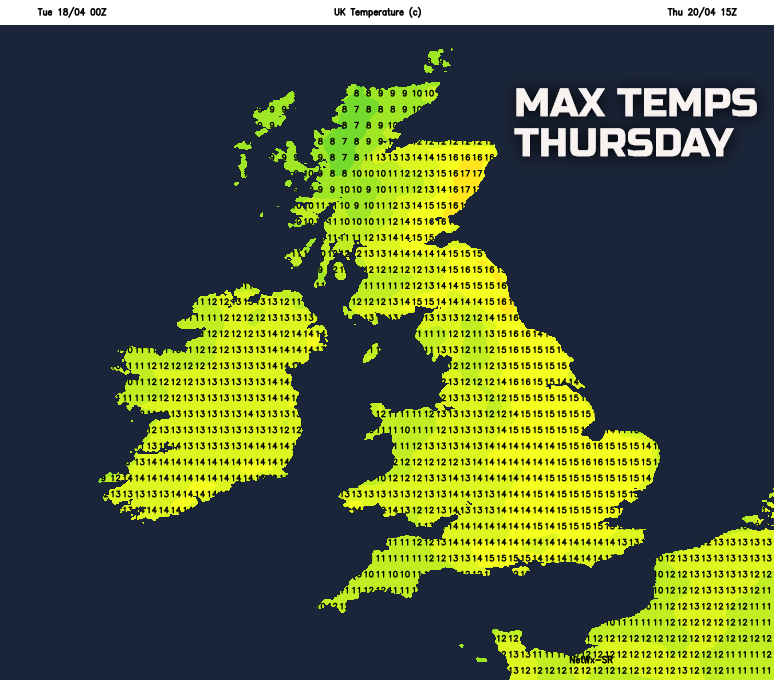
Temperatures will recover somewhat too in the coming days with a decreasing risk of frost by night and temperatures will ease back nearer to the mid-April average. By the time we get to Thursday then maximum temperatures, currently at least, may well be near 12C to 16C more widely across the UK and clearly in some sunshine then that will feel pleasantly warm.
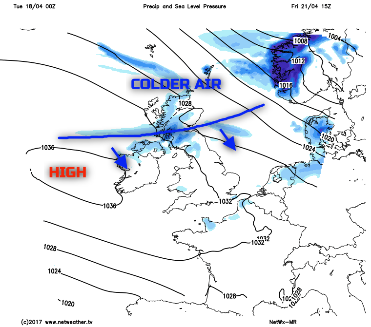
Any rise in temperatures though could be short-lived as the main area of high pressure begins to decline to the west of the UK towards Friday, and a cold front moves down across the UK. This will be a particularly weak feature, so nothing more than light rain or showers are expected, but it may well re-introduce a cooler, if not colder, north or north-westerly wind as the working week comes to an end. Overall though, the emphasis is clearly on a lot of dry and benign weather in the days ahead for much of the UK, despite likely further fluctuations in temperatures, something which can often happen in April.