Rather cool for Easter Sunday, with cloud and rain spreading southeast. Sunshine & showers for Easter Monday. Then settling down from Tuesday as high pressure builds, with risk of frosty nights
First of all, we'd like to wish everyone a Happy Easter from all of the team at Netweather, fortunately it won't be chocolate egg melting weather, but it will turn cloudy with a risk of rain for many by the end of today.
After a promisingly bright start to Easter Sunday in the east, cloud and rain already in the northwest is forecast to spread southeast across central and eastern parts today. Easter Monday will see a mixture of sunshine and showers in a cold northerly flow. But from Tuesday, high pressure builds in, bringing largely dry weather for many for the rest of the week, with sunshine by day but widespread frost overnight. It will feel pleasant in any sunshine, but temperatures will be rather subdued for the time of year at first, though we could see the mid to high teens to end the week.
It’s another chilly start this morning, particularly where skies have cleared across northern and eastern Scotland along with NE England – where temperatures have fallen close to freezing bringing a patchy frost. Eastern areas of England are off to a promisingly bright start, but further west it’s a cloudier picture and also wet across western Scotland, N. Ireland and Cumbria.
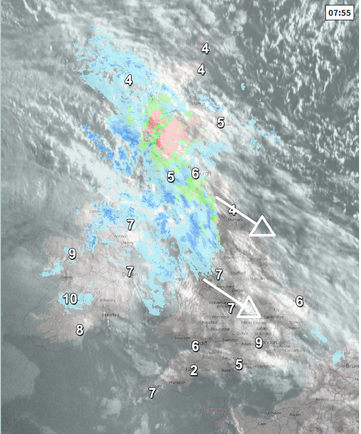
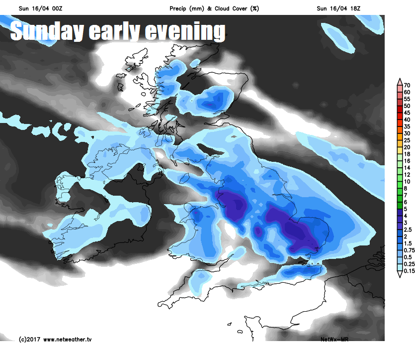
Outbreaks of rain and hill snow already across the northwest will spread southeast across central and southern Scotland, northern England, north Wales and the Midlands during the morning. Sunshine and showers for northern Scotland this morning, while it’s drier and brighter across south Wales and southern England, though cloud tending to thicken by late morning. Rain clearing N. Ireland through the morning, to join northern Scotland to brighter skies by early afternoon, though risk of further showers across northern Scotland during the afternoon. Rain will eventually reach East Anglia and SE England by evening, while clearing from southern Scotland and northern England – where it will turn brighter from the northwest. SW England and parts of south Wales may escape with a dry day though.
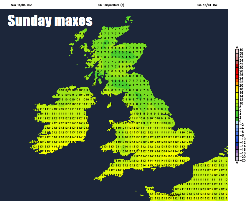
A chilly day across the north, temperatures reaching 7-10C at best across Scotland, N. Ireland and northern England. Temperatures rather disappointing for mid-April further south too, reaching 9-12C at best.
Rain across central and eastern England overnight eventually clearing away from SE England and East Anglia by dawn. Elsewhere, a few showers across northern areas, otherwise clear spells will mean it will turn chilly in the light northerly flow, turning frosty across northern areas.
Eastern Monday is looking brighter, with a better chance of some sunshine, but there will be some passing showers moving down on a cold northerly wind, some of the showers on the heavy side towards the east. The northerly flow will dig deep into central Europe further east too, bringing some late season snow to the Alps to start the new week. Chilly down the east coast – where the northerly wind will be strongest – temperatures reaching 7-10C at best. Elsewhere we are looking at 10-13C, perhaps 14C in London.
Then with winds falling light and skies clearing Monday night, a widespread frost can be expected in rural areas and perhaps towns and cities in the north too, so gardeners take note.
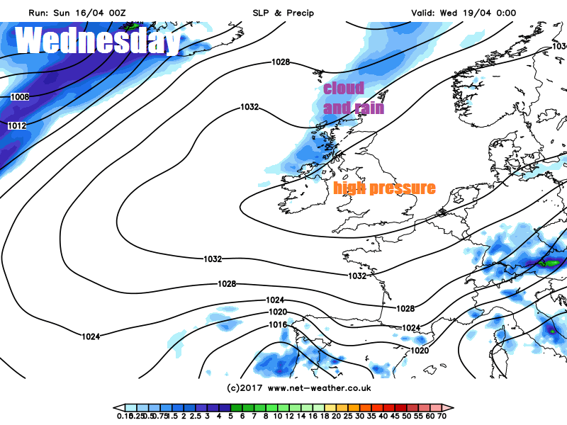
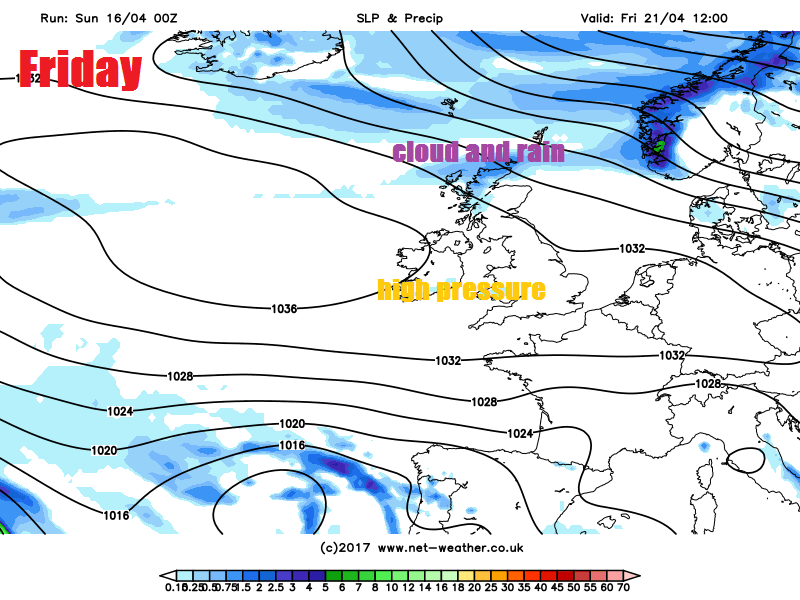
High pressure will build in from the west on Tuesday, so the rest of the week is looking largely dry for many with sunny spells and feeling pleasant in the sun, but with clear skies overnight there will be a risk of frost – especially, but not exclusively, in more rural areas. The exception will be across Scotland, N. Ireland and perhaps far north of England on Wednesday, as an Atlantic front moves SE bringing thicker cloud and some rain. The cloud and rain fizzling out as the front continues southeast into Thursday and weakens as it bumps into high pressure. Cloud and rain could return again to northern Scotland on Friday too. But for most, a dry week ahead from Tuesday. Temperatures by day rising by the end of the week, a long way off – but Friday could see 16-18C.