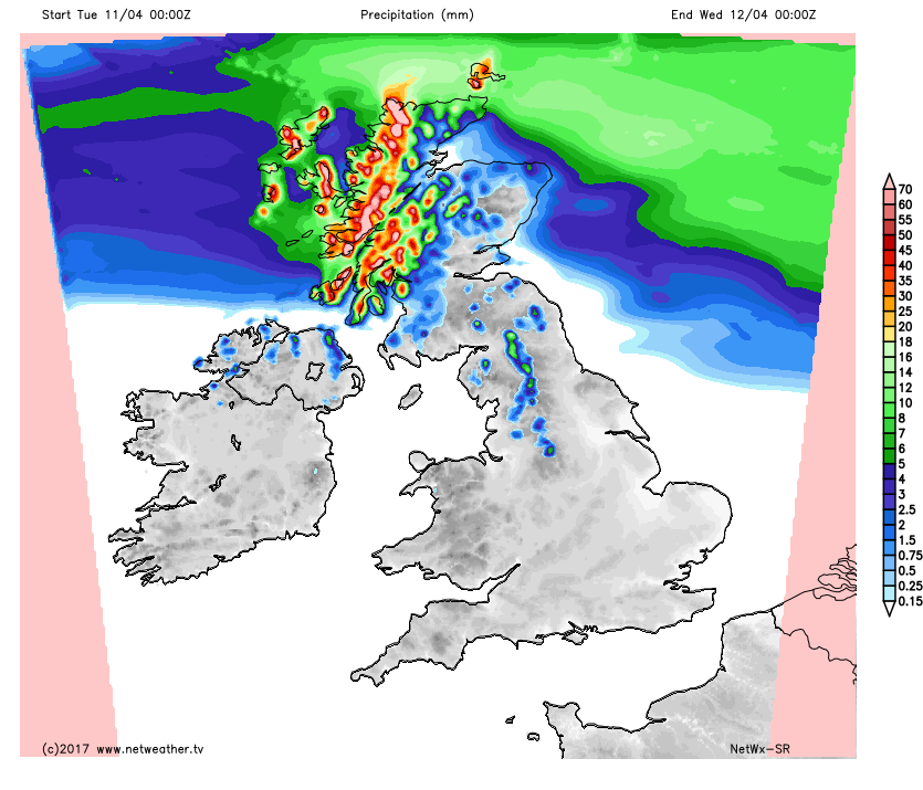
It's the Northwest of the country catching most, but not all of the unsettled weather over the next couple of days.
It's often the northwest of the country in line to catch most of the unsettled weather in the coming days, with some of that occasionally spreading further south and east. Today is one of the days where most other parts of the UK get away dry, as the Northwest sees the rain and also some strong winds.
The rain total forecast for today about sums it up, with parts of the far Northwest getting quite the soaking, along with just a few showers here and there over the Pennines and in one or two other parts of northern Britain.
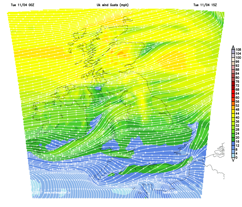
For those drier regions, there'll be some decent sunny spells, especially during the first half of the day, but the cloud will increase as the day wears on. Temperature wise, it's not far from the norm for the time of year with highs of 14-16c across the south, 9-13c typically elsewhere, but cooler than this under the rain. The wind will also make it feel that bit cooler than the thermometer shows as well, especially across the northern half of the country, where gales are possible in exposed spots.
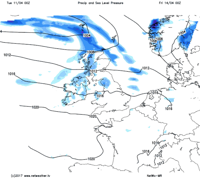
Overnight and into tomorrow, winds start to swing more into the Northwest - a cooler direction, as the rain slowly edges further Southeast, readily breaking up into showers as it does so. Behind that, there'll be a fair few showers, and with the cooler air, they'll be falling as sleet and snow up over the high ground of Scotland and later also Northern England, Northern Ireland and North Wales.
The Southeast of the country should get away mostly dry until much later in the day, and it's here where the milder temperatures will be, again peaking into the mid-teens, whereas elsewhere will sit at the 7-12c mark.
Into Thursday, and with the high pressure which has kept the south of the country more settled and a touch warmer just retreating a little further away, it'll bring the whole of the UK similar, but not identical weather. With a broad brush, it'll be cool, with a noticeable breeze, with scattered showers amongst the sunny spells. But as per the theme of much of this week, it'll be the Northwest often in the firing line for the showers, whereas the further Southeast you are, the more likely you are to see the best of the sunshine, along with lighter winds.
That pattern continues into the first part of the Easter break, but as we move through the weekend, high pressure is set to make a move back in across the Southwest. This will settle the weather down, killing off the bulk of any showers across the southern half of the UK, whereas further north, low pressure retains an influence, bringing some showery rain at times. We will keep the fairly cool theme going through the long weekend though, but with the sunshine quite strong at this time of year, it'll still feel warm enough during those sunnier periods - even in the showery north.
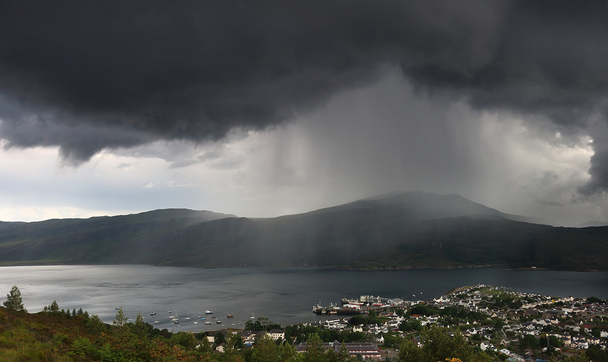
Todays photo - A shower over Ullapool (Northwest Scotland).