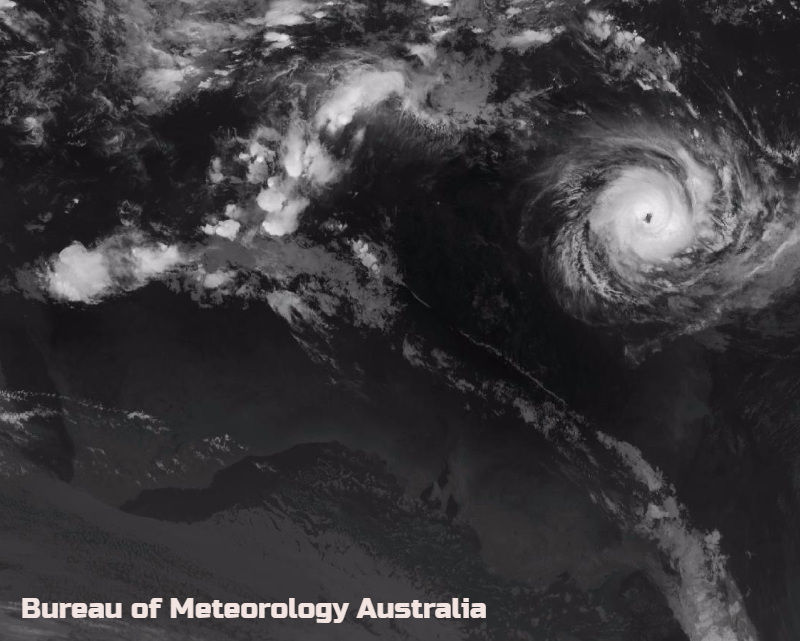
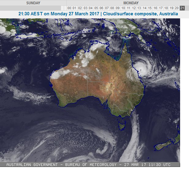
Cyclone Debbie is heading for the coast of Queensland, Australia with gales already affecting the Whitsunday Islands.
Queensland Australia watching severe cyclone Debbie. A category 4 cyclone with warnings for the Queensland coast on Monday night local time and for the Whitsunday Islands. Coastal towns are busy boarding up but some of the buildings have been around long enough to not have any cyclone-proofing, which is present in newer builds. This area is also farming country with many fruits and vegetables grown here, most of Australia's tomatoes and peppers
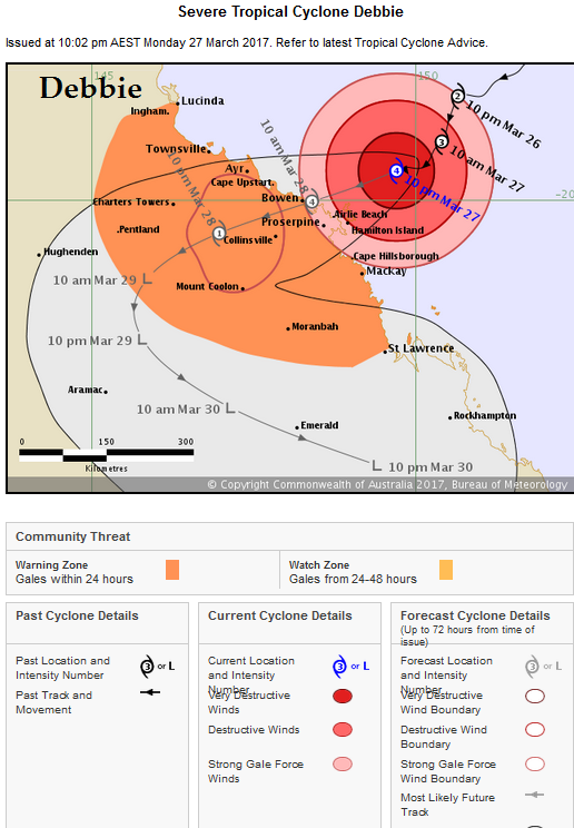
Severe tropical cyclone Debbie is currently a category 4 cyclone, with thousands of people already being evacuated. It may intensify further as it continues to move west-southwest towards the north Queensland coast tonight. Severe tropical cyclone Debbie is forecast to make landfall between Ayr and Cape Hillsborough (north of Mackay) on Tuesday morning. Intensity on Monday: Category 4, sustained winds near the centre of 175 kilometres per hour (108mph) with wind gusts to 250 kilometres per hour.(155mph)
Hazards:
The VERY DESTRUCTIVE CORE of tropical cyclone Debbie is forecast to cross the coast between Ayr and Cape Hillsborough (north of Mackay) on Tuesday morning with wind gusts potentially to 275 km/h (170mph) near the centre of the system.
DESTRUCTIVE WINDS with gusts over 125 km/h (77mph) are beginning to occur about the Whitsunday Islands, and will extend further to the exposed coast and islands between Ayr and Mackay later tonight. These DESTRUCTIVE WINDS may extend further northwest along the coast to Townsville and to adjacent inland areas during the day on Tuesday.
Widespread gales and a dangerous storm tide are forecast, with damaging waves and flooding of low lying areas. The cyclone is forecast to make landfall around 9am Tuesday morning at a similar time to high tide. Preparations continue for this major weather event.
Heavy rain is likely to cause severe flash flooding. Widespread daily rainfall totals of 150 to 250 mm, with isolated event totals of 500 mm, are also likely to lead to major river flooding over a broad area this week.