The fine weather actually came at the weekend for once, although there was still a nip in the air. Southerly winds will bring some warmth this week but it's a more unsettled picture overall.
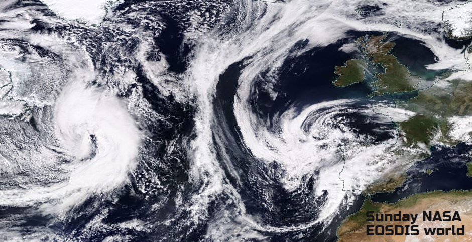
After a weekend of glorious sunshine, this week becomes more unsettled. A large low pressure coming out of NE America will churn slowly eastwards across the Atlantic and begin to throw rain over the UK accompanied by brisk winds.
NE Scotland saw the highest temperatures with 19.1 on Saturday and 19.9C yesterday. Many places had a real taste of spring, but there was still a cold nip in the wind, to remind us it is still only March.
We have a cool start this morning with inland frost for parts of northern Britain. High pressure is centred over the UK, a slight shift from the weekend when it was over Scotland. As a result, there has been a slow drift of low cloud from the North Sea overnight. Parts of eastern and central England have a grey, murky start. There is mist and patchy fog in other areas too but still more sunshine. Inland, this cloud will erode, lift and break through this morning but for eastern counties of England, it will linger.
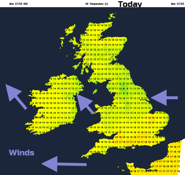
For much of the UK, it will be another fine, sunny day. Western areas will see the best of the spring weather although starting the day on a breezy note. The brisk SE winds remain for Devon and Cornwall but should lessen for Northern Ireland and around the Irish Sea. Scotland has very light winds for the NW Highlands with 18 or 19C possible again in the north. Belfast will still feel cool in the easterly breeze at 12C but Co. Fermanagh could reach 15 or 16C. Western Wales will feel warm at 16 or 17C, but only 12 or 13C were low cloud has stuck, or the moderate breeze catches. Much of England should see 14 to 17C in the sunshine but under the stubborn cloud or along the east coast only 11 or 12C and feeling nippy.
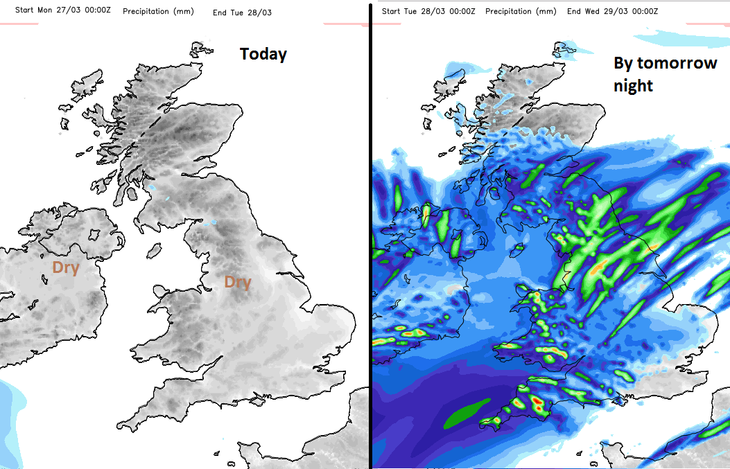
Tonight, more cloud creeps in from the North Sea over more of eastern and northern Britain with dampness in the air. A low pressure from the Bay of Biscay swirls up towards southern Eire before being swamped by the large Atlantic low. This also introduces more cloud and light showery bits of rain, heading their way northwards through Ireland and over SW Britain. So, a change in the weather after the dry, rather sunny few days.
Tuesday will have a milder start for southern Britain after the recent chilly ones. The SE winds veer round southerly to the SW as milder air moves in. Temperatures in England and Wales of 15 to 17C. By the afternoon, eastern England will be feeling warmer, but there will be outbreaks of rain over Wales and Northern Ireland, pushing up into NW England
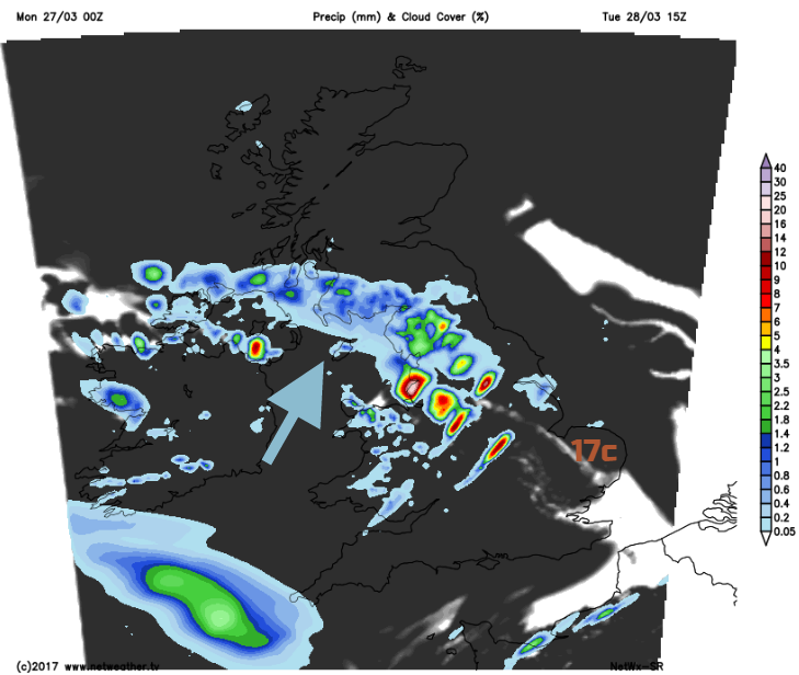
By the evening another band of rain will push in from the SW, but SE Britain should stay dry and bright through Tuesday and reach a warm 17C. With a SW breeze, rather than the easterly, it will feel quite different.
Midweek
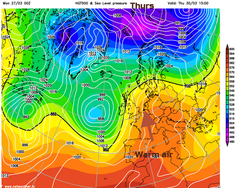
Wednesday becomes blustery but still mild. There will be more rain coming in from the SW, so still drier in the east, although some rain will reach across Britain. Temperatures of 12 to 17C. This more unsettled, blustery pattern continues, with SE Britain and NE Scotland seeming to miss most of the rain. Thursday shows signs that it could be warmer for England with maybe 20 or 21C (70F) in a southerly wind
Friday could see rain spreading over southeastern parts before an improving weekend as pressure rises once more.