Blue skies and warm spring sunshine for many today, though turning cold again tonight, with frost in the north. Remember clocks go forward tonight. Fine and sunny for Mother's Day.

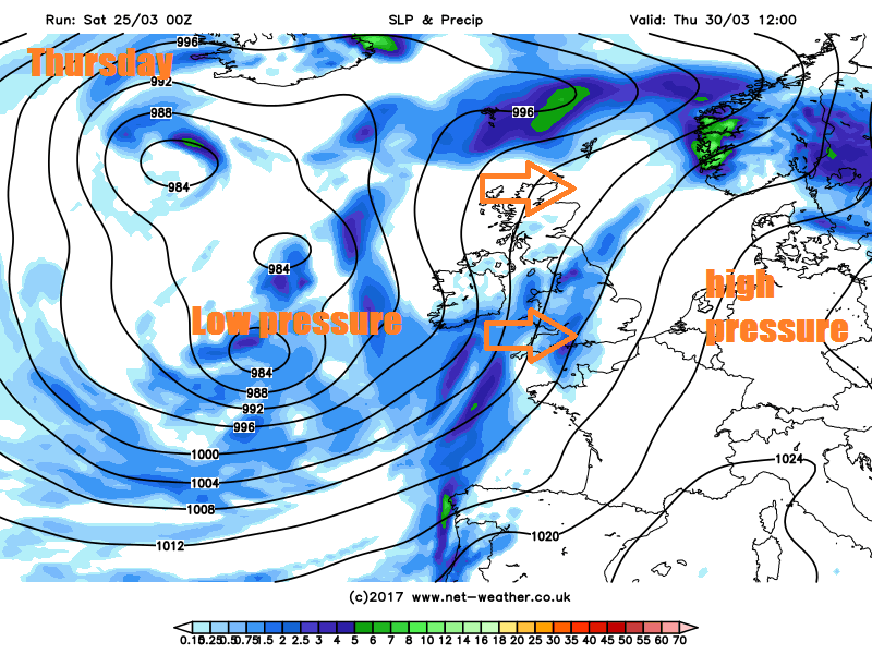
The UK and Ireland is the place to be for sunshine and spring warmth this weekend, with a large area of high pressure in charge centred over northern Britain bringing fine and settled weather. Low pressure will be slow-moving over SW Europe this weekend, so Portugal, Spain, southern France, northern and western Italy will be cloudier and see spells of rain, showers or thunderstorms through the course of the weekend. The fine and locally warm weather looks to continue through Monday and Tuesday for many, though showers look likely across the west on Tuesday and generally turning unsettled from the west from Wednesday, with spells of rain.

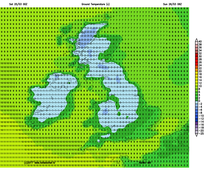
For now, it’s a dry, chilly and sunny start across most areas. Temperatures fell below freezing across rural areas over central, northern and western Britain during the night, with the temperature falling as low as -5C at Katesbridge in N. Ireland and Topcliffe in northern England. Also, some fog patches have formed overnight across central and northern areas too.
It is now warming up in the sunshine, with the sun burning away quickly any early fog patches and for many it will remain dry with mostly blue skies for much of the day. Temperatures warming up to around 14-16C quite widely, perhaps a few spots one or two degrees higher than this in the west. The exception will be across southeastern coasts of England which will have a brisk northeasterly wind and other eastern coasts of England will have a cool onshore breeze - keeping temperatures pegged back. The Northern Isles will be cloudier, with the odd spot of light rain or drizzle.
Turning cold again tonight, thanks to clear skies and dry air, with patchy frost and localised fog patches developing. Temperatures again falling to around -4 to -5C locally in the north. Cloudier across the far north and a brisk easterly wind keeping the frost at bay across southern and southeastern counties of England.
Remember tonight clocks go forward into British Summer Time (BST), so an hour less in bed, especially like me if you have to get up for work in the morning. But at least we will now see daylight for longer in the evenings.

Mother’s Day will be fine, dry and sunny for most – with largely blue skies and warm sunshine to be enjoyed. More in the way of cloud across the far north of Scotland, the Northern Isles and later across eastern coasts of England, making it cooler here. A brisk easterly wind across southern counties of England also taking the temperatures down a few degrees compared to today. Still feeling pleasant in the sun out the wind, temperatures reaching 11-12C across the far north and towards eastern coasts, 13-16C elsewhere.
Monday’s looking mostly fine and dry again, though probably more in the way of cloud than recent days across northern areas, which maybe thick enough for some patchy drizzle or light rain. Warmest in the south of England and Wales – where temperatures look to reach 13-15C, elsewhere 10-13C.
Winds switching from easterly to southerly on Tuesday, so warmer air spreading north, but also some showers spreading north along a frontal system across western and eventually northern areas during the day. Eastern of England areas staying dry, fine and sunny – temperatures reaching 16-18C across East Anglia and SE England.
Eventually turning unsettled across all areas from the west for the rest of the week. Cloud, rain and strengthening southwesterly wind across northern and western parts on Wednesday, dry and fine towards the southeast. Then it looks like cloud and rain spreading slowly east across all parts on Thursday, before clearing the east Thursday night followed by cooler and clear conditions – but with heavy showers in the west which may become more widespread on Friday.