
Warmer by day this weekend, a few spots in the north and west reaching 18C, but nights will be cold and frosty. Warmth more toward the SE early next week, before turning unsettled for all from mid-week

As we head into the last week of March, the weather is warming up once again, after what has felt more like winter since the beginning of the week, with snow settling, frost and ice in some northern areas.
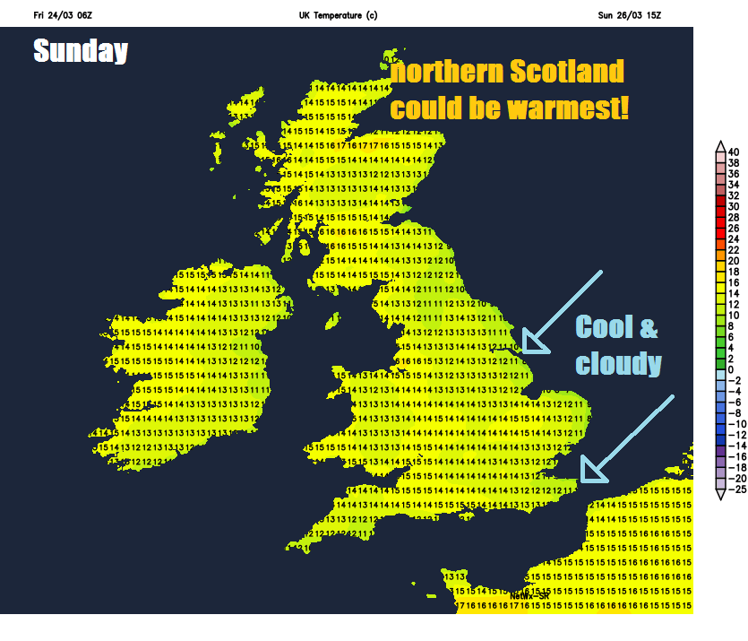
High pressure is building in across the UK, centred over northern Britain over the weekend and into beginning of next week. The highest daytime temperatures could be across more northern and western areas of Britain this weekend where we will see lighter winds. A brisk and chilly easterly wind across SE England and E Anglia, normally the warmest part of the UK, will keep temperatures pegged back into low double figures. The far southwest of England, west Wales, western Ireland and parts of Scotland could be the warmest spots on Saturday with daytime temperatures perhaps reaching 16-18C in a few spots. On Sunday, northern Scotland could be the warmest spot with 17-18C, though western areas of the UK could see temperatures reaching the mid-teens. Cooler and cloudier across eastern England with that nagging northeast wind.
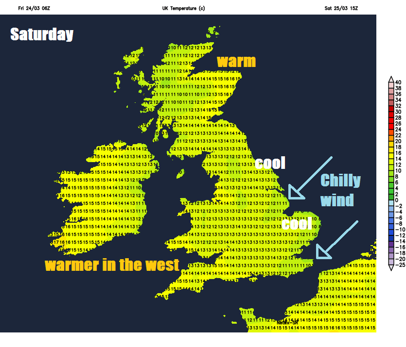
However, although the daytime will feel warmer for many compared to recently, especially in the north, the nights and early mornings will be cold. This is thanks to clear skies under high pressure allowing any warmth during the day to escape upwards into the atmosphere which combined with dry continental air at the surface (low dew points and humidity) allows temperatures to fall lower than they would if the air was moist off the Atlantic and it was cloudy too. So gardeners should still be wary of keeping out tender new plants this weekend, despite the warm sunshine during the day.
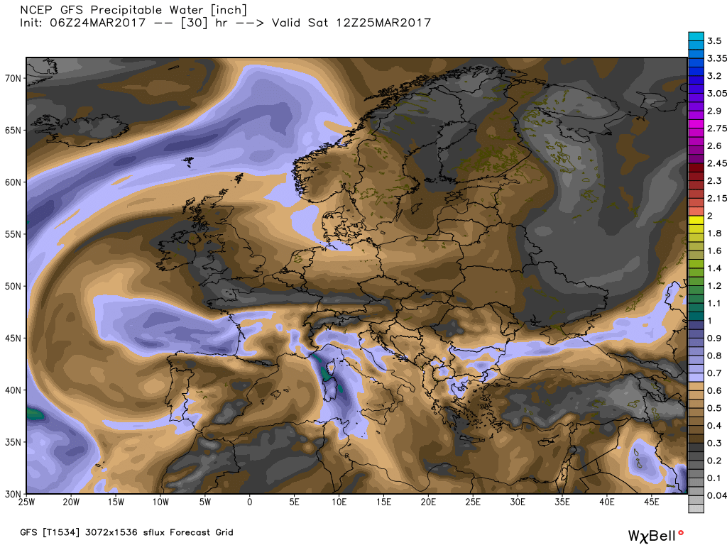
This GFS PWAT (Precipitable Water) chart for Saturday shows very dry air across the UK (greys/browns = dry air)
Tonight and Saturday night we could see temperatures fall below freezing in rural parts of the north and west of Britain, perhaps as low as -3C. But during tomorrow and Sunday temperatures could reach a warm 16-18C in the same areas. This large difference temperatures between day and night is known as a large ‘diurnal range’. Under similar pressure and airmass conditions in winter, it would likely stay cold during the day after frosty nights even with the sunshine, but with longer daylight and the sun higher in the sky and stronger in late March, the days warm up quickly.
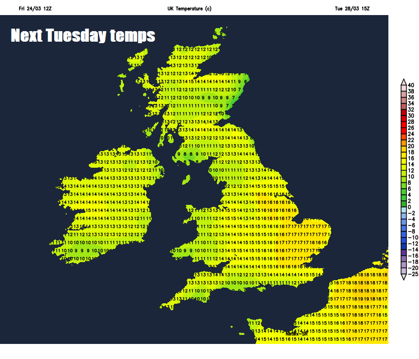
By Tuesday next week we will likely see a change in wind direction, as the high that’s been sat over northern Britain slips southeast over mainland Europe, with the wind turning southerly and the highest temperatures towards SE Britain on Tuesday and perhaps again on Wednesday – where we could see temperatures reach 16-18C or maybe higher.
A change in wind direction from on Tuesday from an easterly to a southerly sees highest temperatures over SE Britain
It looks like the nights will warm up from Tuesday too, as the southerly flow brings in milder air, with night-time temperatures in the south perhaps staying in low double figures.
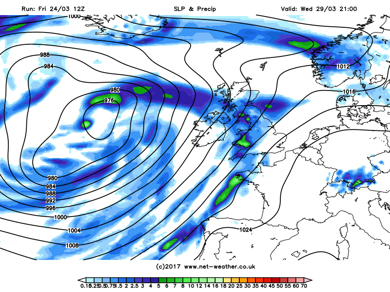
We could see a few showers break out from the south on Tuesday, before northern and western areas turn increasingly unsettled from the west with cloud and rain by Wednesday. A large Atlantic trough and associated low pressure is generally indicated by the models to edge in from the west for the rest of the week, spreading cloudier and windier conditions with outbreaks of rain across most areas by Thursday. So, towards the end of the week temperatures look like tailing off again as we see cooler air from the west spreading in. However, there is some uncertainty how quickly the change back to more unsettled conditions takes place across all areas from mid-week.


