More wintry weather is expected tonight with snow in places. There will also be rain, ice, wind and frost. Apart from a cold wind, SE Britain won't be too bad
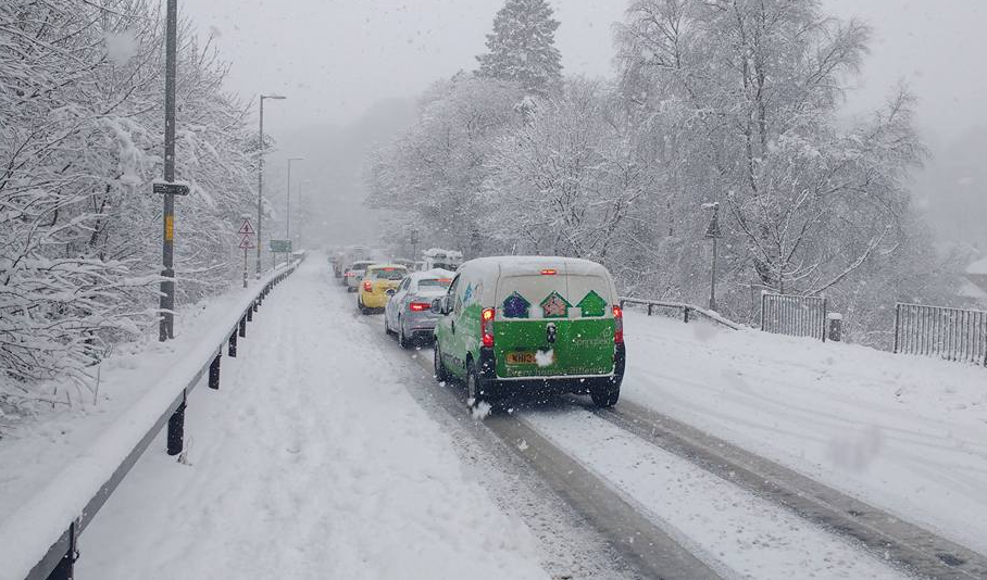
Parts of Scotland have already seen snow this week with several inches in places as people woke up on Tuesday 21st March, one day after astronomical spring started. The wintry weather looks set to pester parts of the UK.
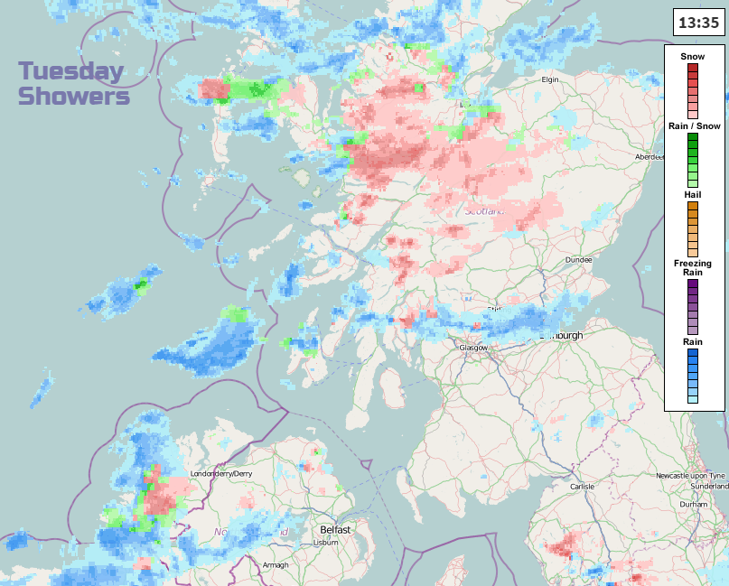
Middle of Tuesday, brisk W or SW winds continue to blow rain/sleet/hail and snow showers over Scotland and N.Ireland, feeling cold in the wind. Also a scattering of wintry showers over Cumbria.
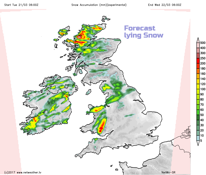
This chart shows areas which could see lying snow Tuesday into Wednesday with an idea of forecast amounts. The showery areas over Scotland today will be more varied with some areas seeing the showers and others just missing it. There will also be more snow for the Cheviots, over the Scottish Borders into southern Uplands through Wednesday morning and for the Welsh mountains
The next area we are watching for more wintry weather comes up from the SW
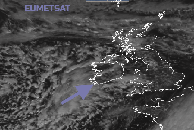
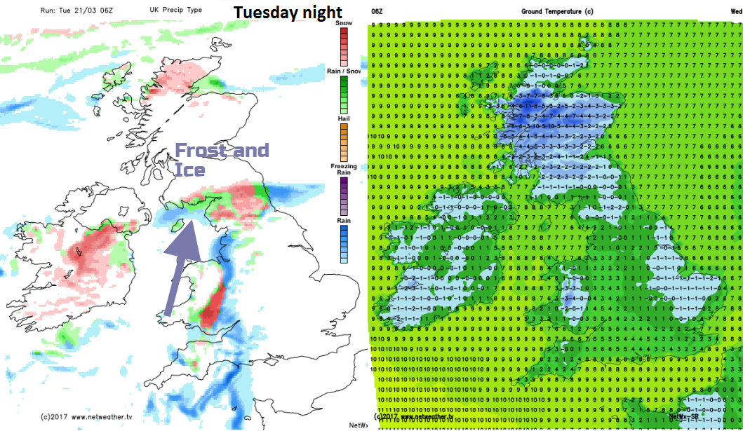
A rather complicated frontal system with a central low pressure will move over SW Britain. As the frontal rain comes up against cold air over northern Britain and Northern Ireland, it will begin to turn to sleet and snow. There are uncertainties with this band and the snowfall. How far north it will push from northern England into southern Scotland, the areas with rain, a mix or decent snow. Around 7am with minimum temperatures the snow will reach down to 100m, accompanied with ice and frost. With cold wind conditions will be horrible whether just as rain or with wet snow mixed in too.
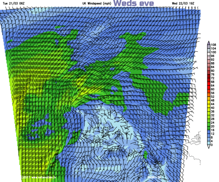
The cold front will gradually nudge eastwards through the day, but there will be wet and wintry weather over Wales through the night and further pulses running northwards during Wednesday morning. The areas affected could vary west/east too. Powys looks quite prone with higher totals for the Brecon Beacons but winds look to be lighter over most of Wales at the centre of the low.
It looks like the curl of the frontal system could rotate round into Co Down and south Co Antrim through the day bringing wet and wintry conditions into the afternoon. Also, a strengthening NE wind will make it feel bitterly cold.
Thorugh Wednesday much of the precipitation sets in a rain for Wales, England and Northern Ireland, some more wet snow over the hills. A feed off the North Sea will provide more snow showers to NE Scotland and wintry bits into more of eastern Scotland, in a cold NE wind.
Met Office Weather warnings for Snow and Ice
Midlothian Tues 21st morning snowy commute