If you are disheartened by the UK's lack of snow this winter, think of NE USA tonight as a huge snow storm heads in. #SnowDay
Heavy snowfall, blizzards and major disruption are forecast for Monday evening and all through Tuesday. A good part of the US eastern seaboard will be affected by a winter storm with severe winter conditions extending up through New York City and much of New England.
New York can cope with heavy snowfall and it has occurred before at this time of year but the recent cold but quiet weather means that the warnings need to be a loud reminder that winter is not over yet.
New York and New Jersey are currently covered by Blizzard warnings. The heavy snowfall is expected Monday night into Tuesday with whiteout conditions during Tuesday morning. Local airports are already over-run as people try to leave before the storm and inevitable delays. The strength of the winds means power outages are possible starting on Tuesday and there will be travel problems for the Tuesday morning commute in the highly populated area of the US. Many roads will be impassable, schools closed and a significant 'snow day'.
Preparations are underway with the US national weather service talking about at least 11" of snow for NY and NJ, possibly double that (22"/half a metre).
There are also coastal flood warnings, with high tides coinciding with the push of the strong onshore winds. There will be high seas and storm force gusts.
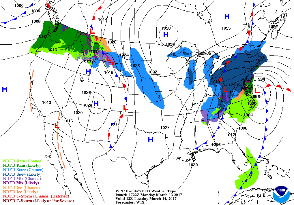
Northeast winds over the top of the low pressure.
Forecasters at the National Weather Service's Weather Prediction Center (WPC) noted that the low pressure system crossing the Midwest states and Ohio Valley is expected to merge with another low off the southeast U.S. coast. WPC stated "This will allow for a strong nor'easter to develop near the coast and cause a late-season snowstorm
A Nor'easter is a storm along the East Coast of the US and Canada, where the winds over the coastal regions coming in from the north east. Severe storms can still occur into April but this mid-March event is still getting on for the main part of the season. They can cause billions of dollars in damage, hitting the area around Washington DC, Philidelphia, New York and Boston. You have the warmer waters of the Gulf Stream making the coastal waters relatively mild at this time of year. Cold Artic air plunging down from Canada and the temperature gradient = a strong jet energising this storm.
The wintry weather will continue through Tuesday night with significant windchill as the true north winds stream down the eastern states. The winter storm then heads off into eastern Canada, as high pressure takes hold over eastern US and fine, more spring like conditions take hold. Ontario, Quebec, New Brunswick and Nova Scotia all have winter storm warnings or watches.

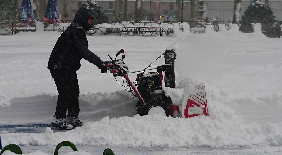
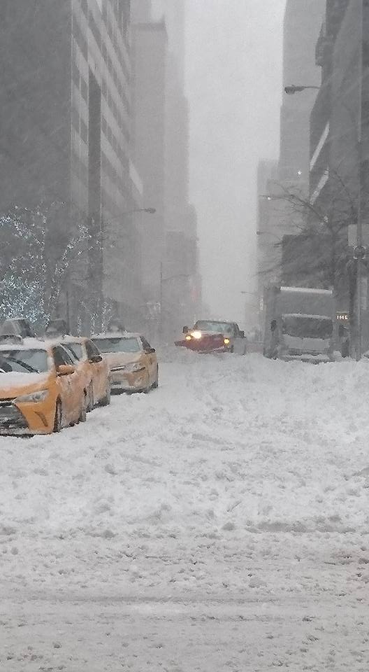
Thanks to Ian Scrimgeour for NY snow photos