More rain at times today, and with low pressure never too far away, next week keeps the unsettled weather coming.
The unsettled weather that has dogged March so far continues, with complex low pressure bringing further showers and bands of rain across the country. As a result, there’ll be further wet weather today particularly in central and southern parts, with the best of the sunshine across the North at first.
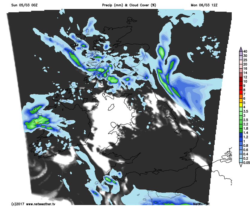
This morning sees a real mixed bag of weather across the country. We have a front that is already bringing rain to Wales and much of the South that'll spread to all but the far North of England through the morning. Some of the rain will be heavy with a little snow on higher hills, followed in the South by sunny intervals that have already reached Devon and Cornwall, but more showers will be moving in from the West before mid-day. The South of Northern Ireland will also see some rain for a while, but much of Northern Ireland and Scotland have a morning of sunny spells and scattered showers, these mostly over Scotland at first giving hill snow.
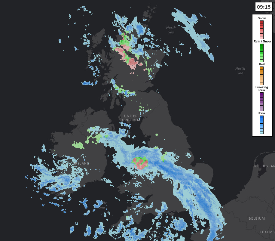
View the latest weather type radar here.
The afternoon sees rain draped across Lancashire, Yorkshire, Lincolnshire, the North Midlands and East Anglia that'll turn showery later. Further South expect sunny intervals but showers most frequent over South Wales, the South West and West Country where some will be heavy, blustery and prolonged perhaps giving thunder. Meanwhile, Northern Ireland, Scotland and the far North of England see a mix of sunny spells and scattered showers. Here too a few could be heavy mostly in the West, and while some parts will miss the showers, any dry spells of weather shouldn’t be relied upon.
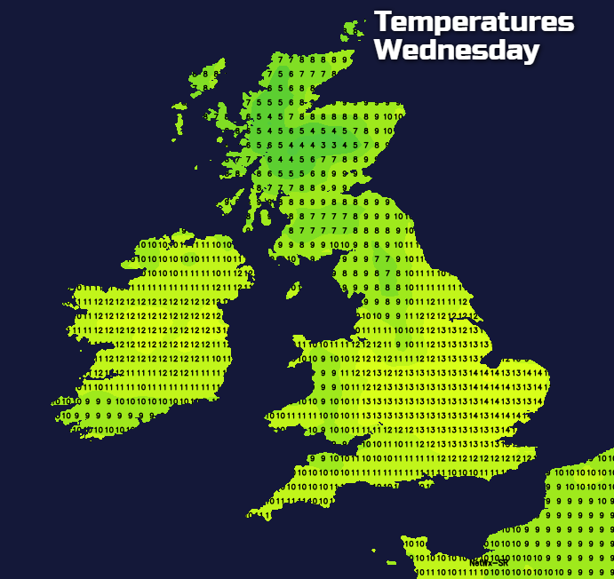
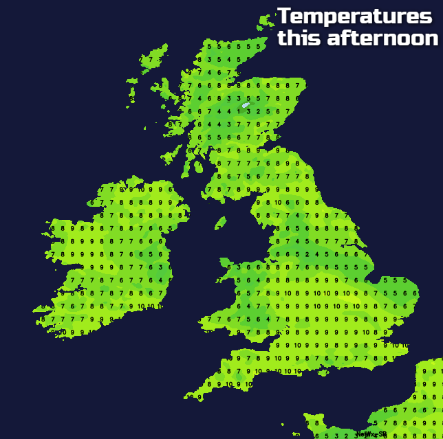
Winds generally will be light and variable in direction, but it’ll be gusty in the vicinity of heavier showers. The exception will be southern England where a westerly wind becomes fresh and blustery once the rain clears particularly towards the South coast and across the Channel Islands where gales are likely for a while. It’ll be milder in the South but afternoon temperatures, on the whole, shouldn’t be too far from normal, reaching 7 or 8C in the North and 9 to 11C in the South.
It’ll still be wet into the evening across parts of East Anglia and North East England, but the rain will eventually peter-out with broken skies moving in later in the night. Northern Ireland and the North and West of Scotland continue to see showers after dark as will Southern England at first, where the wind will decrease. Most parts then see clear intervals overnight, and with generally light winds, mist patches and a ground frost may form in some rural areas, with lowest temperatures 1 to 5C. By morning, though, more rain or showers will have moved into the Channel Islands, Cornwall and Devon.
The start of the working week continues unsettled, although Monday does see somewhat of an improvement. There’ll be further scattered showers mostly over North and West Scotland, Northern Ireland and perhaps towards the East coast at first. A small depression will also give some rain in the South West and across the Channel Islands for a time, but overall there should be fewer blustery showers and more in the way of sunny spells particularly later.
Winds on Monday become moderate or fresh North West or Westerly, with perhaps strong gusts later over exposed coasts and hills in the West. This’ll make it feel chillier, but temperatures should reach 6 to 8C in the North and 9 to 11C again in the South.
North Scotland may see cloud and showers into Monday evening, but most places should see clear intervals after dark. This'll allow it to turn quite cold in sheltered rural valleys of eastern England and South East Scotland, where a ground frost may form later. Elsewhere scattered showers and more of a Westerly breeze should be enough to prevent a frost, with lowest temperatures 0 to 5C.
The remainder of the week remains breezy at times and unsettled particularly in the North and West, while the East and South could briefly see more 'spring-like temperatures around mid-week.