A look at the stats showing that winter 2016-17 was dry and mild for the UK overall, though there were some regional differences for each month
The past three winter months in the UK have been characterised by anomalous high pressure, which has brought generally drier and milder conditions than the average overall. This is because high pressure that was over or nearby Britain for much of the winter kept the more usual Atlantic low pressure systems and their rain that affect the UK in winter at bay and tending to divert to the north of Scotland.
Though, unsually, even though high pressure has been dominant, it has often positioned as such that it has kept at bay the cold conditions that affected much of mainland Europe in January and early February, though colder conditions did affect the far southeast in late January, which brought the regional mean temperature here close to average. But elsewhere it has allowed milder air from the south to prevail at times. It's not often that dry conditions go hand in hand with mild conditions in winter. So winter 2016-17 was unusual in this respect.
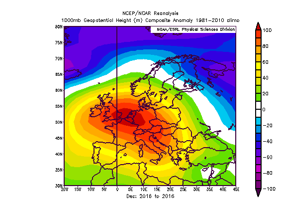
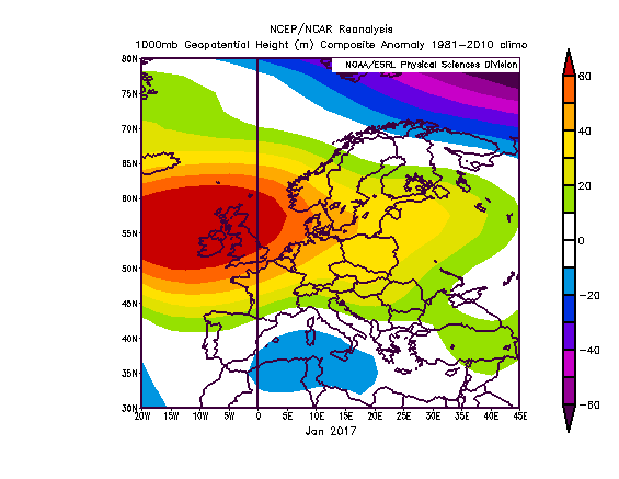
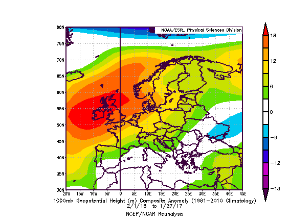
The mean sea level pressure anomaly charts below for December, January and most February shows the dominance of high pressure (orange to red high pressure):
December 2016 mslp anomaly
January and February 2017 mslp anomalies
UK received 73.9% of its average winter rainfall, third driest on record.
The past dry winter over the UK, as a whole, follows a dry autumn in 2016 too, which is in big contrast to the previous 2015-16 winter – which was the second wettest winter on record, which followed the wettest winter on record in 2013-14 in a series that goes back to 1910.
According to the Met Office, 2016-17 saw around three-quarters of the average rainfall overall for the UK. Though there were regional differences for each of the three winter months.
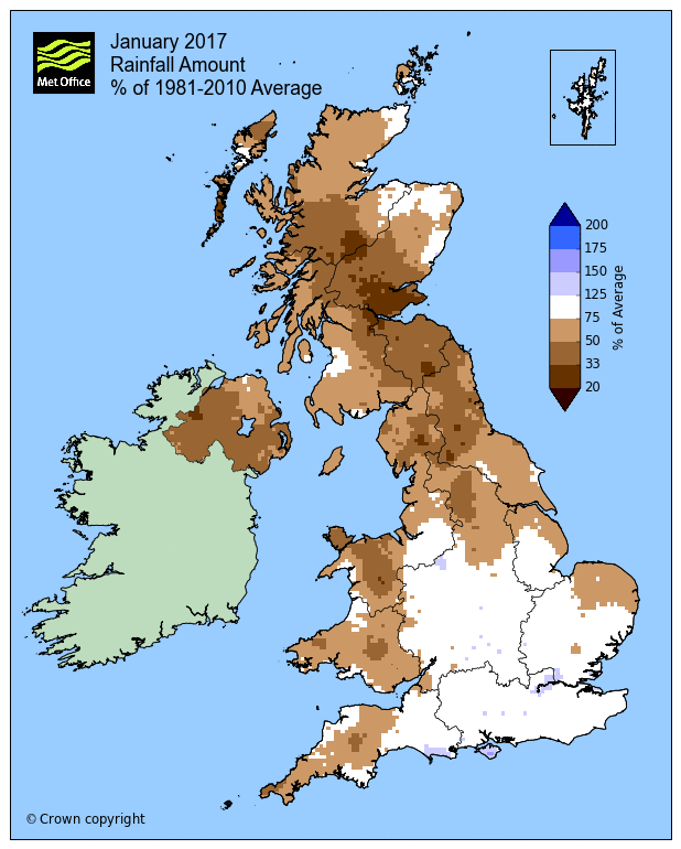
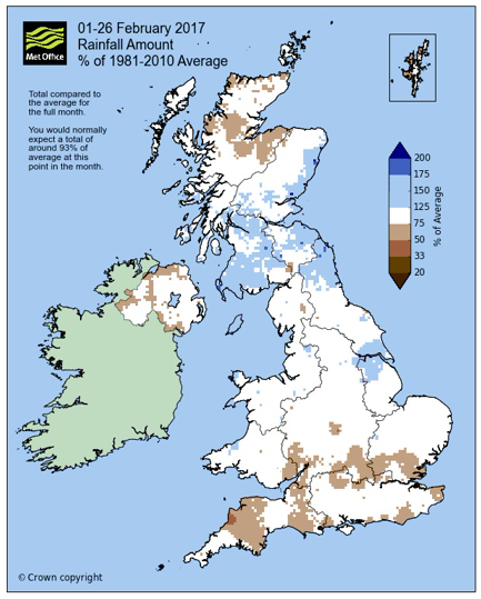
Rainfall amounts % of the average for December, January and February (images courtesy of the UK Met Office)
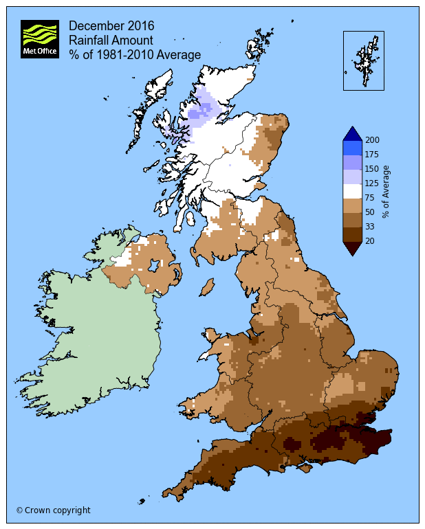
December was dry for much of England and Wales, but more particularly in SE England with 20% of average. While NW Scotland was above average.
January was actually drier further north than south, due to high pressure dominating across the north for large periods.
February saw slightly above average rainfall for southern Scotland, close to average elsewhere, Essex the driest area.
Mean UK temperature was 1.26C above normal
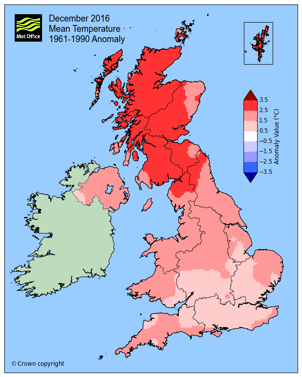
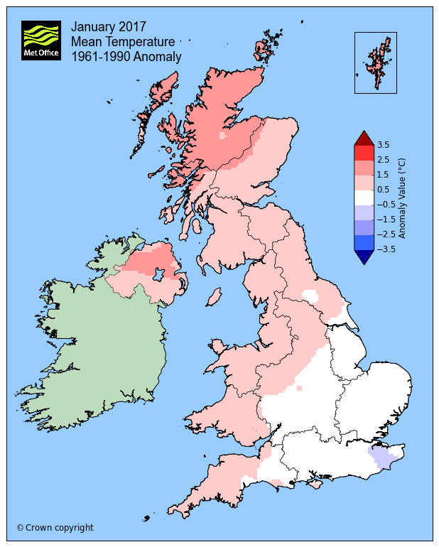
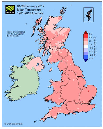
There were some regional differences with regards to temperatures. For example, In December, the south-east was only slightly above average, while further north it was well above average, with northern Scotland some 3C above the ’81-’10 average. In January, the southeast to northwest difference was more pronounced, and was colder than average in the southeast of England while elsewhere is was close to or milder than average – which meant the UK’s overall mean temperature for that month was close to the 1981-2010 long-term average. February has been some 1-2C above average for pretty much all of the UK though.
Mean temperature with 1981-2010 anomaly for December, January and February (images courtesy of UK Met Office)
Another measurement of temperatures used is the Central England Temperature. CET has been considered the most effective way of measuring how the UK's temperature averages across long timescales. The CET temperature series goes back as far as 1659. Whereas the UK temperature series used by the Met Office goes back as far as 1910. The area that weather stations are situated within for this measurement cover as far north as Lancashire, then down southwest toward Bristol and across to London .
Met Office Hadley Centre Central England Temperature Data
Mean Central England Temperature 2017
Netweather CET Temperature Tracker
The CET figures for the last three months are as follows:
December: 6.0C; anomaly: 1.3C
January: 4.0C; anomaly: 0.1C
February: 6.3C; anomaly: 2.5C (provisional)
Anomalies are against the period 1961-1990.
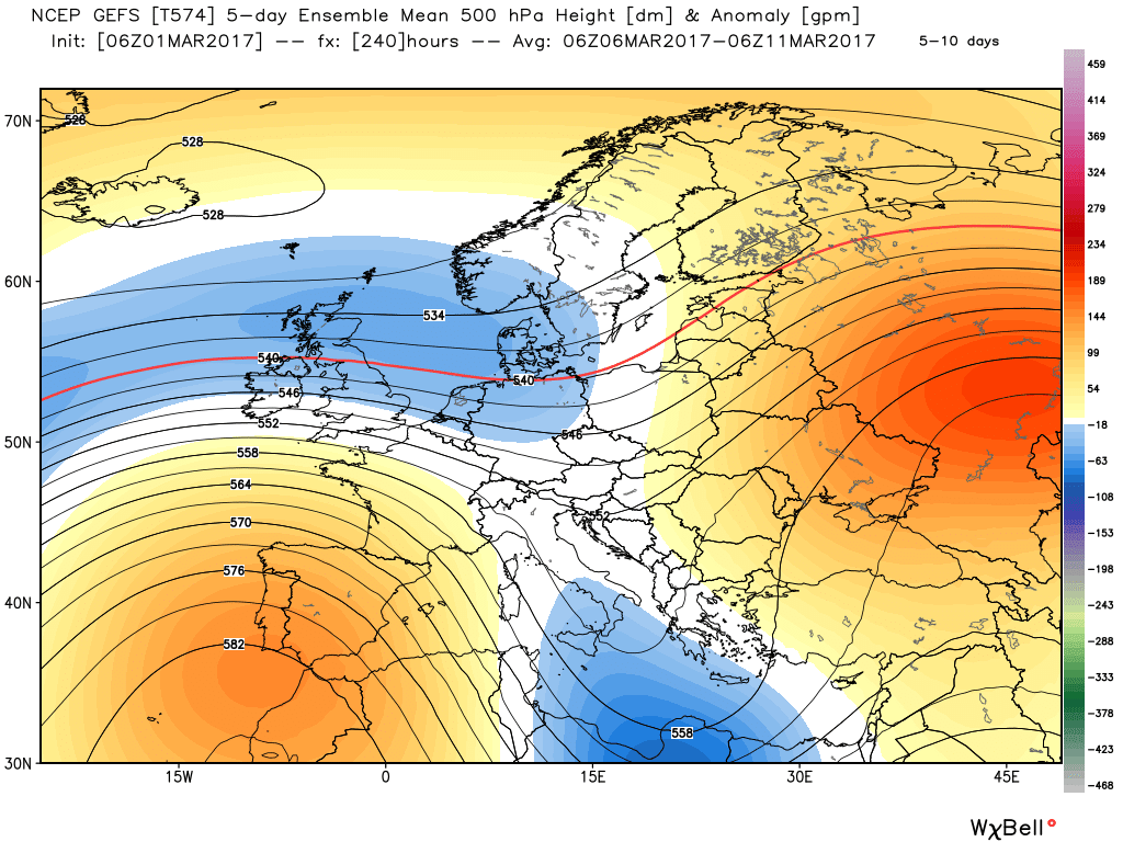
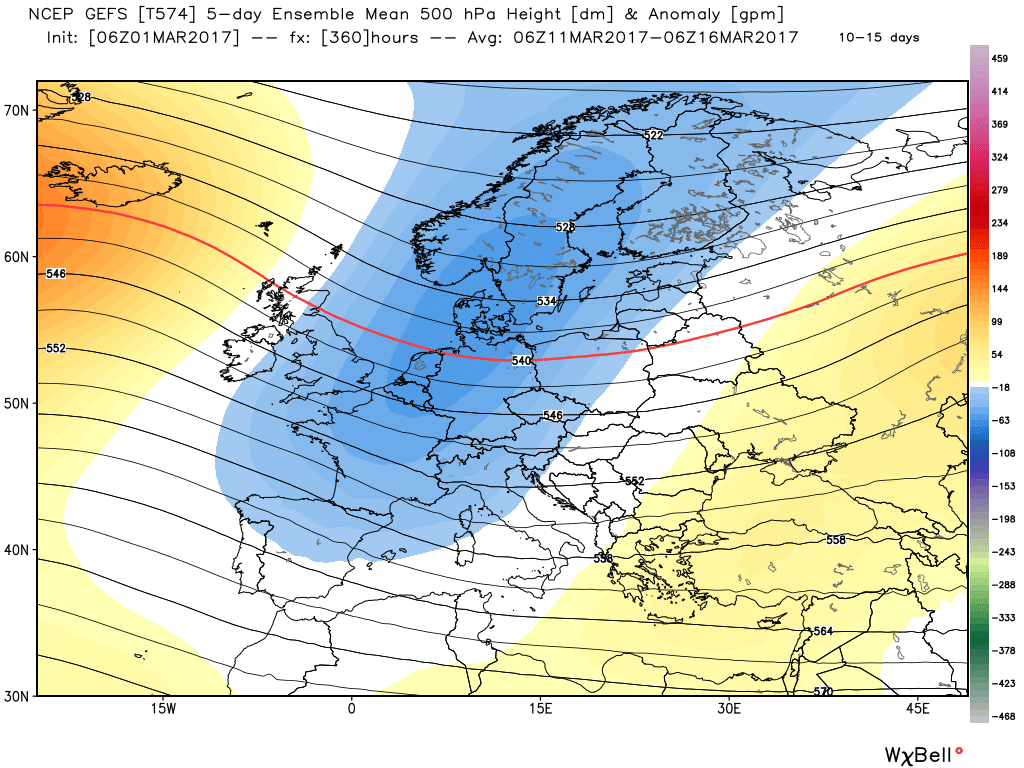
The weather looks to remain generally unsettled over the next 10-15 days. Although most of the unsettled conditions with rain will be affecting England, Wales and N. Ireland this week along with milder conditions in the south, drier, with colder and sunnier conditions for Scotland, all areas look to turn unsettled from the weekend, as slow-moving areas of low pressure move in off the Atlantic. In the medium and longer range, looking at model ensemble guidance - it looks to remain unsettled, but with the mean upper trough currently to our west perhaps moving to our east - which suggests winds blowing more from a northwesterly direction, perhaps briefly northerly. So this would mean colder at times for all, with wind and rain at times, but maybe also some snow at times for northern areas at elevation.
GEFS 5-10 + 10-15 day mean 500mb height anomaly (images courtesy of Weatherbell.com)
So, perhaps don't pack away those winter woolies just yet ...