Low pressure dominates this weekend, and into next week, so expect rain and strong winds to be frequent visitors.
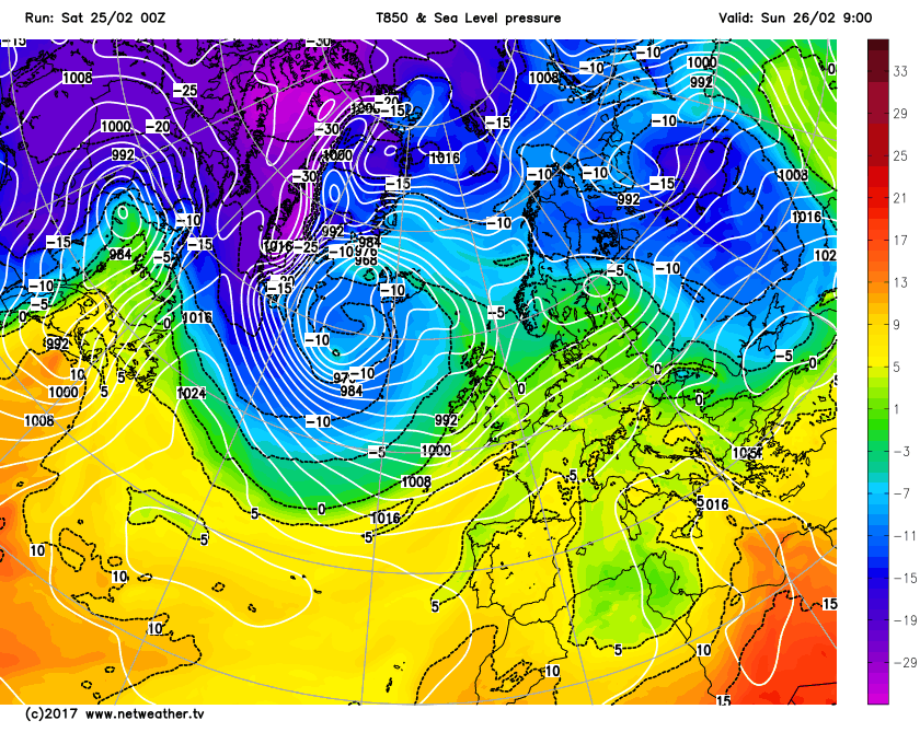
Unsettled conditions, due to areas of low pressure that have been dominating for some time now will continue to be influential this weekend. Weather fronts associated with a very deep area of low pressure, with a central pressure of 938mb west of Iceland this morning, will bring wet and windy weather to many parts through the course of Saturday. Further weather fronts will also then move into the UK through Sunday as low pressure dominates across the N Atlantic and most of the British Isles in the coming days. Active weather fronts will slowly move south-eastwards through Saturday bringing some heavy rain to more northern and western areas, and this is exampled well by recent rainfall radar imagery.
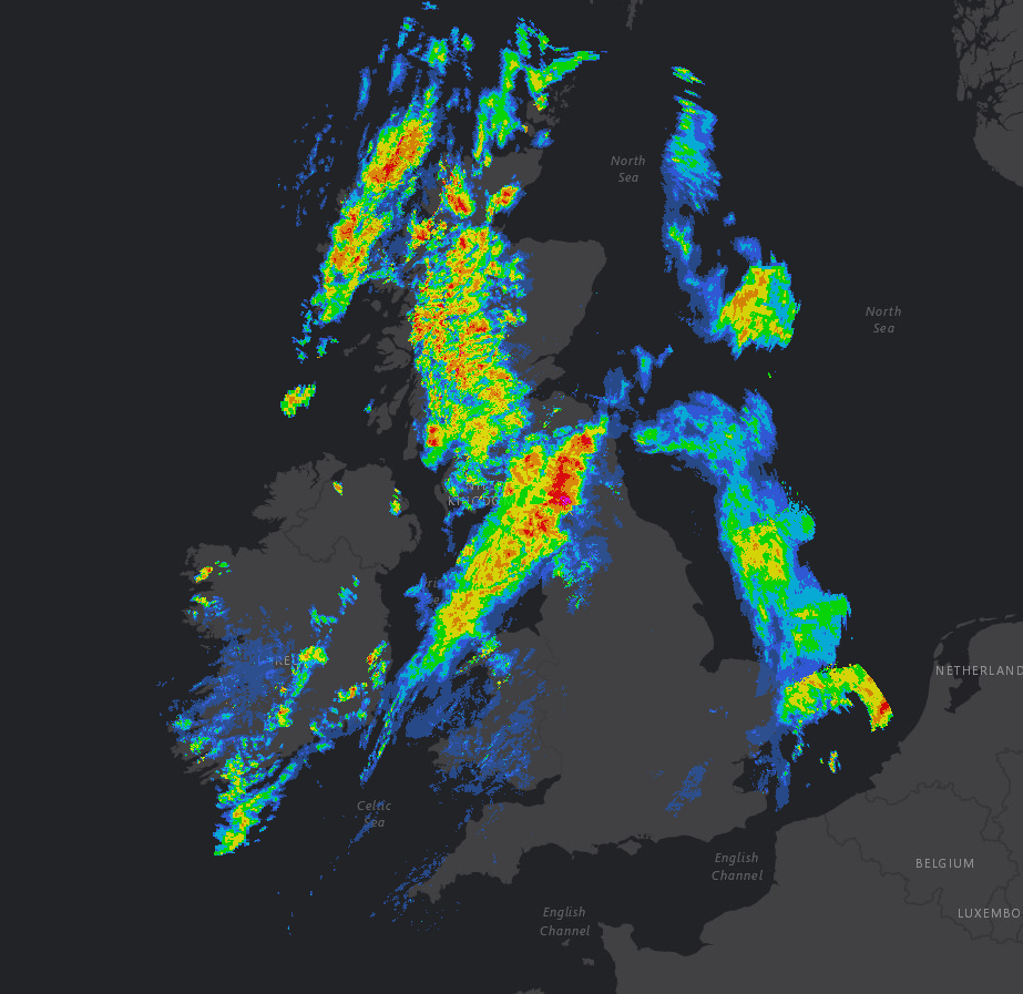
View the latest weather radar here.
Through the remainder of Saturday and the wet weather across parts of Scotland, Ireland and N England will only slowly move south-eastwards, probably not reaching SE England until this evening and by that point, most of the heavy rain will have eased. For parts of S Scotland, NW England and Wales a particularly wet day is expected, and our high-resolution model highlights the slow progress south-eastwards of the rain through the day.
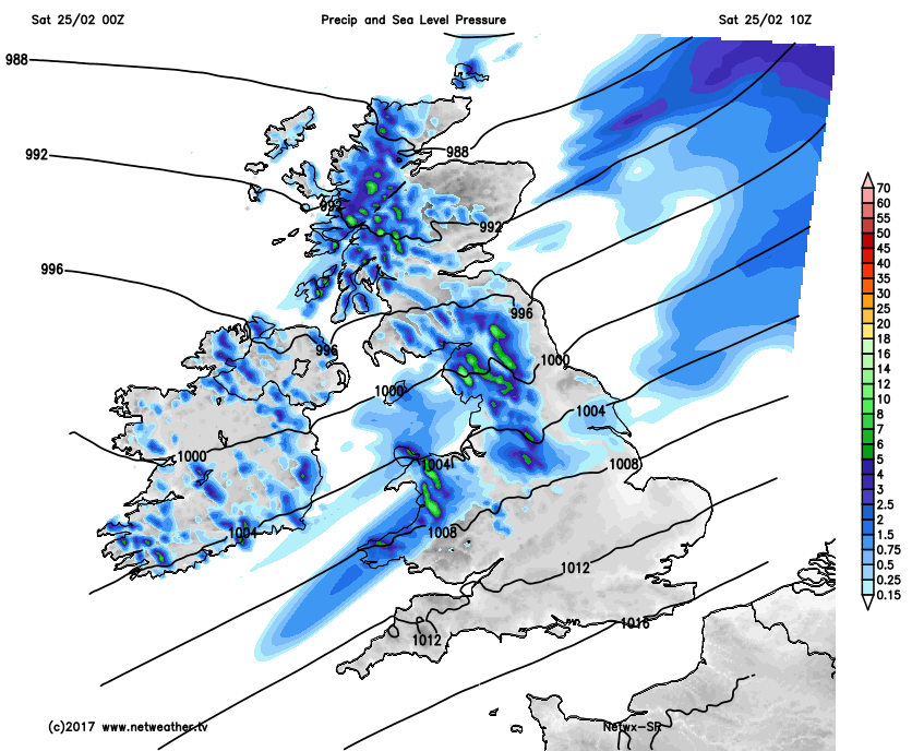
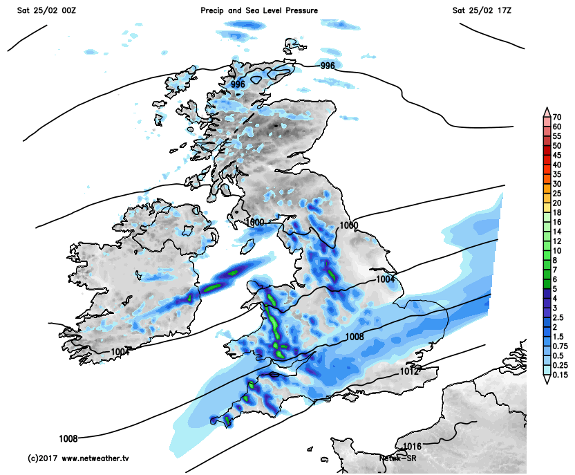
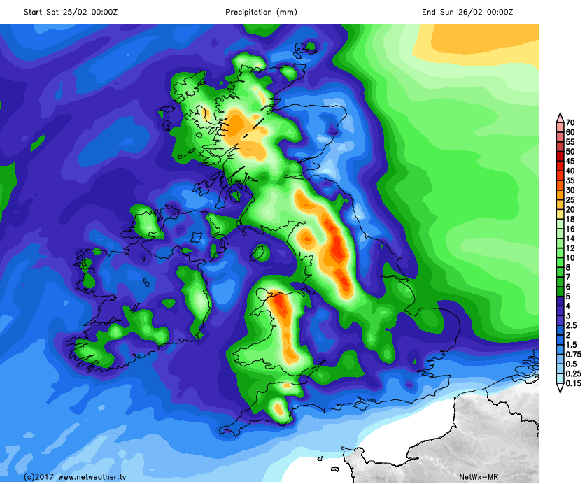
A clearance to drier and potentially brighter conditions will follow into Scotland and Ireland, with some scattered showers, but after the wet morning, the weather will improve as Saturday progresses. For parts of NW England and Wales though once the rain sets in today then it will be particularly persistent and will lead to some locally large rainfall totals. Some areas may well see rainfall totals up to 40mm to 50mm or more through the course of the day, and this may bring a risk of some localised flooding, especially in more prone areas, especially after recent wet weather as well.
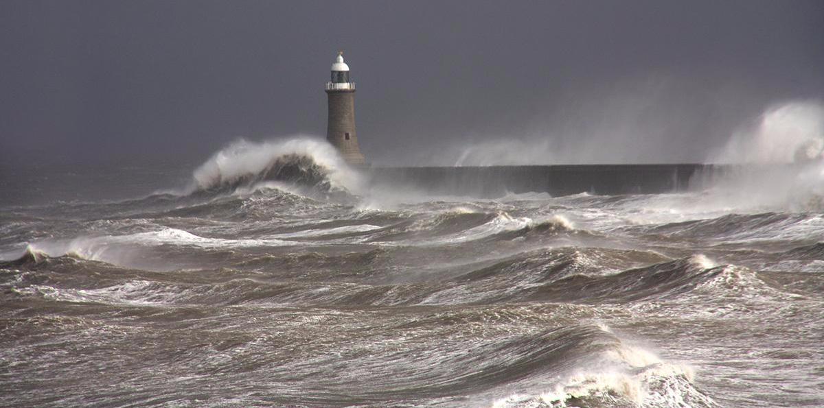
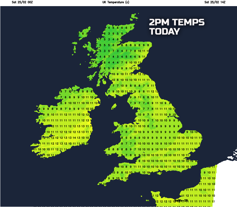
Accompanying the wet weather will be a strong or near gale force SW’ly wind, this particularly gusty across higher ground of S Scotland, N England and Wales. Temperatures today will generally be slightly above average, so relatively mild, but the wet and windy weather will make for quite a cool feel, but highs ranging between 5C and 11C are generally expected.
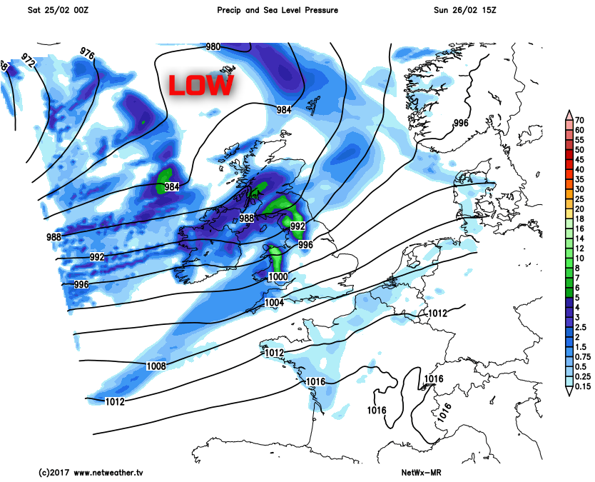
Into this evening and overnight and mostly cloudy, mild and drizzly conditions will dominate across England and Wales with most of the heavy rain easing away. It will be a colder night across the north, particularly across rural areas of Scotland given some clear skies, with perhaps some frost or icy patches here, but most will have a mild night. As we move into Sunday and it is expected to be a relatively dry start across most of England and Wales, with the exception of some patchy light rain or drizzle. The next weather system though will already be moving into parts of W Scotland and Ireland first thing, this being accompanied by yet another strong or near gale force SW’ly wind. So a wet and windy start to Sunday is to be expected across far northern and western areas of the UK, and these wet and windy conditions will then spread eastwards across the rest of the UK through the course of the day. The wet weather isn’t expected to reach SE England until later in the day so that it will be driest here for longest, but the emphasis is most certainly on yet another wet and windy day developing across many areas of the UK.
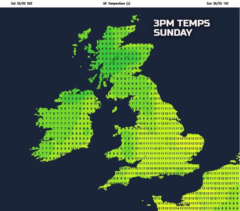
Any additional rainfall across parts of S Scotland, NW England and Wales through the day won’t be particularly welcome and may well continue to signal a risk of some localised flooding, again particularly in prone locations, and there will be some poor driving and travelling conditions at times too. It’ll be another mild or very mild day across southern and eastern areas of England with temperatures up to 11C to 13C, but cooler, if not colder conditions, will follow into the UK from the west later on, so a north and west, south and east divide in temperatures developing through the day.
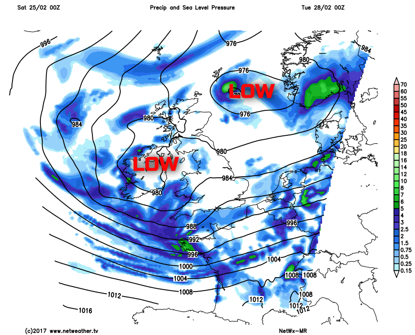
As we move into next week and confidence is high for unsettled conditions to unfortunately continue. There is good agreement between the weather models for low pressure to dominate the weather pattern across NW Europe well into next week, and this will maintain a risk of showers and longer spells of rain across all areas of the UK. There is also likely to be a drop in temperature too, at least to start next week, with somewhat colder conditions arriving from the west and north-west. This may well lead to a rather awkward mix of precipitation type, with rain and hail at lower levels, but some sleet and snow should be expected across higher ground of Scotland, Ireland and N England. Our medium range weather model highlights this unsettled outlook with low pressure well and truly dominating over the UK by Tuesday.
The progression towards colder conditions into early next week, especially in comparison to the mild weekend, is highlighted well on the below animation. Note how the yellow and green shadings, indicating the milder conditions ease away as blue shadings ease into the UK from the west and north-west through Monday. So, in summary, the outlook for next week is for further unsettled conditions but feeling rather cold with it too as February, and winter comes to a close.