Temperatures could reach 16-17c for some on Monday, as our mild run of weather continues. Not all will see the sunshine and spring-like weather over the next few days, though.
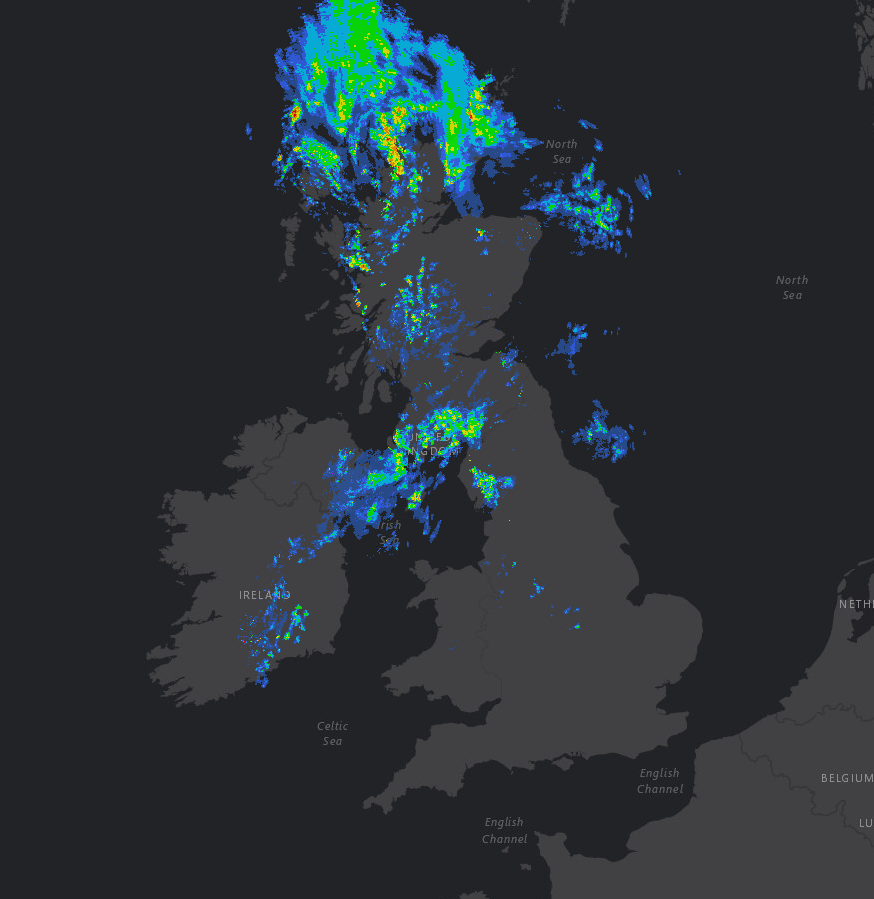
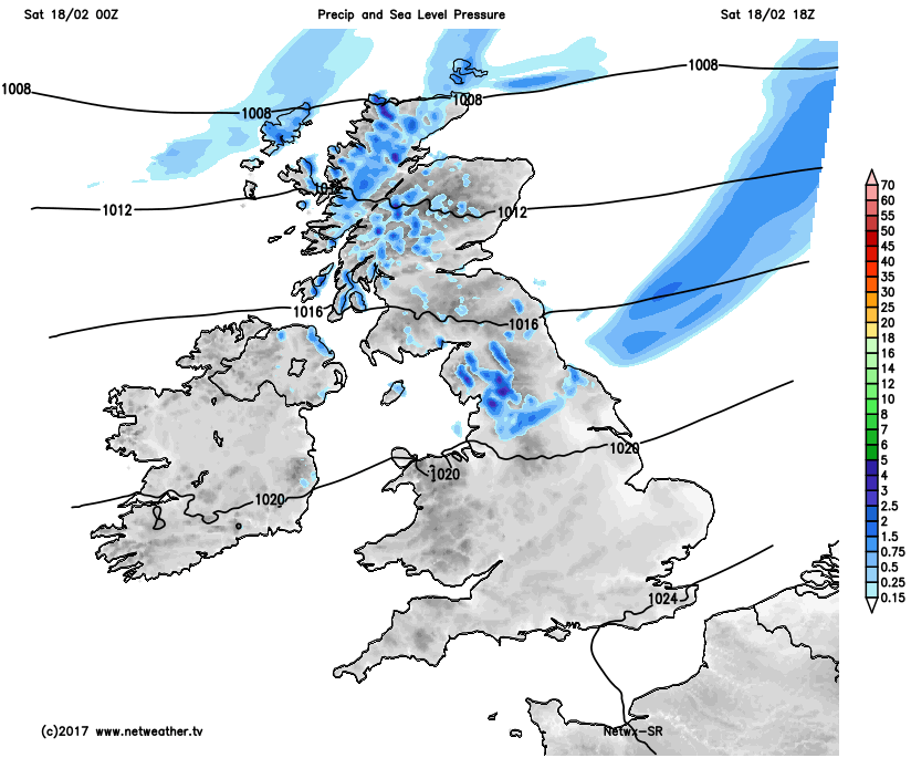
It’s a relatively mild start to the day across much of the UK with some areas starting the day with temperatures near 8C and 9C; this is generally the average for this point in February. Emphasis is on further mild or very mild conditions too in the coming days, perhaps exceptionally so by the time we get to Monday across more eastern areas of the UK, but more on that shortly. Within the short term and it is quite a grey start across most of England and Wales, but it is dry, whilst further north and west some rain and drizzle is in evidence across parts of Scotland, Ireland and the far north of England, as evident on rainfall radar from a little earlier.
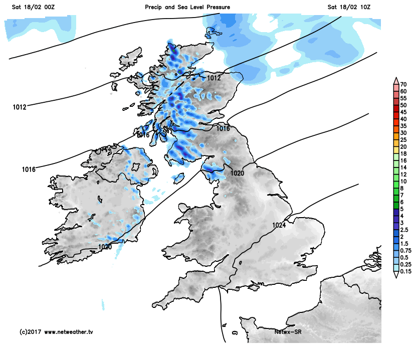
Through the rest of Saturday and it will, overall, be a north and south divide in conditions. For most of England and Wales, but especially central and southern areas, a dry day is expected with some bright or sunny intervals developing after the rather grey start. However, further north and west relatively weak weather fronts will bring thicker cloud and some showery outbreaks of rain and drizzle to parts of Scotland, Ireland and N England too. It is across parts of S Scotland and N England that a particularly grey and dreary afternoon is expected, especially when compared with more central and southern areas of England and Wales. Our high-resolution weather model highlights this split in conditions through the day, along with the wet weather across parts of N England too.
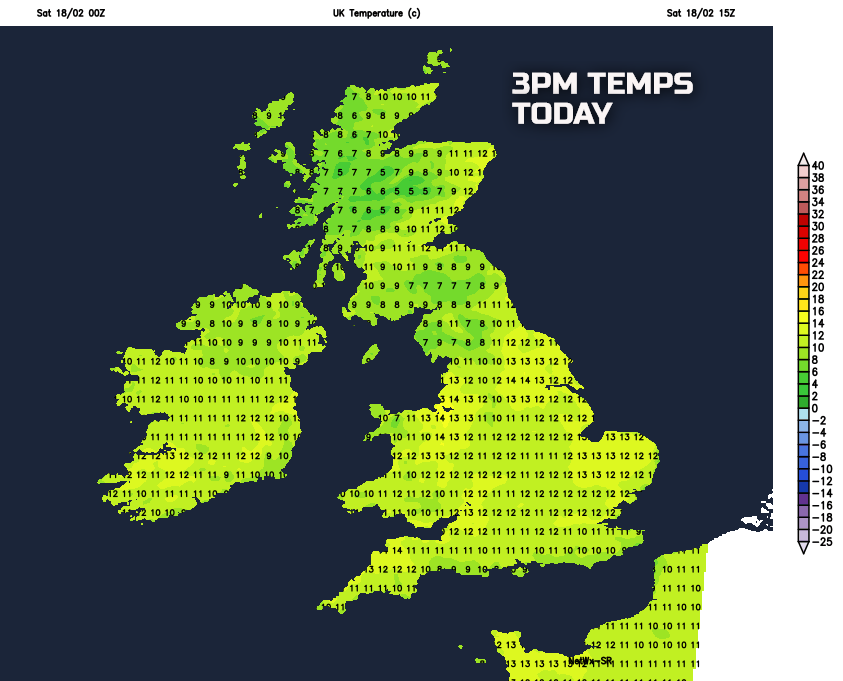
It will be a mild or very mild day for many areas of the UK for the middle of February, but it is across parts of England and Wales that with light winds and some February sunshine to bring about a particularly Spring-like feel to the weather. Where cloud is thicker, along with some wet weather further north, then it won’t feel as pleasant, but many areas will have temperatures above, or locally at least, well above average with some seeing maximum temperatures reach 13C or 14C.
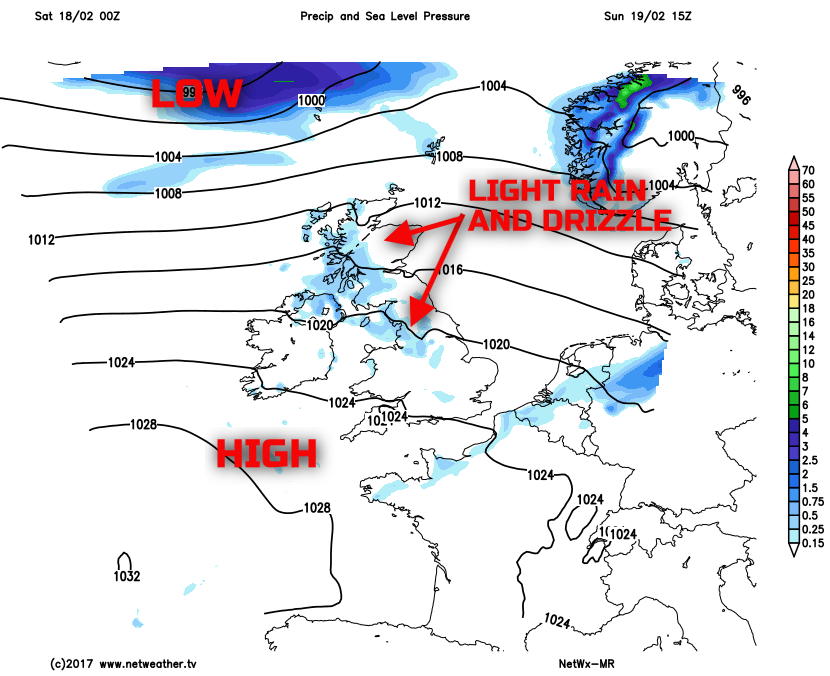
It stays mild overnight, primarily due to a lot of cloud and also a continued mild air mass in place over the UK. Further patchy light rain and drizzle, but nothing more than nuisance value really, will continue to affect parts of Scotland, Ireland and N England, perhaps also then moving down into parts of Wales and SW England too during the early hours of Sunday. Sunday is then, overall a cloudier day for a good part of the UK. It will, however, continue to be predominantly dry across more central, southern and eastern areas of England with some brighter weather here, primarily due to higher pressure continuing to be of some influence. However, for much of SW England, Wales, N England, Scotland and Ireland then an overcast day is expected with some increasing amounts of mainly light or moderate, rain and drizzle, especially across hillier regions as weather fronts move over the top of the high pressure situated to the south-west.
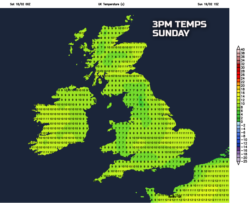
Temperatures on Sunday aren’t expected to be quite as high when compared with Saturday, this primarily due to more cloud. But despite that temperatures will still reach ‘double figures’ across parts of England and Wales and many other areas of the UK will have temperatures still slightly above or above average overall, especially to the east of high ground.
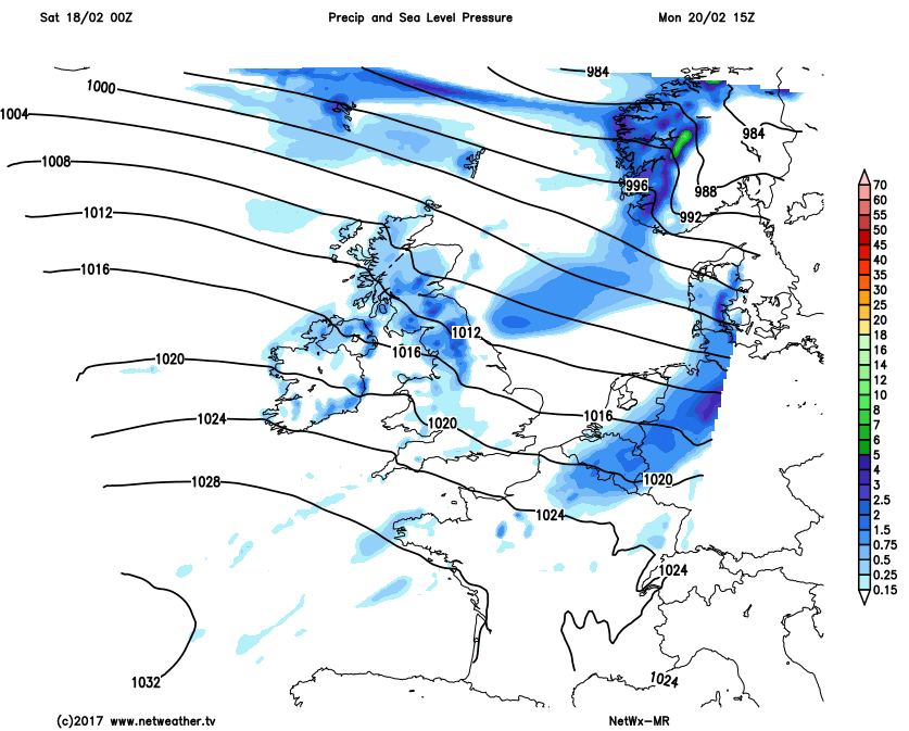
Into the start of next week, further weather fronts will continue to move over the area of high pressure situated to the south-west. As a result, further spells of rain and drizzle are to be expected across parts of the north and west of the UK in particular and especially so across western hills of the UK. It will become windier too across the north with a fresh or locally strong wind developing.
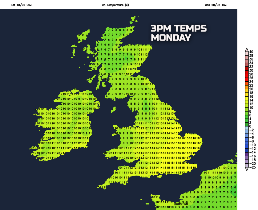
However, the air mass over the UK will, if anything, become even milder as we move into Monday and there is the potential for some very high maximum temperatures indeed for the time of year through the course of Monday afternoon across more eastern areas of the UK. Temperatures may well reach 15C to 17C across some central and eastern areas of England, as shown below, but note the wet and rather windy conditions across more northern regions of the UK.