
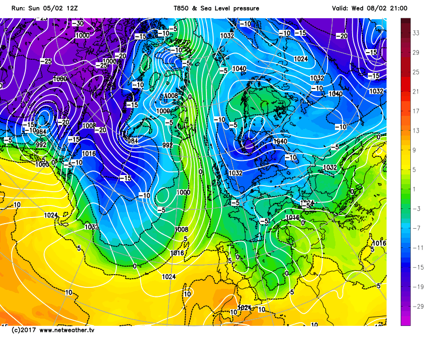
Atlantic in charge to start the week, but high pressure expanding over Scandinavia will introduce much colder conditions from the east by Thursday.
Over the past week the weather has been coming in off the Atlantic bringing mild air, along with wet and windy conditions at times. Though fortunately we’ve avoided the worst of the Atlantic depressions, thanks to the strong jet stream being to the south of the UK across northern Spain and France – which has taken a few intense lows across France over the weekend. One deep depression, named Leiv not Doris (as it didn’t affect the UK) brought some violent and damaging wind gusts across the central Atlantic coast of western France on Saturday morning, with a gust of 92 mph (148 k/h) on the coast to the west of Bordeaux. Another deep low, named Marcel, moves off the Bay of Biscay into France today, bringing damaging northwesterly winds gusting to 70-80mph with exposure across northern Spain and SW France.
Although we will see further wind and rain from another Atlantic frontal system moving through on Monday and Tuesday, high pressure is building stronger over Scandinavia in the meantime and from mid-week we start to see this large blocking high pressure system influence our weather from the east, bringing a much colder but drier flow from the east or southeast to end the week, through the weekend and perhaps into early next week.
Atlantic in charge Monday and Tuesday, with frontal rain moving east, but front hits brisk wall of Scandinavian high expanding west by mid-week, with colder air winning out from the east by Thursday
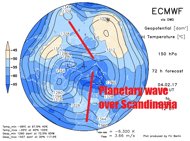
The omega-shaped ridge developing across Scandinavia this week is a blocking high, with pressure/heights high at all levels of the troposphere, which means it will keep Atlantic low pressure systems and their fronts at bay to the west of the UK.
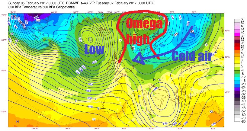
This block is likely developing in response to the Madden Julian Oscillaton (MJO), a tropical convection disturbance that moves east and can influence ex-tropical weather patterns, moving coherently and amplified through into phase 7, 8 and perhaps 1 – which tends to favour more blocked upper flow configurations in higher latitudes. A planetary wave in the tropospheric flow is already present across Scandinavia/NE Europe building a ridge to our NE, so the MJO propagation into these colder phases will only serve to reinforce the block to our NE.

However, for now the models suggest a mostly dry but cold easterly or southeasterly flow, day maxima falling into low single figures Thursday onwards, probably cloudy towards the east, but cloud thick enough and surface flow dry enough to support some snow flurries inland or snow showers towards eastern coasts, but not amounting to anything disruptive.
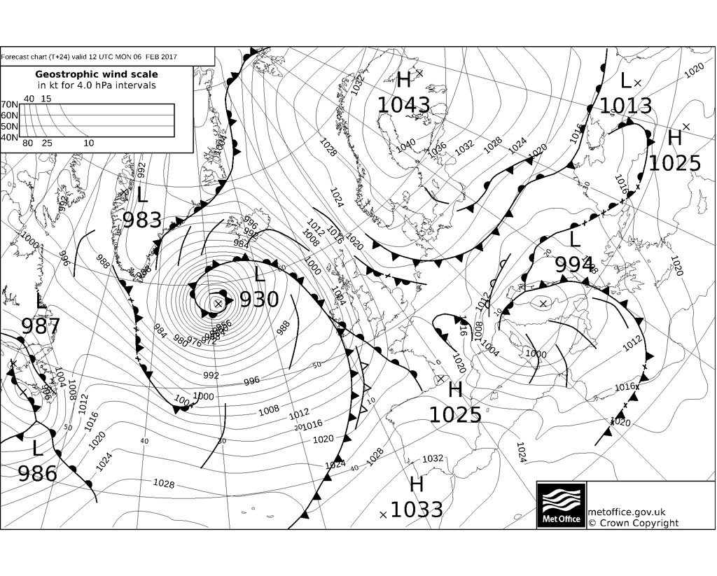
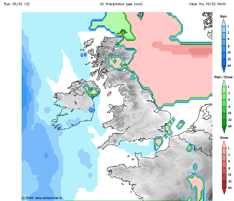
So we start the new week with a cold, bright and icy start on Monday. An intense depression (see chart below) out over the Atlantic heads toward Iceland, central pressure falling to as low as 930mb accompanied by hurricane force winds, we won't see anywhere near such strong winds, but associated frontal system will move east over UK and spread wind and rain in across EIRE and Northern Ireland during the morning, before edging east across SW England, Wales and western Scotland during the afternoon, then all areas Monday night, turning to snow too over northern hills.
The frontal system and its rain and hill snow in the north clears out into the North Sea Tuesday afternoon, but then hits the brick wall of the Scandinavian blocking high – the high is expanding a little further west, so the frontal system actually returns back west on Wednesday, though as a weak feature bringing cloud and light precipitation back in across eastern Scotland and eastern England, which will turn wintry as much colder air to the east of the front edges west.
Colder air moving west from Scandinavia and eastern Europe later this coming week
A cold and probably cloudy easterly to southeasterly flow then sets in Thursday and Friday as the Scandinavian high expands a little further west, with a chance of some snow flurries getting inland and light snow showers towards eastern coasts as the dry Polar continental flow picks up moisture over the North Sea in the lower layers.
Next weekend and beyond, growing uncertainty, as some recent models ensemble means suggest the block over Scandinavia may sink south a little, but if it does, we still keep a cold and dry southeasterly flow – so probably staying cold with below average temperatures, but mostly dry bar the odd snow flurry/shower near eastern coast.
However, there is potential, albeit low probability for now, that the Scandinavian blocking high may not sink and we may see another surge of deep cold air coming out west Russia towards NW Europe after the initial cold surge later this week. Particularly given the models may not be handling correctly changes to the upper patterns caused by the MJO. Such a second cold surge from the east next week could bring deep cold air, which would be more conducive to snowfall – but not showing in the models for now.
So we could be looking at the longest nationwide cold spell of the winter thus far starting from the middle of the week, though any snow, for now looks like and limited to more eastern areas with scattered flurries elsewhere.


