Another frosty morning with dense, freezing fog in places. Take care on the roads, flights are delayed in London. Gradually, the high loses its hold this week.
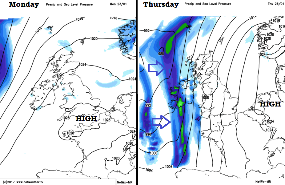
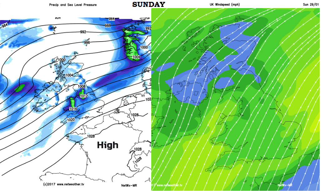
The high pressure which has been bringing settled, quiet weather recently will begin to lose its grip over the UK this week. The South-eastern half of the UK keeps nearer the high with mostly dry, calmer and chillier conditions but further north and west winds pickup and rain bands nudge in. Atlantic weather fronts will begin to push up against the high and change the weather over Northern Ireland, parts of Scotland and also into Wales and western England at times.
Today
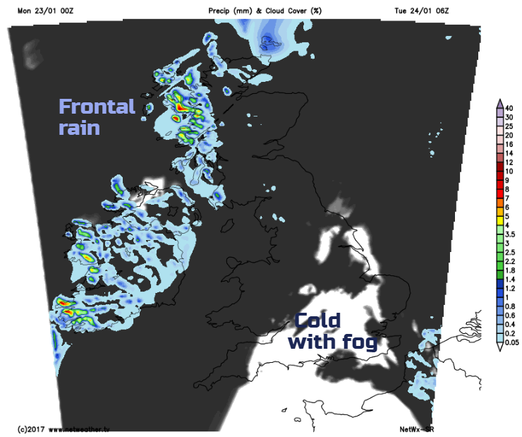
It’s cold again this morning and fog is a problem, freezing fog in parts. Although there is mist and frost in many areas, it is southern Britain seeing dense fog from the Midlands down into southern England. For the Monday morning rush hour, there will be poor visibility and the problems with freezing windscreens, allow a little more time and do take care if you are driving.
Again, we have a day of clear blue skies and sunshine for some but a grey cloudy picture for others. The sunshine will clear the fog through the morning but some areas won’t shift and will linger right through Tuesday morning, another foggy one.
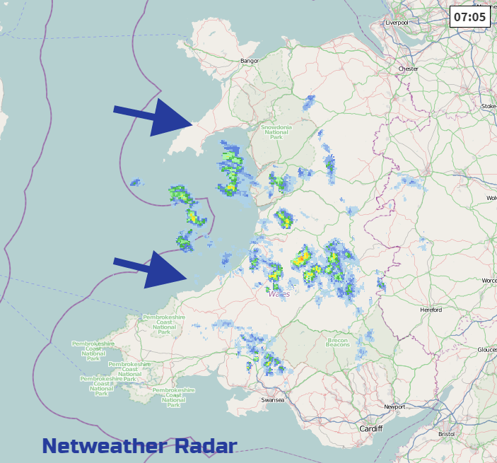
The cloud is thick enough in places to feel damp and Wales has seen a feed of showery outbreaks coming in off the Irish Sea.
This mix of bright sunshine for some and gloomy cloud for others has been the pattern for over a week now, quite tricky to pinpoint in a short forecast. Things are shifting this week but only gradually.
Through the day Northern Ireland and western Scotland pick up a moderate south to SW breeze, before weather fronts edge in from the west. Northern Ireland should manage 8C, Central Belt only 5C. Much of England 4 or 5C, coldest in the SE with SW England and Wales milder at 7 to 10C.
Tonight
The dense fog will return or just thicken further where it has lingered all day. Much of England will again see a frost with sub-zero temperatures. The incoming frontal cloud may save other places from dipping too low with Northern Ireland staying up around +5C
So, further problems are likely into Tuesday morning due to the fog, particularly for England.
It will become a more breezy day for northern and western parts. The far SE will stay calm and still. Slightly milder air will reach Northern Ireland and SW England allowing temperatures to reach double figures. The rain band falters over Dumfries& Galloway, Cumbria and the Isle of Man, with damp picture for Northern Ireland and most of Scotland. England and Wales should see some brightness with sunny spells and not feel as cold
Another frontal band tries to move in on Wednesday but really fails, as it comes up against the high pressure. Northern and Western parts won’t be as chilly and the SE stays cold. There will be more of a breeze from the south adding to the chill and it looks windy for western parts of the UK. There will be a widespread frost for inland Britain, much milder over Ireland
And really this pattern continues through the week. Bit more of a tilt to the flow off Europe from the SW to south to SE, staying cold for SE England, and then attempts from the Atlantic for cloud, wet and blustery conditions to take hold.
The forecast at the moment shows this Atlantic westerly flow will take hold by next weekend but High pressures can be notoriously stubborn and may just refuse to shift for a bit longer.