
Sunshine and frost becoming a little more widespread to end the week, and into the weekend.
It’s another cold start to the day across many central and southern areas of England and Wales as the ‘upside down’ temperature pattern that has dominated most of this week continues. Minimum temperatures down to -6C have been recorded at Farnborough, with many sites reaching -4C and -5C too including; Gatwick, Benson, Bournemouth and Lakenheath but to name just a few. In contrast, across cloudier areas of the north, temperatures haven’t dropped below 6C in Glasgow, 7C in Kinloss and no lower than 9C across Shetland. You can see the temperature variations well across the UK on our recent temperature observation map below.
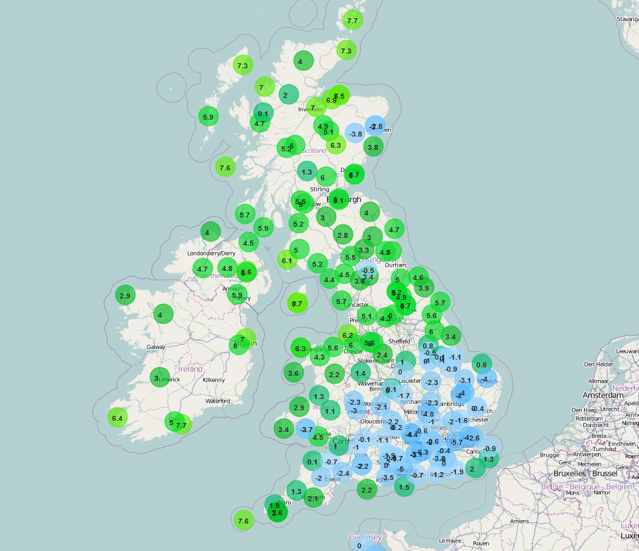
Temperatures shown are from earlier this morning - check the live weather map here.
The general weather pattern remains very similar to the last several days across the UK today, and that is high pressure continues to dominate the weather maintaining the quiet and benign conditions of late. However, the good news is that a change in the position of the high means that the clearer and colder conditions across southern areas of England will transfer northwards today to finally bring some sunshine to the Midlands and parts of N England where it has been overcast for several days. Unfortunately, though, these clearer conditions are unlikely to reach more northern areas of N England and S Scotland, so another relatively mild and overcast day is expected here.
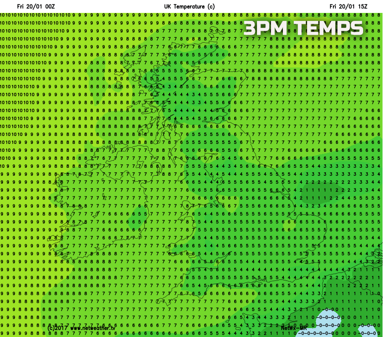
So, through the course of Friday afternoon and most of England and Wales will see increasing amounts of sunshine, prolonged spells of sunshine too and whilst Friday morning and the early afternoon will be rather cloudy across southern areas of N England even here some sunshine should materialise before sunset. The rather cloudier and milder conditions of late will continue across most of Scotland the far north of N England, but some cloud breaks, with some sunshine, may develop to the north and east of the Grampians though. A chilly afternoon, despite the sunshine, across England and Wales and most areas of the UK will have maximum temperatures generally near to average for the middle of January with highs around 4C to 8C.
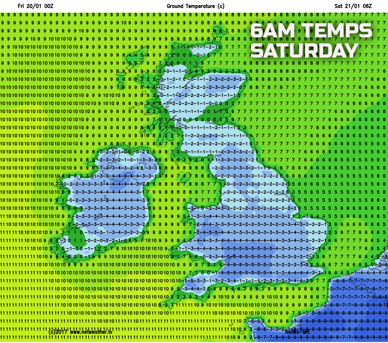
The clear skies this afternoon will then lead on to a chilly evening after sunset across the majority of England and Wales with a more widespread frost developing into the overnight period across the UK. Some low cloud and fog are likely to develop across parts of central and eastern England, and this may well prohibit frost more locally. Overall though Friday evening and overnight will be a colder night for many areas of the UK than compared with so far this week and, again, frost is likely to be more widespread as our temperature chart for early Saturday highlights with sub-zero temperatures in evidence. Some central and southern areas of England and Wales may well once again see minimum temperatures down to -5C or -6C, so a harsh frost for some.
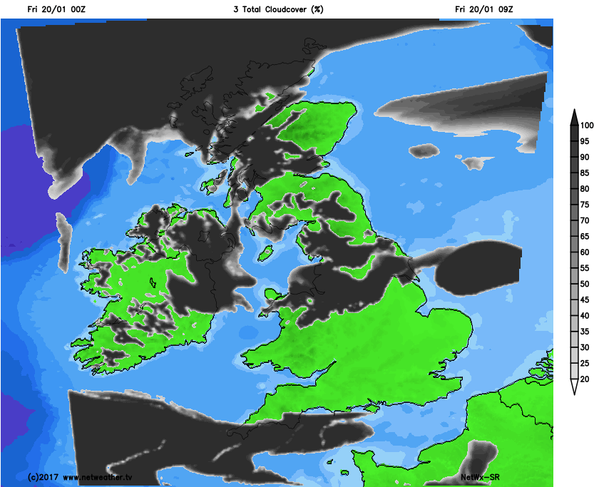
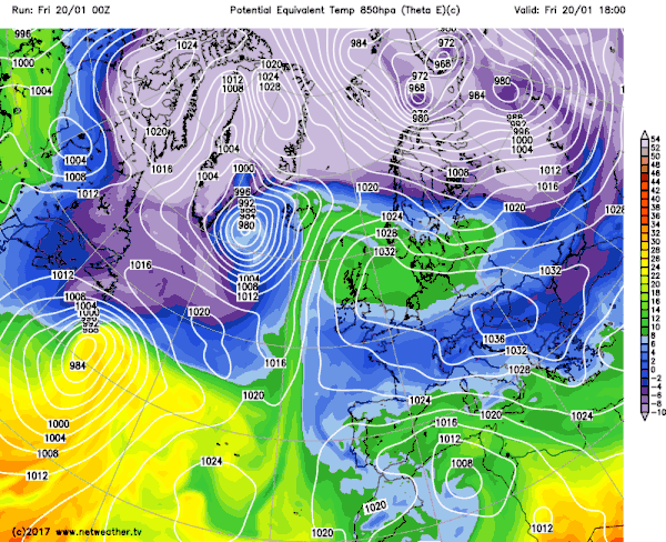
As we move into the weekend and, overall, high pressure will continue to dominate the weather, so a lot of fine and dry weather will be maintained across the UK. The colder air that will filter northwards across the UK through Friday will continue to spread to most areas over the weekend, so the emphasis is most certainly on a chilly weekend with temperatures near or slightly below average by day and with certainly a risk of overnight frosts. However, the forecast is complicated by a small disturbance that will be tracking northwards into the UK, of which originates from more unsettled conditions across parts of Spain. This disturbance will lead to the re-development of thicker cloud across parts of England and Wales, perhaps especially so across parts of SW England where some scattered light showers may develop through Saturday. Equally a region of thicker cloud across parts of N Wales, N Midlands and up into N England is also expected through Saturday and into Sunday, and beneath this some light rain or showers are possible. And when this is combined with the cold air mass in place then some light sleet and snow flurries are certainly possible, especially above 200m to 250m or so. The movement northwards of this colder air over the weekend is highlighted well on the below animation, noting the darker blue shadings, (the colder air) moving north through Saturday as higher pressure declines to the east and south-east.
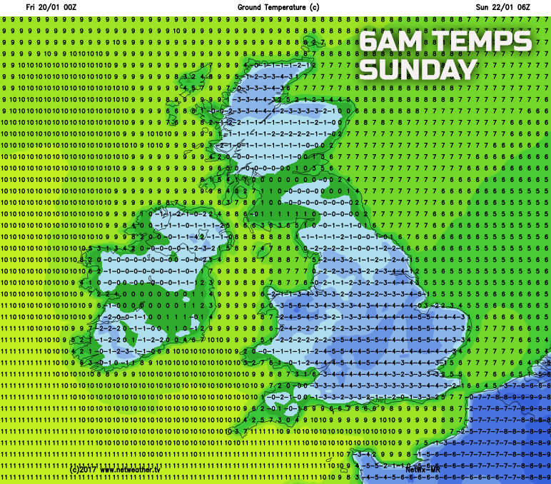
So, the fine and settled period of weather is set to continue overall. Yes, some patchy light precipitation is possible in places as Saturday progresses, but the emphasis is most certainly on further dry and settled conditions for many along with some sunshine too. This blocked weather pattern that has dominated this week and the coming weekend will also be maintained into next week too with further dry weather but with overnight frosts. Additional frosts are expected this weekend too, with maximum temperatures no higher than 3C to 7C, but with sub-zero temperatures certainly widespread by night, as shown on the below chart for early Sunday. Where any precipitation is experienced, across parts of the N Midlands and N England on Saturday, then some local icy patches may also be in evidence too.


.jpg?w=350)

