Much of the UK continues with the grey, cloudy skies resulting in a rather gloomy picture. However, there have been some breaks meaning a chilly start in the SE and the chance of seeing the sun over the next few days
Clear skies over southeastern Britain mean it is a cold start this morning with temperatures around -5 or -6 Celsius. A very chilly, frosty start for London and many of the Home counties into East Anglia. Further north it is still mild at around 8C under a lot of cloud, but even so, it’s not an even blanket and there are a few gaps. For example, Aberdeenshire and Durham having a cooler start thanks to eastern breaks.
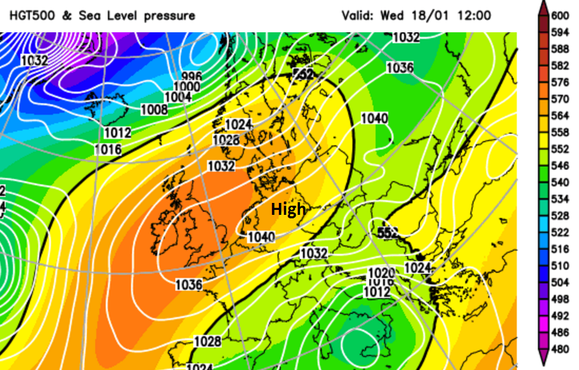
High pressure centred over Germany is keeping our weather quite steady. There are still weak weather fronts east/west over the UK giving a lot of cloud and some dampness. In the SE, we have the clearer skies and so brightness but also some mist and patchy fog as there is hardly any breeze. A waving weather front will edge closer to the Northern Isles today and there is more of a breeze due to northern Scotland being at the edge of the high pressure, a brisk SW wind.
Temperatures in northern Britain and Northern Ireland will stay at 7 to 9C, so on the mild side once more. The Midlands, SW England and Wales will reach 7 or 8C, up to 9C at the coasts. The gloomy grey skies will remain for most, just chinks of brightness, mainly in the east. However, for East Anglia and SE England it will stay chilly with temperatures this afternoon only up to 3C, London at 5C. There will be winter sunshine though so not a bad day.
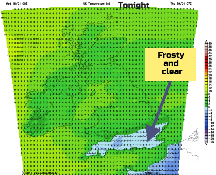
Tonight, it will be more of southern England having a frost. So, from Kent across to inland Cornwall in the evening and up to the M4 across to Essex by morning. The clear skies will let any of the daytime warmth scoot away into the night and temperatures fall just below freezing. Fog may reform. For the rest of the UK, it’s another cloudy and mild night, just a few breaks.
Thursday is another similar day, with a lot of cloud, a few drizzly bits. SW England will have a brighter day with sunshine, so a cheerier prospect here. Parts of Wales and Co Fermanagh with Co Tyrone could see sunny spells breaking through too. More of an easterly breeze begins to take hold for the Thames estuary and this will draw in more cloud by the afternoon.
End of the week
With high pressure over the UK we continue with the quiet spell of weather. There will still be large areas of cloud, greyness and slight dampness in the air. However, more areas should see brighter breaks. It will feel cool by day and there is still the risk of frost by night, more-so on Saturday night.