Another cold day with wintry showers today, but milder weather will be arriving tomorrow.
It is another cold start across many areas of the UK with some frost and also quite a lot of ice as well, certainly something to be aware of if travelling this morning. Minimum temperatures have widely fallen below freezing across the UK overnight, hence the risk of ice with the thermometer having dipped away to -9C across the Highlands of Scotland.
For the latest temperatures across the country, take a look at our new current weather map - updated every 30 minutes.
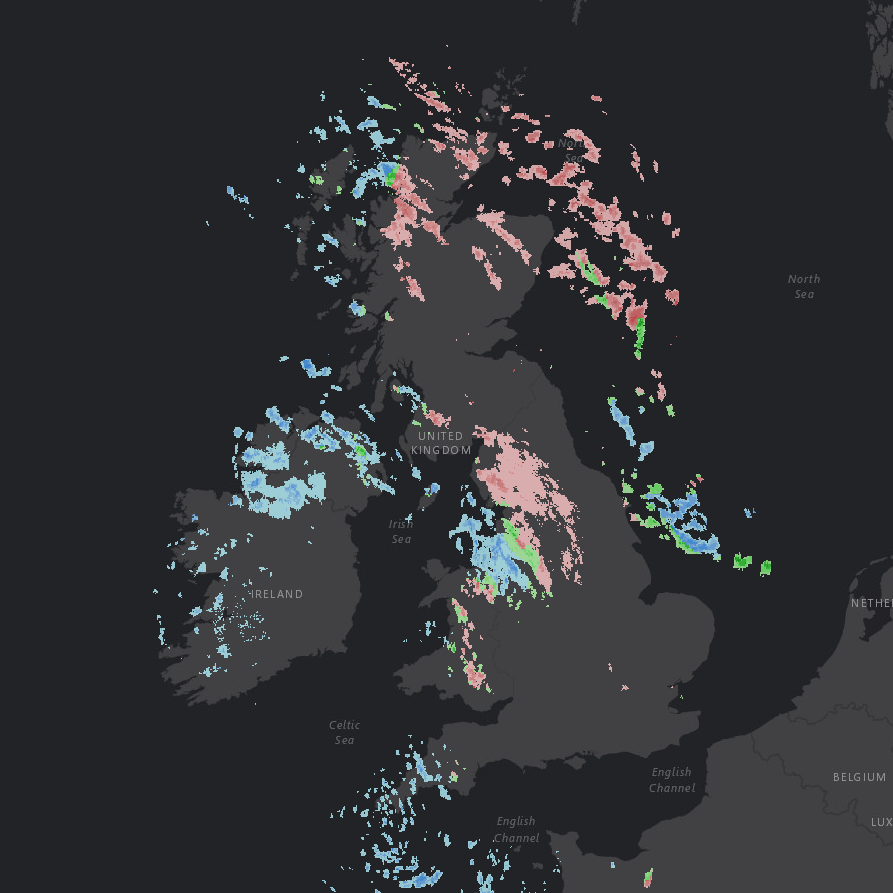
Many areas are starting the day dry, with some sunshine, but there are some wintry showers around the periphery of the UK, these filtering into parts of NW England this morning for example. Whilst some of these showers are falling as snow, they are now mostly of rain across western areas of the UK, and this is an early indication that milder conditions are waiting to move into the UK from the west. Our precipitation-type radar imagery highlights the wintry showers this morning across parts of the UK with, as usual, pink shadings highlighting snow.
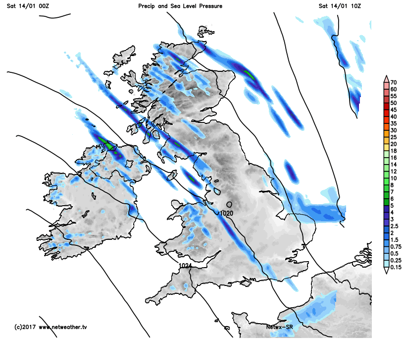
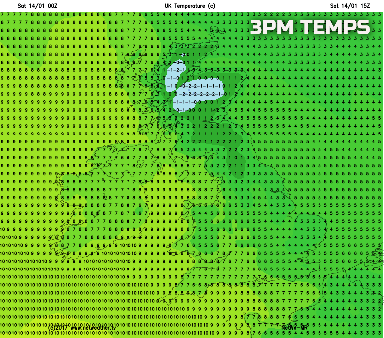
Through the course of Saturday and it is definitely a case of making the most of the cold, dry and sunny weather if that is what you like before changes arrive from the west. Many areas of the UK will maintain cold conditions today, but there will be a lot of dry weather too, especially across central and southern Scotland, down into N England, once the morning showers clear NW England, and further south into central and southern areas of England. Bright or sunny spells are expected and whilst cold, with generally lighter winds than the last few days it won’t feel quite as bitter. Further wintry showers are possible around the periphery of the UK in particular, but as the day progresses these will turn increasingly to rain for the most part. Our high-resolution model highlights this general evolution through the day, noting the showers in some coastal areas in particular, but with a lot of dry weather inland.
As indicated it will be another cold day for most, perhaps with the exception of W Scotland, Ireland and SW England where it will begin to turn less cold than the last few days. Maximum temperatures this afternoon are expected to range between 2C and 7C generally, highest across more western areas of the UK, lowest across more central and eastern areas.
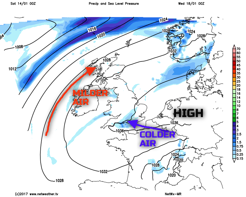
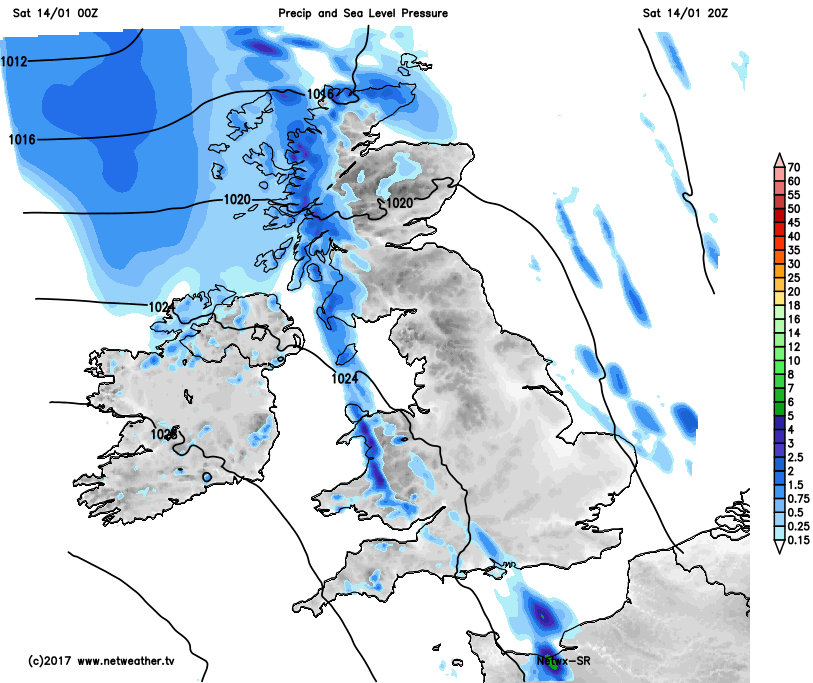
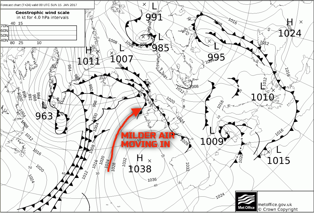
Into Saturday evening and overnight and we then start to see a more significant change in the weather take place from the west and north-west. High pressure will be a dominant feature to the south-west of the UK but weather fronts will be able to move up and over this region of high pressure and then move down into the UK from the north-west, along with it a much milder air mass, sourced from the Azores. Outbreaks of rain and drizzle, perhaps preceded by some sleet and snow will move into Scotland and Ireland first, before then spreading southeastwards across most of England and Wales during Sunday morning with again some snow possible for a short time. Ahead of this, though, it will be another cold evening and night across England and Wales with frost and ice re-developing, especially across central and eastern areas of England. As the milder air moves in over the cold surface conditions then some extensive low cloud and hill fog is expected across many northern and western areas of the UK, with a particularly, overcast, grey and dank start to Sunday for many parts. The UKMO weather chart highlights these weather fronts moving into the UK over the high pressure.
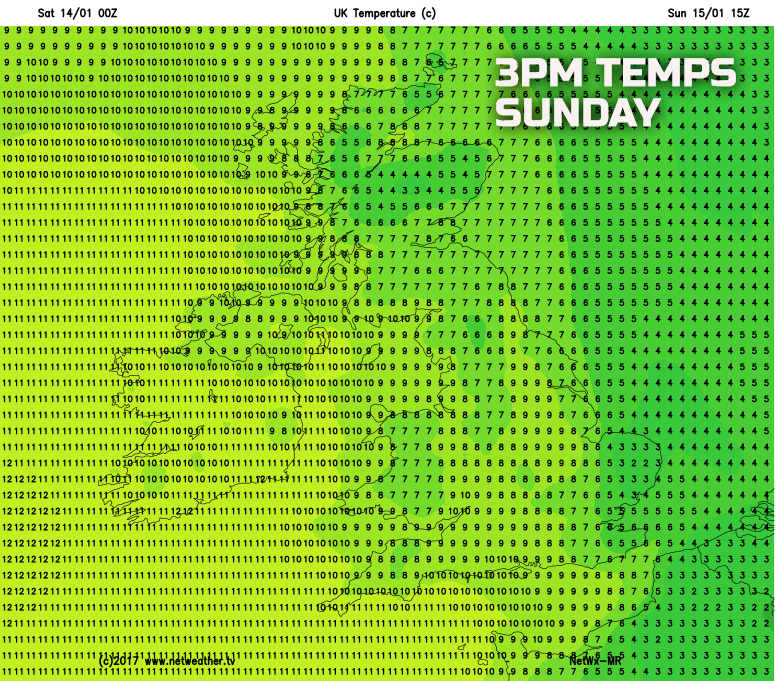
So, after the cold, crisp and sunny weather of today (Saturday) then Sunday will clearly be a very different day across many areas of the UK with overcast conditions and with residual rain and drizzle moving south-eastwards, along with a lot of low cloud and hill fog. The colder conditions may hang on across the extreme east and south-east of England and here it may well feel particularly cold and raw through the day, but for many other areas of the UK temperatures will be several degrees higher than compared with the last few days.
Looking further ahead into next week and confidence regarding the general weather pattern is high, and that is for high pressure to build over the UK and then become the dominant feature of the weather. As a result, a benign period of weather is expected across many areas of the UK next week, and this is in-keeping with the winter overall so far, with little in the way of any severe or active weather expected next week. The position of the high pressure will mean that more northern and western areas of the UK, so Scotland and Ireland in particular, will be dominated by a rather cloudy and mild SW’ly air mass along the northern and western periphery of the high pressure, so some rather grey weather is expected here through next week. Across England and Wales though and there is a greater risk of cloud breaking with time and with some colder air filtering back in off the near Continent, not to the extent that was initially expected, but chilly days and some frost is likely. Our medium range weather model highlights the general situation well towards the middle of next week.