
Rain and hill snow spreading east across southern Britain turning to snow at low levels across SE later. Cold wind with snow showers in the north and west. More snow showers spreading south on Friday. Quieter over the weekend, cold on Saturday, rain spreading south on Sunday.
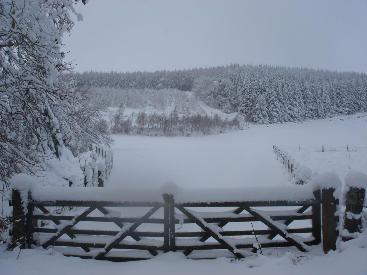
Parts of the north have woken up to snowy scenes this morning, particularly across Scotland, N. Ireland and NW England – where snow showers have blown southeast overnight and they will continue through much of today across northern and western areas, bringing further accumulations. This wintry weather will become more widespread across Britain over the next few days, as increasingly cold arctic air pushes south.
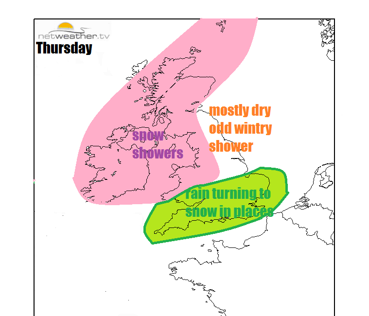
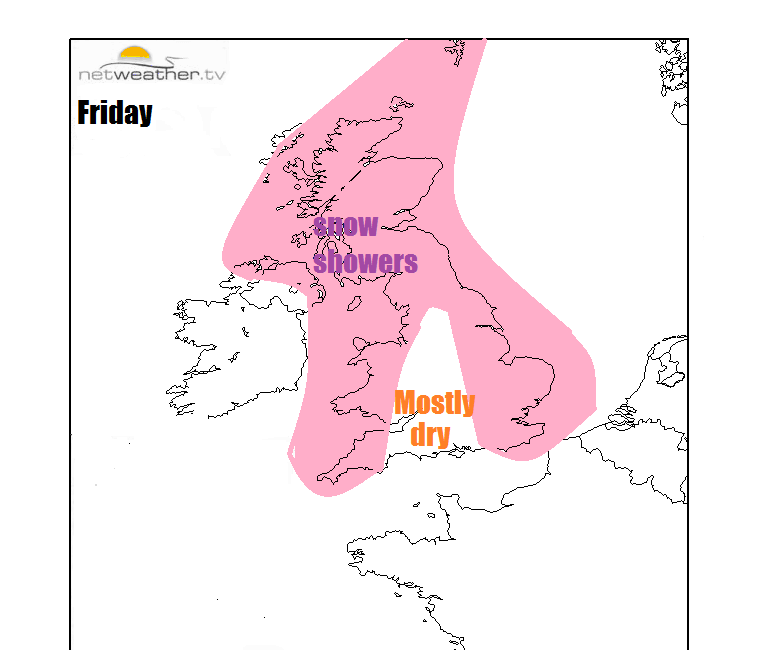
The wintry weather is yet to reach southern areas and we will see some rain spread in from the west through the day across Wales, central and southern England. However, as the rain clears this evening – it is forecast to turn to snow, even to low levels in places. A cold northerly or northwesterly flow will continue to blow snow showers south on Friday, though some places will remain dry, sunny and cold. Fewer wintry showers on Saturday, which will be confined to coasts. Then on Sunday, cloud, rain and milder air look to spill southeast across all parts. But colder conditions look likely to return from the east next week.
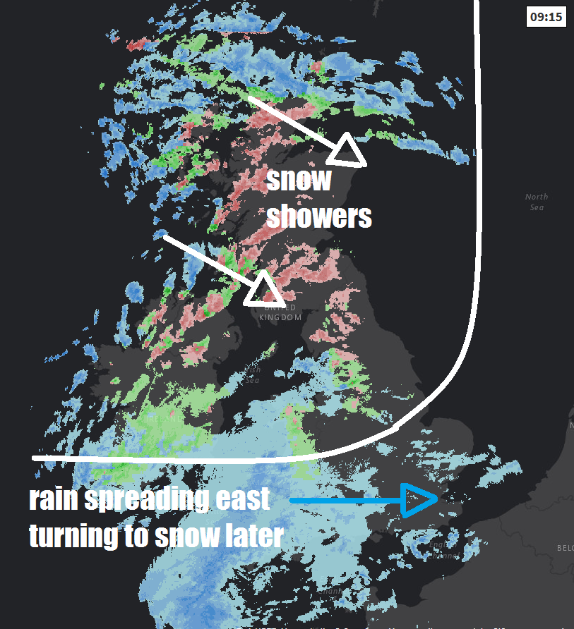
For now, the winds have eased across the northern half of Britain overnight, but a strong and raw westerly wind will continue to blow in sleet and snow showers across Scotland, northern England and N. Ireland through the day. Largest snow accumulation will be over the hills – where 5-10cm are possible, perhaps 10-20cm over the mountains of western Scotland. Low-levels perhaps seeing 2-5cm in places. The strong westerly wind, which will reach gale force over western coasts and hills, will cause some drifting of lying snow and temporary blizzard conditions over the hills in the heavier showers. Some travel disruption possible, particularly for the higher routes. NE England perhaps escaping with fewer showers though, with a mostly dry and bright but cold day.
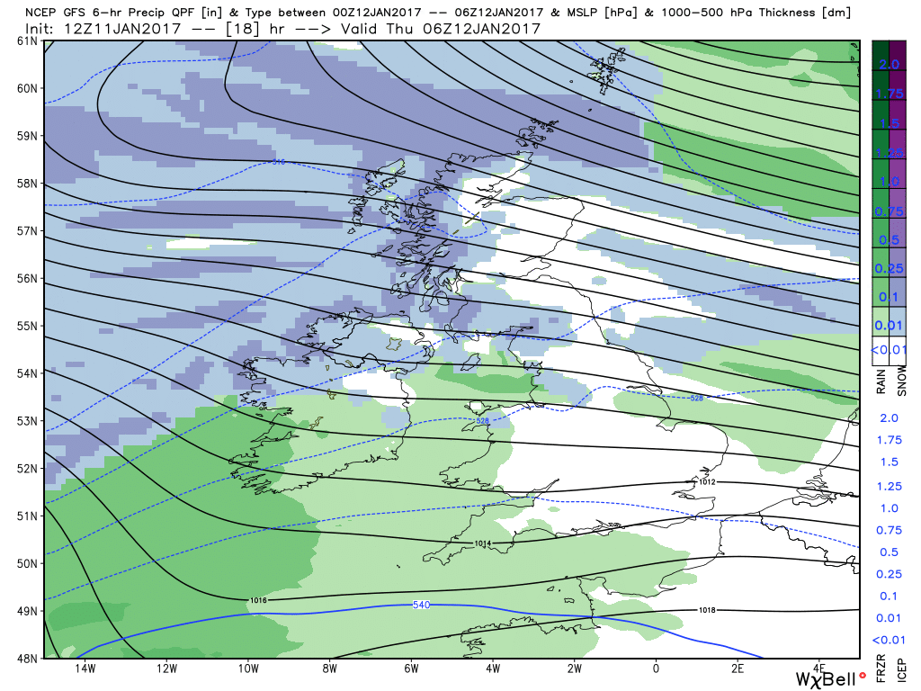
Further south, thickening cloud bringing rain and hill snow will quickly spread across Wales and SW England this morning. The rain spreading east across the Midlands, southern England and East Anglia through the rest of the morning, after a dry start in the east. The rain will turn heavier through the afternoon as it continues to spread east and as colder and drier arctic air from the northwest undercuts the swathe of rain clearing east, it will turn to snow across parts of the Midlands, central southern and southeast England along with East Anglia. Snow will readily settle across The Chilterns, North and South Downs, where some significant accumulations are possible, but snow may also settle at lower levels too – all bringing a risk of some travel disruption, especially as the rain looks to turn to snow between 3pm and 7pm during the rush hour.
Temperatures this afternoon reaching a high of 7C in London, 5C in Cardiff, 4C in Manchester, 3C in Newcastle, 2C in Belfast and Glasgow, 1C in Aberdeen. Factoring in the strong wind chill and it feel more like 0 to -4C in the north.
Then this evening and overnight, sleet and snow will clear SE England and East Anglia later this evening, then clearing skies spreading south across many areas will allow temperatures to fall close to freezing, bringing a threat of ice where sleet and snow has fallen on untreated surfaces. Sleet and snow showers will continue across western areas and also a more organised band of sleet and snow looks to spread south across Scotland and the eastern side of England by the end of the night.
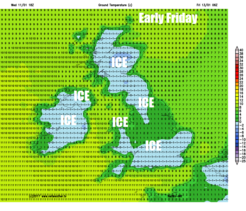
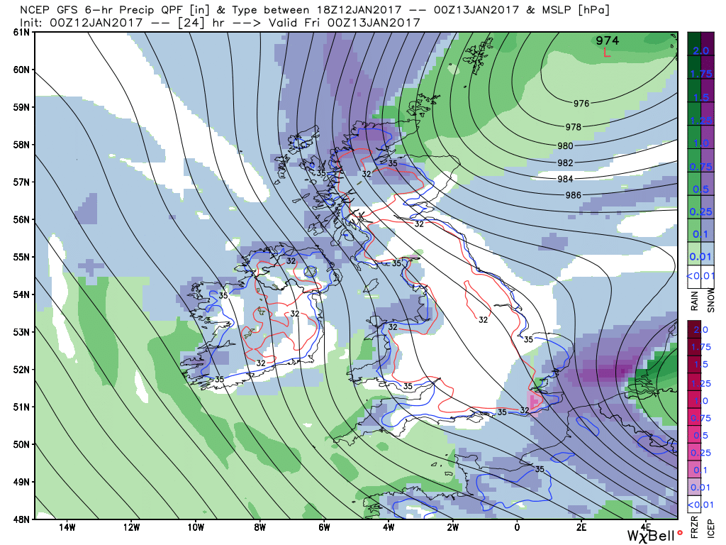
So a cold and icy start for many on Friday morning, with a risk of treacherous conditions on untreated surfaces. A band of sleet and snow looks to continue to spread south across the East Midlands, East Anglia and SE England during the morning, before clearing to cold winter sunshine. Elsewhere, plenty of winter sunshine too, but also further sleet and snow showers toward western coasts. There will also be gales or severe gales towards the east coast, the very strong northerly wind creating a storm surge down the North Sea, which combined with deep low pressure over the North Sea and spring tides - brings the risk of coastal flooding here. Temperatures reaching 2-4C in the north, 4-6C in the south.
Turning quieter through the weekend, not as windy. Still cold on Saturday with further wintry showers along coastal areas in the west exposed to the northwesterly wind – though tending to fall less of snow and more sleet/rain as less cold air arrives through the day off the Atlantic. Sleet and snow showers along the immediate east coasts too. Otherwise many inland areas dry, sunny but cold. Sunday sees an occluded frontal system with milder air behind it move off the Atlantic with cloud and outbreaks of rain, preceded by snow in places, spreading southeast across the UK.
Early next week sees high pressure build in from the SW, so it’s looking predominantly dry, temperatures probably close to average at first generally, but there are hints from the models that a colder continental flow from the east may develop across S and SE England, lowering temperatures and bringing a risk of hard overnight frosts.


