A spell of wind and rain moves southeast today, followed by blustery showers. More showery weather then continues, before colder conditions arrive from the north later in the week.
Today brings a major change for the start of the working week, as our previously resident anticyclone returns to its normal position near the Azores. It’ll become blustery if it hasn’t already done so, with a spell of rain crossing most parts as a brisk Westerly flow becomes established across Britain.
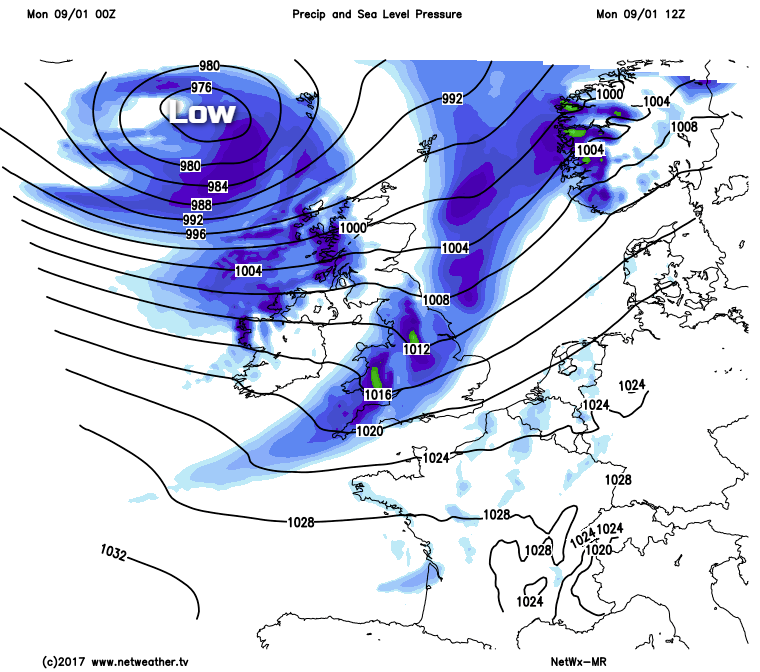
Towards the South East, there'll be the remnants of yesterday’s weather where you'll wake up to grey, damp, misty conditions, but that'll lift and clear as a Southerly wind freshens bringing patchy rain by midday. In complete contrast it's wet and windy across the North and West of England and Wales, this quickly spreading to most other parts through the morning. The rain has already cleared from Northern Ireland and most of Scotland, to leave a morning of sunny intervals and scattered showers here. The showers will be most frequent in the West where some will be heavy, with a blustery South West wind giving severe gale force gusts of 60 to 65mph over exposed coasts and hills in the North.
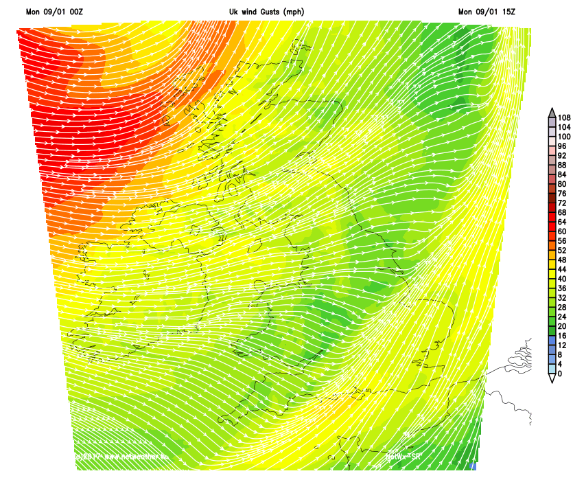
By the afternoon it'll be the turn of East Anglia and the South East to see a brief spell of wet and windy weather before brighter weather elsewhere giving sunny spells and scattered blustery showers follows on behind. The showers will be most frequent across the North and West of Scotland and Northern Ireland where some will be heavy and lengthy. They’ll also turn increasingly wintry in the North giving hill snow, with East Scotland seeing the best of the sunny spells through the afternoon. Central and eastern England will also have some sunshine to end the day, with the bulk of the showers in the West. A fresh or strong and blustery South West wind will feel cold and continue to give gusts to severe gale force over exposed coasts and hills in the North. As a result, temperatures will be no higher than 5 to 7C in the North and 8 to 11C in the South where it'll be milder, to begin with.
After dark, there’ll be clear spells in central and eastern areas, with a West or South West wind decreasing a little. Here there’ll be fewer showers, but elsewhere showers are more likely in a still fresh or strong and blustery wind. The showers could be heavy and lengthy West of the Pennines and over Scotland and Northern Ireland, and they'll be wintry in places falling as sleet and snow in the North and on hills further South. It’ll be a colder night with a ground frost by dawn in more sheltered central and eastern areas, as temperatures generally fall to between 1 and 4C.
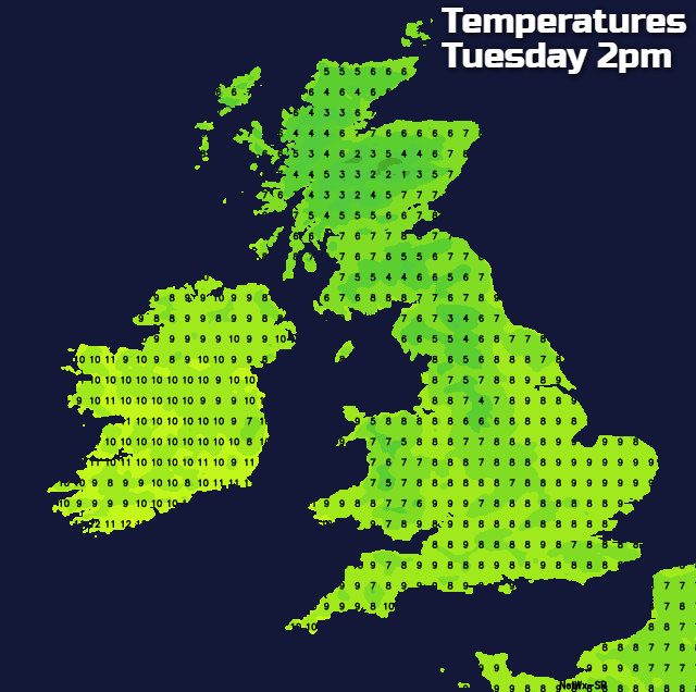
Tuesday looks just as unsettled and blustery, but with a brief lull giving some sunshine in the East before another spell of rain ‘sweeps in’ from the West through the day. This could briefly be heavy as a South West wind increases again to give fresh or strong gusts with renewed gales in the North and West. Clearer weather will follow into more western areas during the afternoon, but it’ll remain blustery with further showers. It’ll feel cold in the wind, although temperatures should reach 6 to 9C.
Clearer weather spreads to all parts during the evening, but a blustery West wind continues to bring showers most frequent in the North and West. They’ll turn wintry again on northern hills falling as snow even at lower levels later over parts of Northern Ireland and Scotland, where ice may become a problem later in the night. It’ll feel raw with a frost in sheltered places by dawn, but the wind will help prevent temperatures from falling below 0 to 4C.
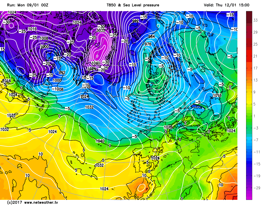
The first proper cold spell of the winter is expected to spread from the Arctic later in the week, bringing snow to parts of the North and East and some sharp frosts. The wintry spell shouldn't last too long, however, with milder conditions returning later in the weekend or into the early part of next week.