A change to milder weather arriving as weather fronts move east across the country today.
The end of the working week is bringing about a change to milder conditions as weather fronts move eastwards. This change after the cold weather over the last few days will be a slow process, though, and most areas of England and Wales, in particular, will have another chilly day.
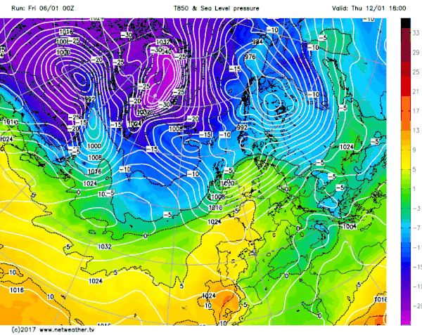
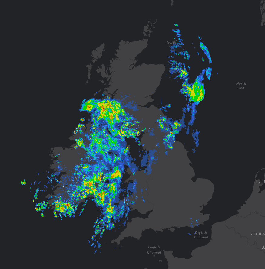
Unlike recent days, it will be more unsettled as weather fronts move eastwards to bring outbreaks of rain as well. It is, however, another cold start for some areas, especially central and southern England and Wales with minimum temperatures down to -6°C in Pershore, Worcestershire and -5°C at Gatwick and Northolt for example. However, further north and west it is a much milder start to the day with temperatures up to 8°C at Camborne, in Cornwall and 7°C in Belfast. So quite a variation in temperature across the UK this morning and outbreaks of rain are in evidence too across more northern and western areas as the rainfall radar highlights.
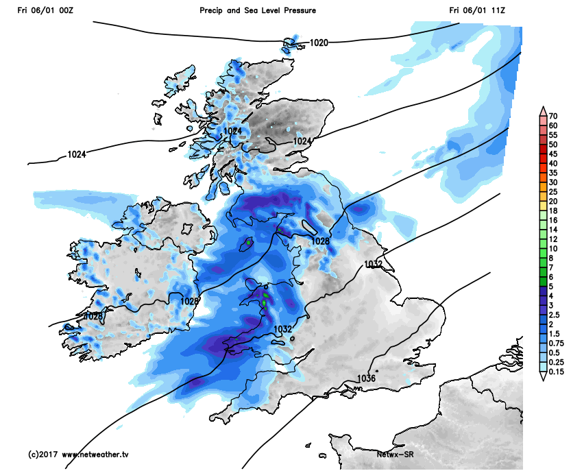
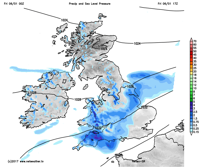
As Friday progresses weather fronts across more northern and western areas, bringing the rain this morning, will slowly move south and eastwards across most areas of England and Wales, but not reaching SE England until well after dark. Some bright or sunny intervals are possible across SE England for a time through the morning and into the early afternoon, but even here it will become mostly cloudy as the day progresses. Most of the rain though will be across parts of Ireland, S Scotland, N England and Wales where up to 10mm to 15mm of rain is possible in places, and after the dry, cold and sunny day of Thursday, this will be a noticeable change in the weather. Our high-resolution model highlights the general progress of the rain through the day.
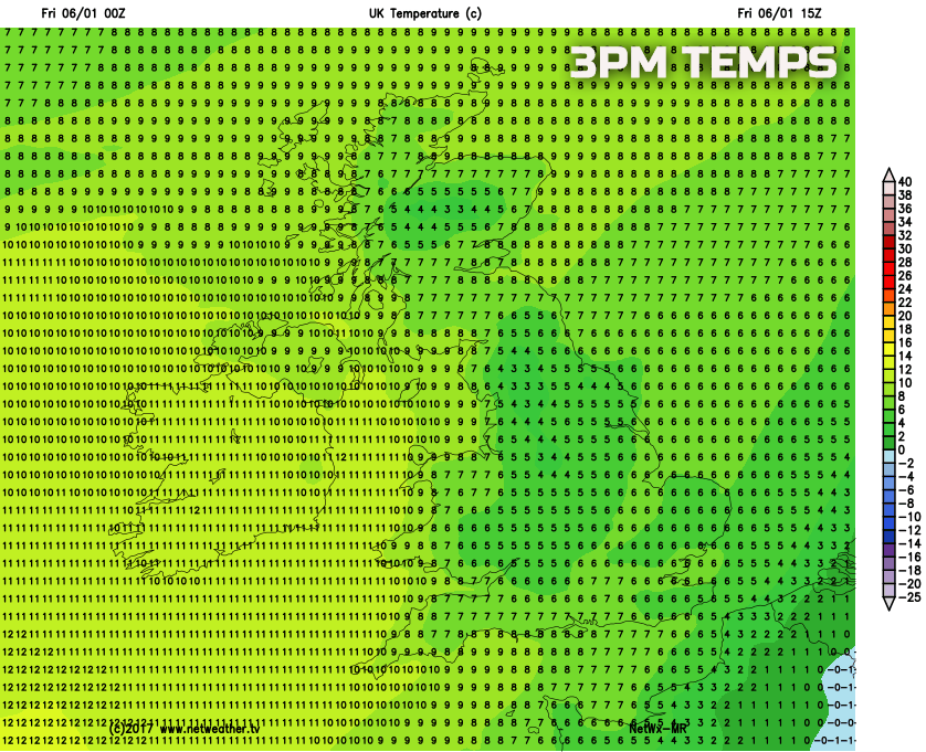
Also of some importance is that despite milder weather trying to move into the UK from the west this process will be a gradual one, especially across England and Wales where temperatures will remain quite depressed today. When this is combined with overcast and increasingly wet conditions, then it will certainly feel quite cold, but with many northern and especially western areas of the UK seeing higher temperatures. This is exampled well on the below chart showing temperatures for 3pm this afternoon, noting the much lower temperatures across England and Wales then further west.
So, we move into the overnight period and through into the start of the weekend with weakening weather fronts moving south-eastwards across England and Wales as milder conditions then filter eastwards to all areas. So a rather cloudy and overcast start to the weekend is expected across England and Wales, perhaps with some residual light rain and drizzle as well. There are likely to be some cloud breaks though across Scotland and maybe N England so some brighter weather here during the morning.
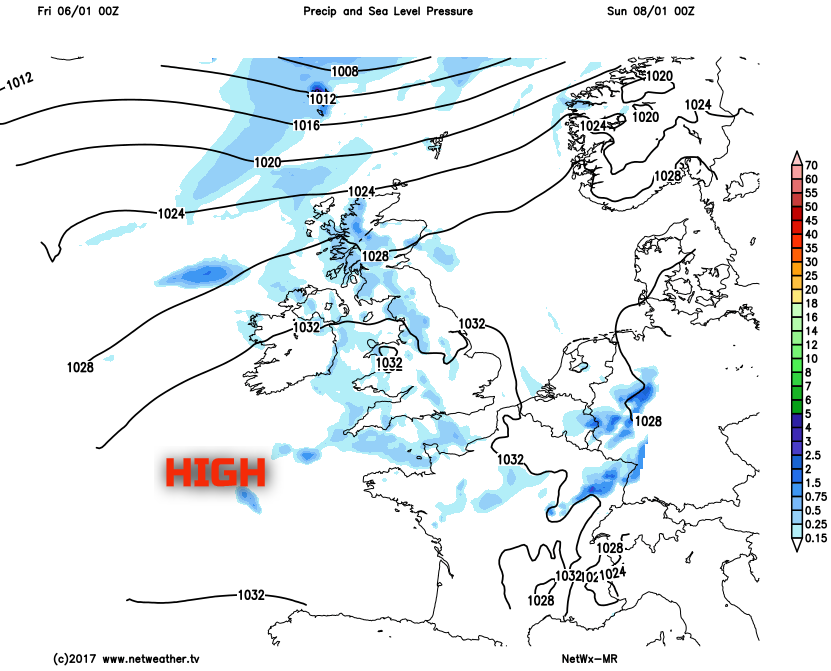
The weekend overall though will be relatively quiet and benign as high pressure, situated just to the south-west of the UK, dominates the weather. Emphasis is on a lot of dry weather, but it will be quite a cloudy weekend overall despite some brighter intervals too given that winds will be west or south-westerly off the N Atlantic. Best of any sunshine though is likely to be across more northern and eastern areas of the UK, perhaps especially to the east of high ground. Equally, some patchy light rain and drizzle may develop at times, though, where the cloud is thickest, especially across western hills of the UK.
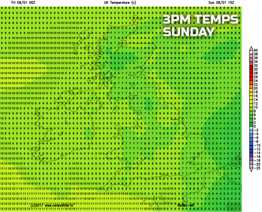
Temperatures over the weekend near or slightly above average across most areas with highs around 6C to 10C, clearly with more cloud around by night too then nights will also be milder than of late as well with little risk of frost. Our medium range forecast chart for Sunday afternoon highlights the general temperatures that are to be expected this weekend.
Looking beyond the relatively quiet and benign conditions of the coming weekend and we are likely to see more active weather conditions as next week develops.
Low pressure is expected to bring some wet and windy weather across most areas through the course of Monday, and there will be a temporary drop in temperature in association with this as well. Some strong winds and gales are possible across the north of the UK too. Looking further ahead and there are some continued signs within the weather models that a colder NW’ly wind may well develop towards the middle and latter half of next week with a more pronounced drop in temperature. There remain uncertainties over the details, given the time frame involved, but confidence is increasing to at least suggest a colder period of weather is possible in around a weeks’ time and with perhaps some wintry precipitation too. This progression towards colder weather, from the north-west, is highlighted well on the animation below with the blue shadings indicating the colder air mass, which, for now at least, certainly looks like it will be cold enough to bring sleet and snow to some areas of the UK, so stay tuned for more on that in the coming days.