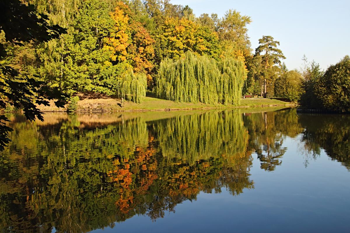
After a cool down over the next few days, parts of the UK look set to see an Indian Summer during the first week of October on the back of one of the warmest Septembers in recent years.
September looks like it may be on track to be the second or third warmest across the UK since records began in 1910 as per UK Met Office figures. Although the weather was mixed across the north, while predominantly dry in the south, there were two nationwide warm spells earlier in the month. Southerly winds sourced from southern France and Spain brought exceptional warmth around the 13th allowing temperatures to reach 34.4C at Gravesend in Kent, making it the hottest day of the year. Before the 13th, the 23rd of August was the hottest day of the year, when a maximum temperature of 34.1 °C was recorded at Faversham (Kent).
Not often the hottest day of year is in September. We have to go back to the 1st September 1954 for the last time the hottest day of the year was recorded in September, when 30.0C recorded at Regents Park in central London. And even more unusual for 30C to be exceeded so late in the year.
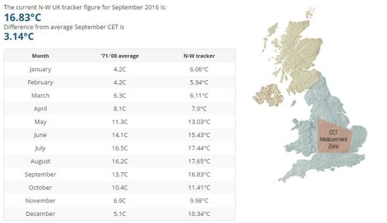
Although obviously not all the figures are in yet, September looks like it will end up a few degrees above the UK’s 30-year average for the month. Not only were the days very warm, but some nights were too, with temperatures on a few nights during the warm spells falling no lower than 20C in the south. Using the Netweather Central England Temperature (CET) Tracker, September is running 3.1C above the 1971-2000 average
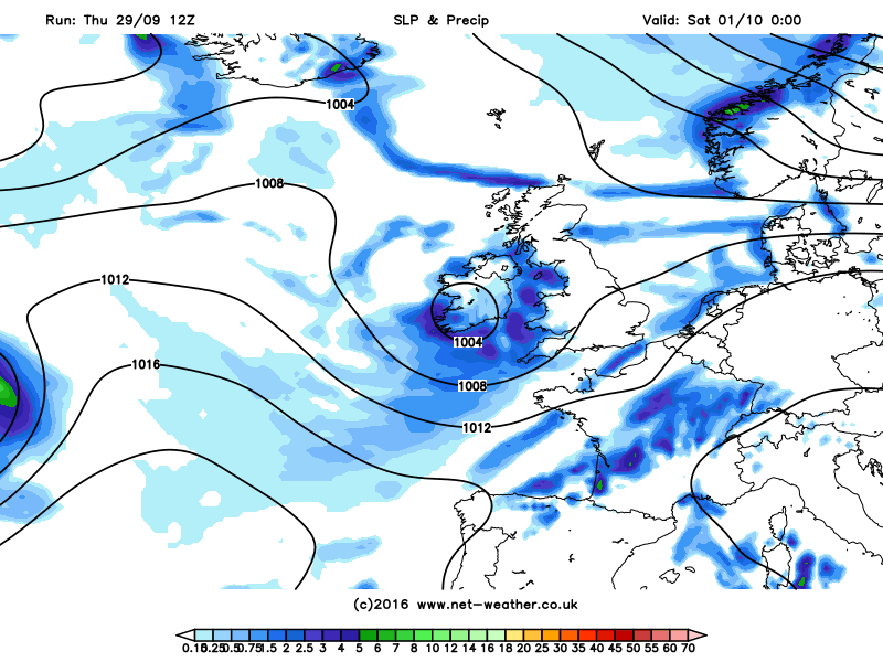
Atlantic low pressure and westerly winds will bring cooler and changeable conditions to see out the last few days of September and into the first few days of October this weekend, with some chilly nights to boot where skies clear. Saturday looks particularly cool and unsettled for England and Wales, as low pressure moving east brings cloudy skies and thundery showers or longer spells of rain.
Not a promising start to October this Saturday:
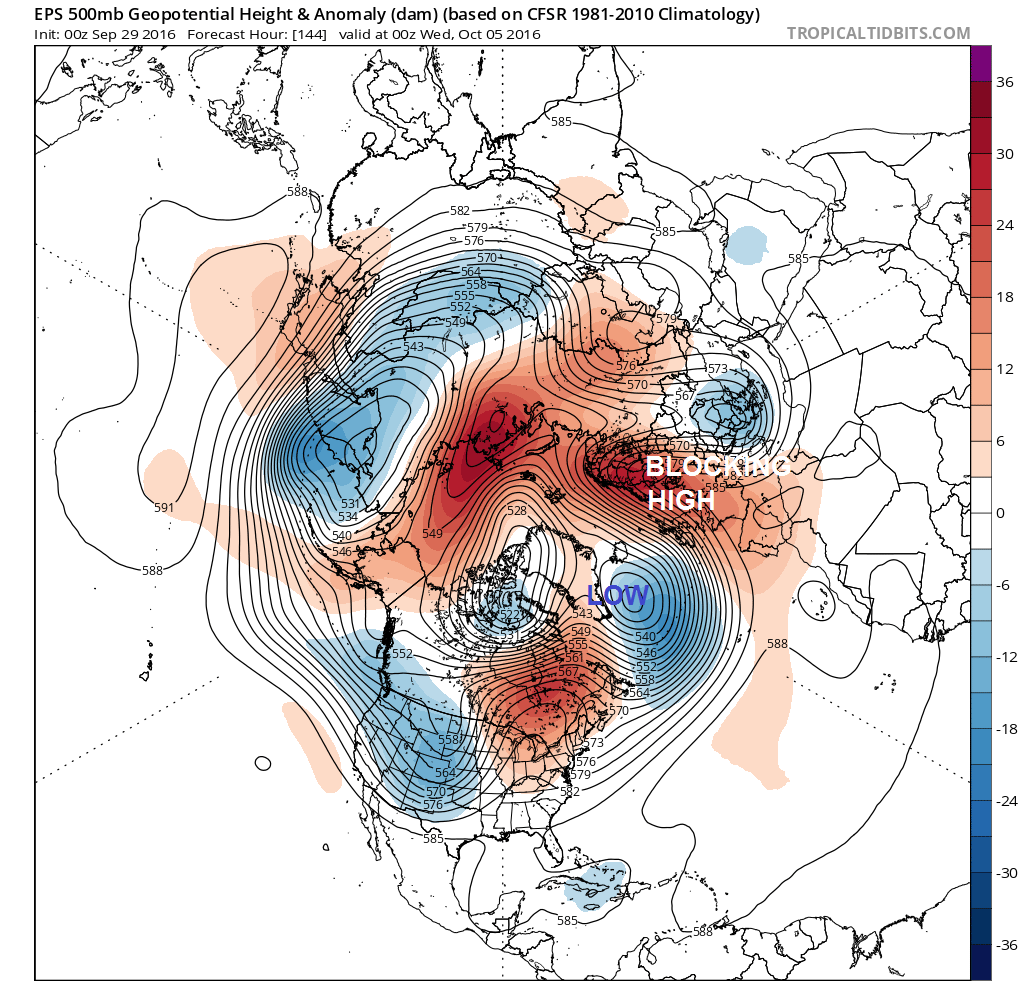
But, it looks like the weather will settle down and warm up again into next week. The numerical weather prediction (NWP) models have been and are currently indicating an amplifying and slow-moving large-scale upper trough over the N. Atlantic next week as a blocking ridge of high pressure builds over the UK and Scandinavia. This will mean south or southeasterly winds drawing up warm and dry air from the near continent, with potential for temperatures across southern England to return back into high teens early next week and the low-twenties degrees centigrade by the middle of next week. Elsewhere reaching the mid to high teens by mid-week, many areas dry much of the week too, though the far west may see cloud and rain at times from Atlantic systems, more especially early on in the week.
Middle of next week has blocking high in place
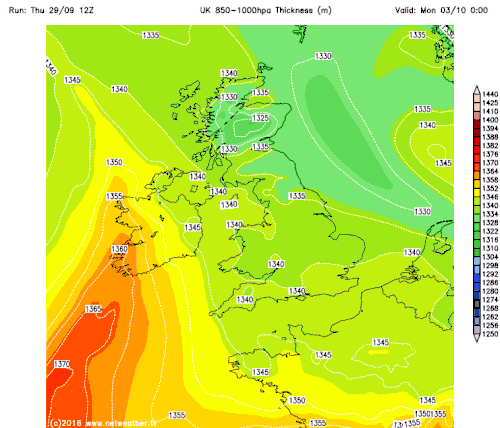
850-1000mb thickness charts show warm air returning from the south next week:
Average highs in October for London start off at 18°C for the October 1st, gradually dropping down to 13°C by October 31st, rarely going over 21°C or falling under 11°C. The average high for October as a whole for London is 16°C. So, with highs forecast to be in the low 20s on Wednesday and Thursday, this will be a few degrees above average at least if not several degrees above average. Having said that, with the longer nights, it could turn chilly overnight across the south in the dry continental flow, so perhaps some large day to night temperature ranges.
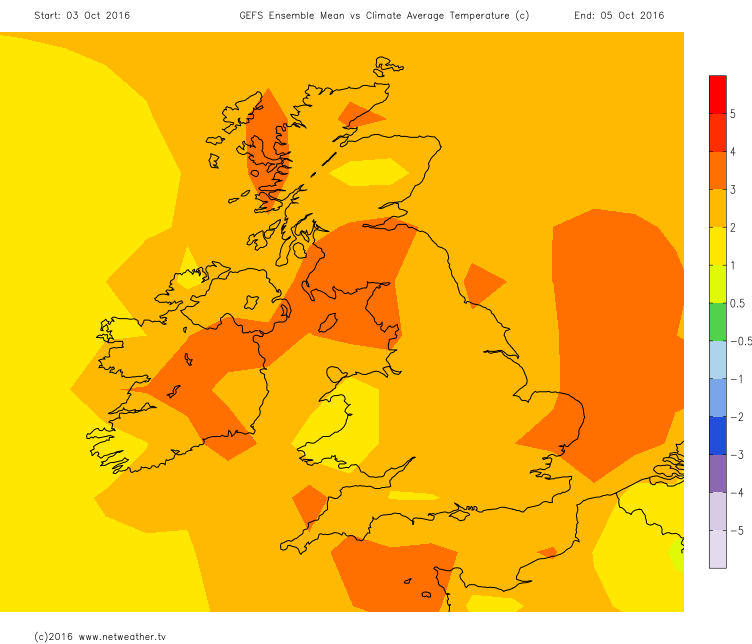
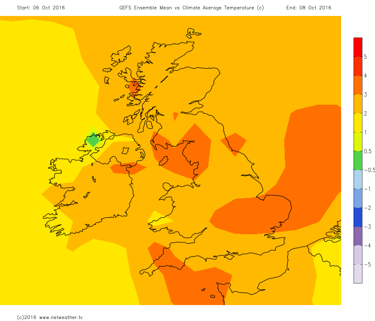
UK Temperatures above the climatic average next week
So it looks like parts of the UK are set to see an Indian Summer next week on the back of one of the warmest Septembers in recent years. My colleague Jo Farrow did a blog about the definition of an Indian Summer earlier this month, but I will leave you with a definition from her blog from The Meteorological Glossary, HMSO which is appropriate for the UK:
A warm, calm spell of weather occurring in the autumn, especially in October and November. The earliest record of the use of this term is at the end of the 18th century, in America, and it was introduced into the British Isles at the beginning of the nineteenth century. There is no statistical evidence to show that such a warm spell tends to recur each year.