


Once every few years on average deep depressions formed from ex-hurricanes make a direct aim at the UK. Ex-Karl may head towards the UK next week after is perhaps becomes a hurricane briefly near Bermuda this weekend.
It is fairly common during September for ex-hurricanes to affect the UK weather both directly and indirectly as they swing NE across the North Atlantic. On average, an ex-hurricane will take a direct aim at the UK once every few years, though even if these storms don’t take aim at the UK and instead head towards Iceland, they can drag large amounts of warmth and moisture across the UK to bring a late taste of summer.
Tropical storms and hurricanes develop over the warm waters of the tropical Atlantic, usually between the months of June and November, when sea surface temperatures are at their highest. Warm ocean waters provide the energy a storm needs to become a hurricane. Usually, the surface water temperature must be 26C (79F) or higher for a hurricane to form.
Most of the systems then track westwards towards the Caribbean, Gulf of Mexico and North America and usually either lose strength when they make landfall or travel over cooler waters of the North Atlantic.
Occasionally their track takes them far enough north over the Atlantic that they interact with the jet stream, which can then transport the remnants of a hurricane towards north-west Europe.
Technically a true hurricane cannot make it as far as the UK, as the waters that surround NW Europe are far too cool to sustain them. Instead, the ex-tropical remnants of such systems can occasionally develop into powerful extra-tropical depressions, thanks to warm and moist air from the tropics still wrapped in them interacting with the contrasting colder air north of the jet stream which tends to scoop up these ex-tropical storms and sends them towards Iceland or the UK.
While such storms are by no means as intense as a hurricane, they can still bring heavy rain and strong winds to the UK, as they still contain some of the vast energy and moisture that they have picked up over the tropical seas.
Most of these ex-tropical storms may not be distinguishable from a normal Atlantic depression, by bringing fairly typical unsettled conditions. However, sometimes they can interact with the jet stream to develop into powerful storms, bringing torrential rain and gales or severe gales.
NHC Track of Karl over NW Atlantic which is likely to become a tropical storm then Hurricane this weekend
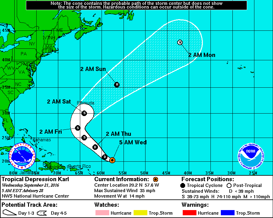
Next week, there is fair chance that the remnants of tropical storm Karl will head NE across the North Atlantic into the NE Atlantic and may affect our weather, though there is model uncertainty over the exact track of the depression forming from the remnants of Karl this far off. The Atlantic depressions that form the remnants of ex-tropical storms/hurricanes are notoriously difficult to model past 5 days. Karl may reach hurricane status as it tracks north near Bermuda at the weekend, before becoming ex-tropical.
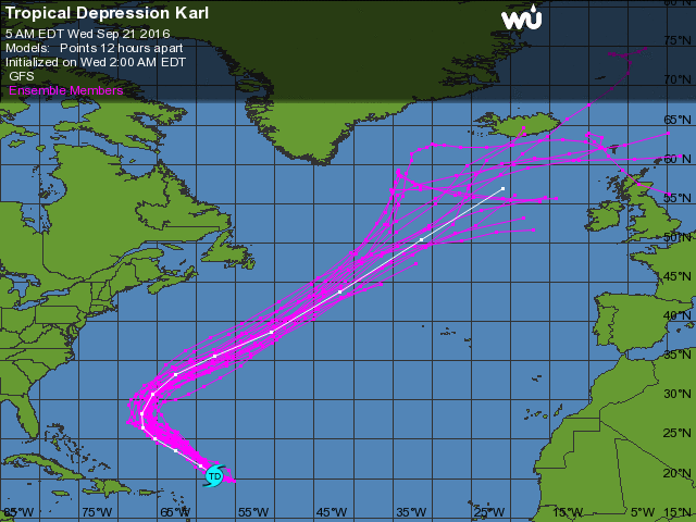
Model ensemble tracks + ensemble mean track of ex-Karl (courtesy of Weather Underground)
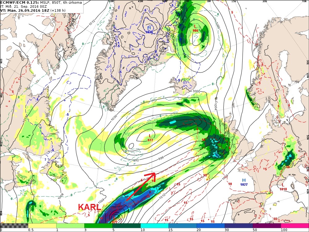
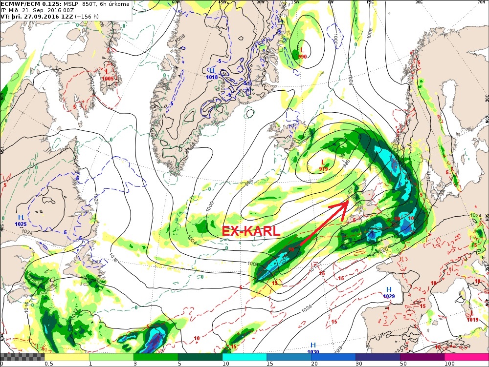
00z ECMWF operational run this morning indicates ex-Karl being picked up by the jet on Monday before being dragged by a strong southwesterly jet streak toward the UK by mid-week, deepening as it does so. On this model run, the low arrives close to N. Ireland next Tuesday evening before crossing Scotland early Wednesday. However, it’s too far off to have any faith in one model run for now. All depends on how ex-Karl phases with the upper westerlies and troughing over the NW Atlantic. GFS also takes a secondary wave, likely formed from ex-Karl, NE close to Scotland next Tuesday, with tight isobars and a tight wind field on its southern flank, bringing a risk of gales for northern and western parts.
Worth keeping an eye on how ex-Karl evolves as it gets swallowed up by the upper westerlies over the NW Atlantic early next week. If it engages favourably with any shortwave troughs in the upper flow and positions favourably with the jet streak – it may deepen into an intense depression.
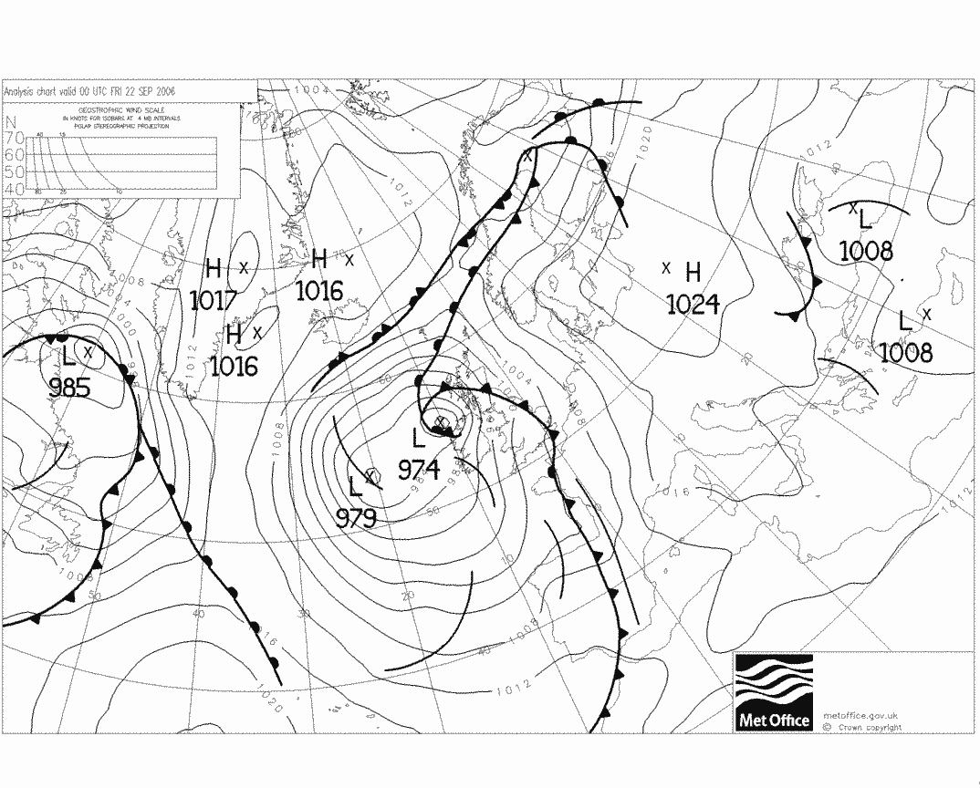
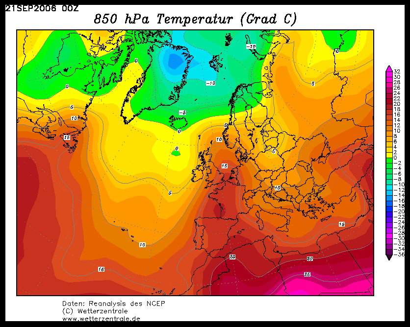
But even if ex-Karl keeps well at bay by tracking way north of the UK, ex-hurricanes or tropical storms can still drag large areas of tropical warmth and moisture northeastwards toward the UK, given its origins in the tropics. For example, Hurricane Gordon in back in September 2006 developed mid-Atlantic and didn’t make landfall before it tracked NE toward the UK. Ex-Gordon brought heavy rain and strong winds to western areas round 21-22nd, but also a plume of hot and humid air across NW Europe including the UK.
The most intense ex-hurricane to hit Britain was probably Debbie in September 1961. The US National Hurricane Centre (NHC) still classed the depression as a category 1 hurricane as it hit the coast of south-west Ireland. Winds from the storms gusted in excess of 100mph across Ireland and western Britain. A gust of 113mph was recorded at Malin Head in the north of Ireland. Many buildings and homes were seriously damaged in Ireland with hundreds of thousands of trees uprooted. Six people in Northern Ireland were killed due to falling trees.
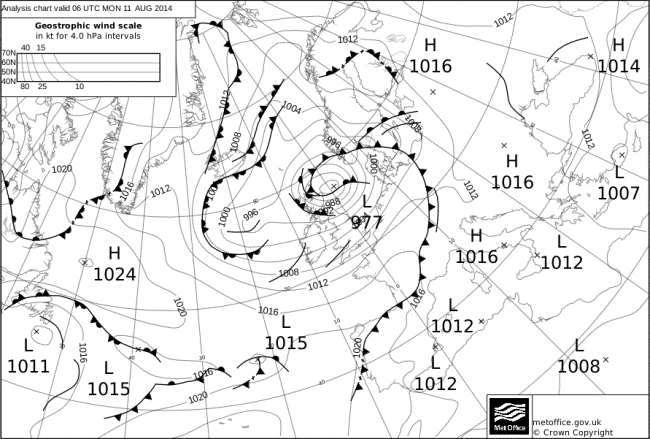
The Atlantic hurricane season has been quiet over the last few years, so the most recent ex-hurricane to hit the UK was Bertha between 10-11th August 2014. The area of low pressure associated with ex-hurricane Bertha tracked NE across Scotland then loitered off north-east Scotland where it remained centred near Shetland for several days before finally drifting east on 14 August. It brought unseasonably strong winds and flooding to NE Scotland.
Deep low associated with remnants of ex-Hurricane Bertha caused strong winds and flooding across NE Scotland 10-1th Aug 2014
Even hurricanes that stay the other side of the Atlantic can have far reaching impacts on the upper flow downstream over north Atlantic to the extent that they can create large atmospheric waves that can influence trough and ridge patterns over Europe. Any high pressure ridges that form in these waves can be more intense than usual due to the large amounts of heat transferred upwards into the atmosphere creating blocking high pressure. This can lead to intense heatwaves over SW Europe for example, as was seen in Iberia earlier this month, which may be attributed to Hurricane Hermine creating waves in the upper westerlies as it tracked NE after hitting Florida.


