
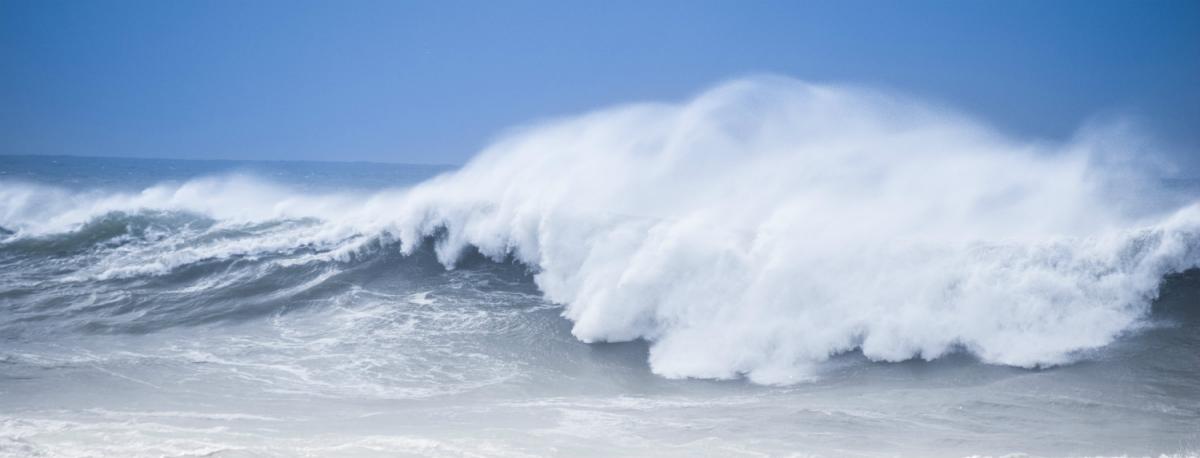
Heavy showers with hail & thunder for Easter Sunday, then Storm Katie arrives in the south for Easter Monday.
This blog is a follow-up on my previous blog issued yesterday – Synoptic Analysis Stormy Easter Weekend?
An active cold front pushed east across England and Wales Saturday during afternoon and evening – thanks to the sharpening upper trough to the west creating a belt of strengthening vorticity along the frontal zone, with the rainfall along the front turning increasingly squally with line convection evident on the radar below this evening, as the front moved towards eastern England.
Radar and fronts for 18z Saturday evening
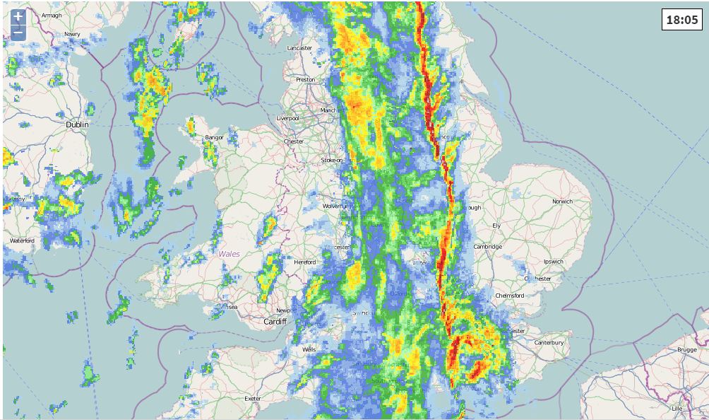
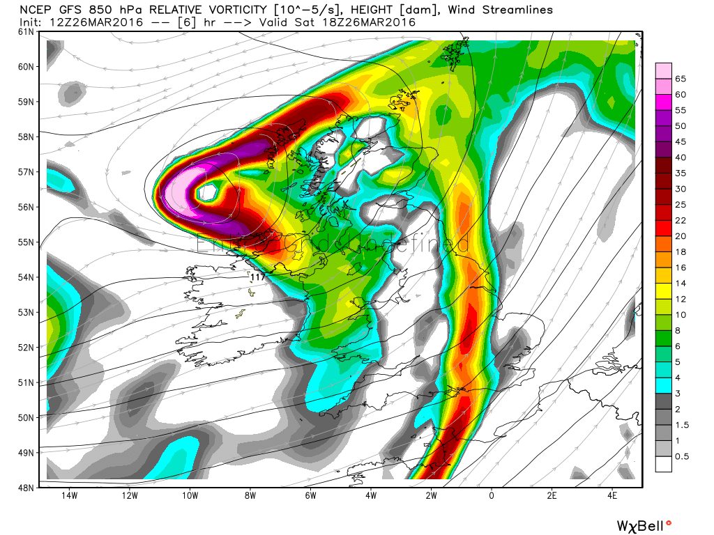
850mb relative vorticity chart for 18z this evening shows the increasing forcing for ascent along the front as the upper trough to the west sharpens
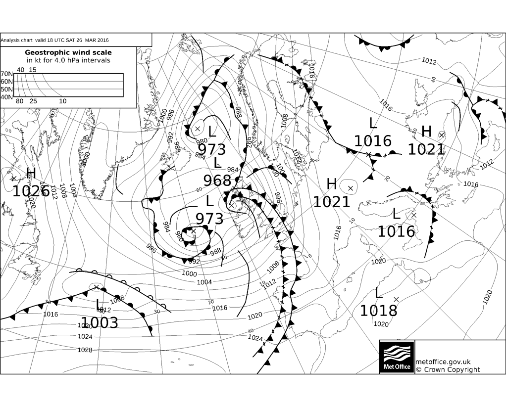
Southerly winds ahead of the front gusted to 45-55mph, but easing and veering southwesterly following clearance of the front which is now clearing out into the North Sea. Winds picking up again across north Wales, Irish Sea coasts and Scotland northern EIRE and northern Ireland though, as a deepening low moves across western Scotland this evening, with gusts of 50-60 mph possible here, perhaps up to 70mph across northern and western Scotland.
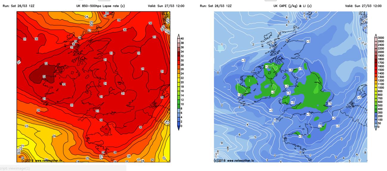
A highly unstable polar maritime airmass follows the cold front from the west this evening, overnight and through Sunday. Squally heavy showers accompanied by hail and thunder likely – particularly over Ireland, Irish Sea, Wales and SW England this evening and overnight, as the very cold airmass that orginated over the Canadian arctic (500mb temps below -30C) becomes unstable to sea surface temperatures. During Sunday, the cold polar maritime airmass will become unstable inland aswell – as surface heating in the sunny spells creates steep lapse rates, particularly over Ireland, England, Wales and southern Scotland. So expect sunny intervals and locally heavy showers with hail and thunder across many parts.
Steep lapse rates and a few 100 j/kg CAPE on Sunday suggest instability = thundery showers with hail
Now on to Storm Katie, still looking likely to track ENE across southern England and Midlands on Monday morning, before exiting out into the North Sea. The low left New Foundland around late morning and will not deepen much over the next 12 hours or so as it tracks east, as the low remains on the ‘warm side’ of the strong 150mph jet stream racing across the Atlantic. However, by Sunday evening, the low turns on to the colder polar side of the jet, as a shortwave upper level trough also coming out of NE Canada catches up with the low, whilst falling increasingly in the developmental left exit of a jet wind speed max too, so starts to deepen more rapidly as reaches the SW approaches then SW England Sunday evening.
There continues to be divergence only 24-36hrs hours out over track, timing and depth. 00z GFS operational run this morning was slightly faster with Katie than 00z ECMWF, GFS had the centre over Bristol at 00z Mon, while ECM has the centre NW of Cornwall.Both similar in track, though, exiting the low around Lincs/Humber - though GFS exits before 6am whilst ECM does it around noon. The 12z GFS further south in track than 00z GFS, exiting the low around the Wash 6am Monday, strongest winds limited to the English Channel and southern coasts and also SE England into southern East Anglia. 12z ECMWF again slower than GFS, and some 5-10mb deeper, though similar in track, with the low not exiting the Wash area until late morning.
12z GFS brings gusts of up to 80mph at 00z Monday across the central English Channel. Both 12z ECM and GFS generally bringing gusts of 60-70 knts through the English Channel and along Sussex and Kent coasts in the morning, 40-60knts inland across SE corner and E Anglia.
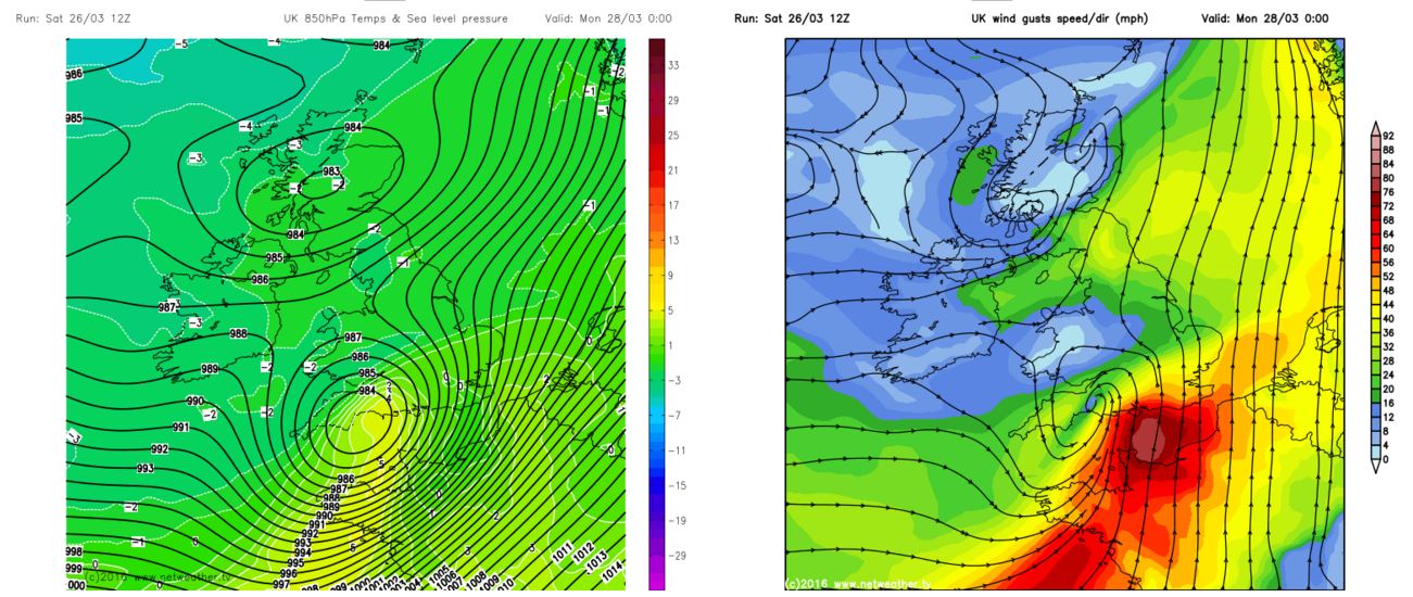
So disruption from strong winds likely to be confined to south coast and far SE of England as it stands, though the track and depth of the low still needs monitoring with regards to extent and strength of potentially damaging winds. Some heavy rainfall wrapping around this low too, models indicating high rates across Wales and the West Country in particular. Some rainfall convective in nature too, so a risk of localised flooding.


