
Blog looking at a persistent synoptic pattern that promises a chilly to cold start to meteorological Spring, with a likely cold early March

With plenty of sunshine on offer these last few days and some vague warmth now from the sun when sheltered out of the cold wind, it is perhaps evoking thoughts of spring finally round the corner. However, the old weather saying of “as the days get longer, the cold gets stronger” may ring true as we head into early March.
Following an exceptionally mild and wet December, followed by warmer-than-average January, it seems that colder conditions have finally arrived as we draw meteorological winter to a close.
It’s turned colder this past week, as winds came down from the arctic earlier in the week. The colder air lingering as the milder tropical maritime air has kept well at bay, as we stay on the cold side of the jet stream – which is well to the west diving SE from Greenland into Iberia (below):
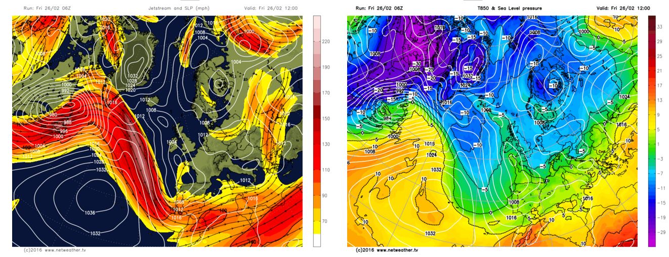
Though despite quite cold air aloft, ranging between -5C to -8C at 850 hPa (about 1500m up), the sun is now radiating more warmth and has been warming up the layer near the surface, so it has been pleasant in the sun with shelter from the cold breeze. In the south temperatures have been rising close to average by day, thanks to the sunshine giving a little warmth. But it’s the nights that really remind us that we are in a cold airmass, with hard overnight frosts widespread where skies clear.
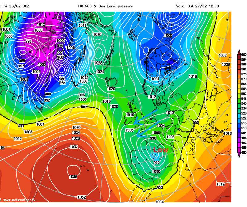
Subtle changes in the pressure pattern as we head into the weekend, as low pressure close to Ireland sinks south across western France then Iberia before extending east across Italy. High pressure building down across northern UK in its wake will squeeze the isobars across southern parts – which will mean a brisk easterly wind develops. So despite screen temperatures reaching 6-9C in the south, it will feel much colder in the raw wind. It will be mostly dry over the weekend, and so feeling pleasant in any sunshine in the lighter winds in the north, but it will feel chilly in the shade.
Turning more unsettled as we head into the beginning of March next week. It will initially turn less cold from the west during Monday, as wind, rain and milder tropical maritime air off the Atlantic pushes east during Monday and Tuesday. The milder conditions will be brief though, as after the rain clears, progressively colder air spreads southeast, as low pressure near Iceland on Tuesday moves southeast into the North Sea on Wednesday. Though the colder air not arriving across the south until Wednesday as winds veer north of west.
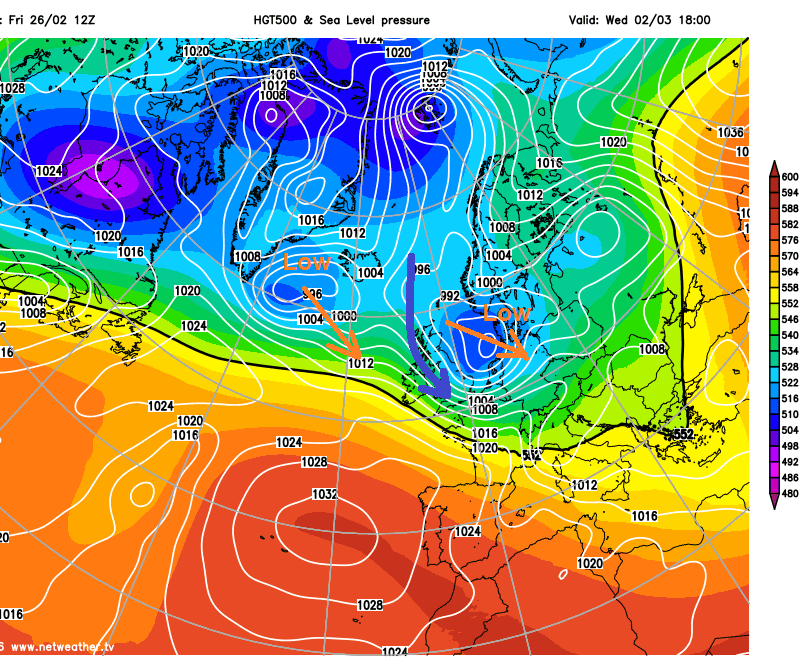
The showery northwesterly flow Wednesday into Thursday cold enough across northern areas for snow to fall in any showers, chiefly over higher ground, but perhaps to lower levels in the heavier showers. Weather models in broad agreement for later in the week of a low pressure system dropping SE towards Ireland by Friday, uncertainty thereafter where this low tracks and also how quickly low pressure further east over Denmark/N Sea clears SE into mainland Europe. The both merging on 12z GFS into a broad multicentred low pressure system covering much of northern and western Europe, with a north to northeasterly flow across the UK. Whilst the 00z ECM deterministic run earlier today confined low pressure to France, Spain, the Alps and SE Europe with high pressure over UK and Scandinavia to bring an easterly flow once again across the UK.
12z GFS for late next Friday
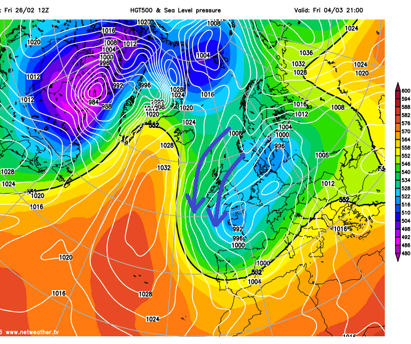
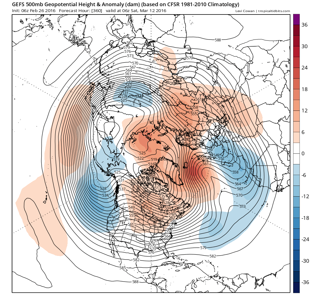
Either way, the weather model operational runs today see chilly to cold conditions maintained across the UK next week and into the following week. This is backed up by recent extended ensemble runs from ECMWF and GFS weather models, which at day 15, signal a persistent upper trough anomaly over SW or southern Europe, with an upper high anomaly over Iceland and also over Kara Sea and NW Russia. This is a synoptic pattern maintained out to day 32 on the ECMWF monthlies which update twice a week. Furthermore the Madden Julian Oscillation (MJO) is currently in phase 8 at a fairly decent amplitude. Phases 7, 8 and 1 of the MJO wave over the global tropical belt is correlated with more blocked patterns at higher more temperate latitudes of the northern hemisphere where polar front jet exists. Which tends to more likely allow cold air to escape from the high arctic southwards across Europe.
Today's ECMWF MJO forecast
.gif)
00z GEFS 500mb ensemble mean and anomaly for day 15 (blue = troughing; red = ridging)
So chilly to cold conditions look to be maintained well into March, with protracted risk of overnight frosts and occasional, albeit difficult to predict, risk of snow in places. Chiefly for higher ground in the north, but not exclusively, depending on how favourable colder conditions are in the south.


