A look at where Thursday's wintry weather is heading and if there will be any more on Friday.
Scotland and N.England, N.Wales have already seen snow throughout the night. Thursday morning brought wintry and windy conditions to NE England with blowing snow for the higher routes. As the low pressure responsible swirls away into the North Sea, it is still trailing more rain/sleet and snow over eastern England, over East Anglia.
Where next?
The Lincolnshire Wolds could see a covering of snow this afternoon. This evening inland parts of Norfolk and Suffolk could also see lying snow as the wintry weather sets in for a few hours. Added to the wet weather there will be strong NW winds. These will reach gale force along the coasts with gust over 50mph here. This meaens there will be blowing snow and hazardous conditions as people travel in the evening commute.
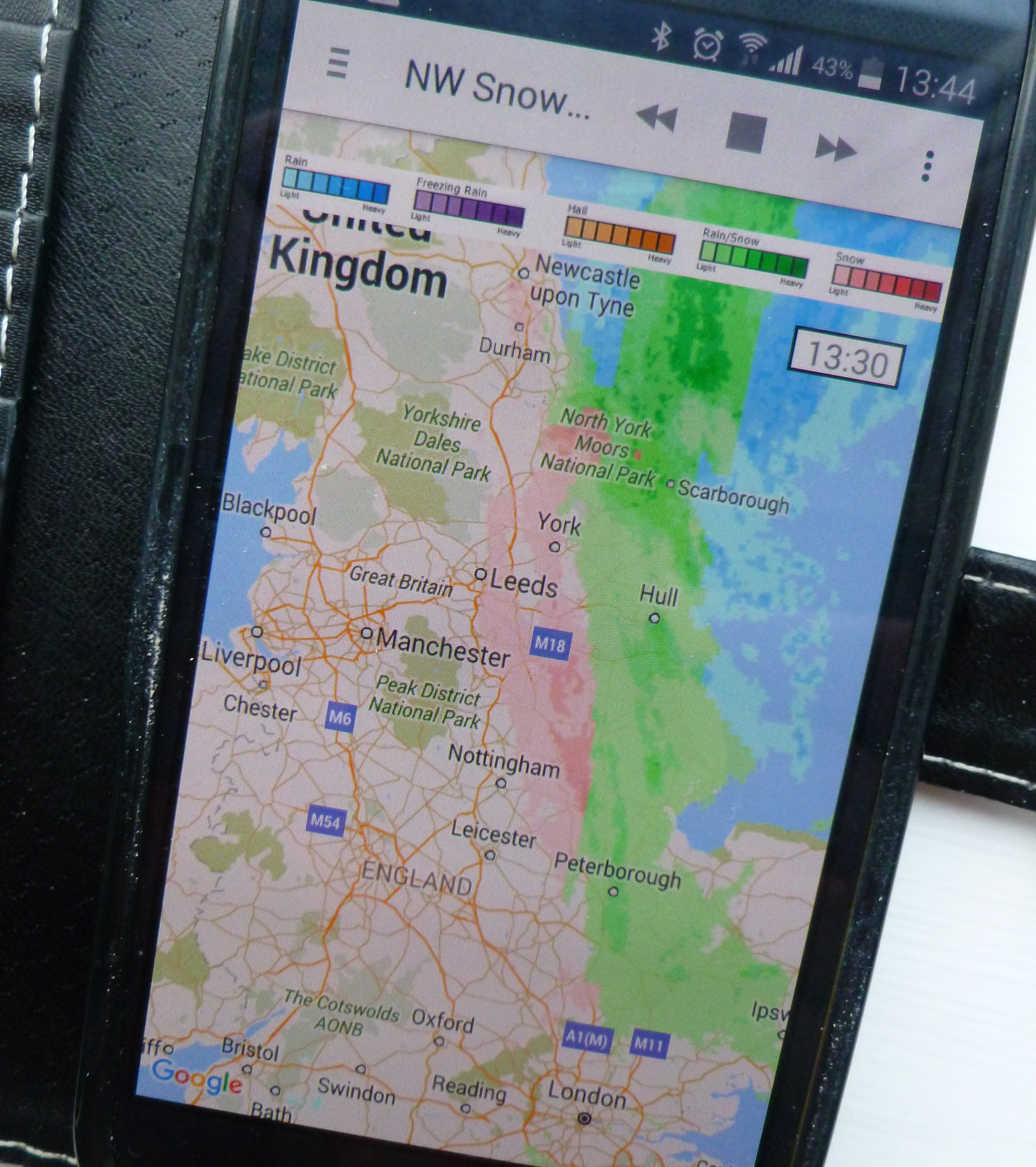
Netweather Snow App, showing today's sleet (green) and snow (pink) moving towards East Anglia
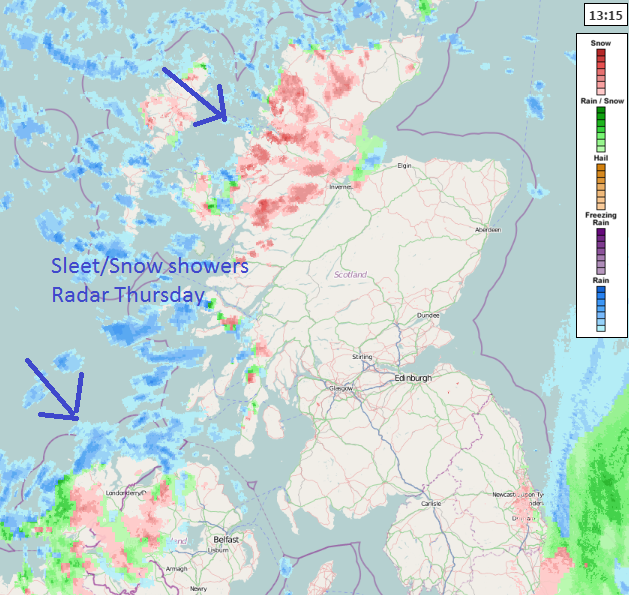
Further north and west there have already been a rash of wintry showers with rain/sleet and snow coming into N.Ireland and NW Scotland. These will make further progress inland by late afternoon, scross the Great Glenn and over much of N.Ireland, with snow lying over the hills in the west. These sleet and snow showers will spread to SW Scotland and NW Wales by evening. There will be a period of snow for west Wales into the night, and wintry showers over SW England with snow over the Moors.
Tomorrow
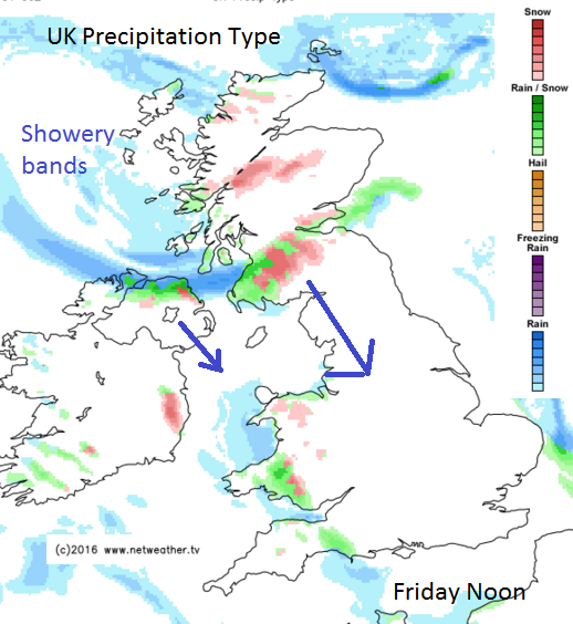
This feed from the NW continues on Friday, reaching further inland for Scotland. So snow showers again for N.Ireland, Wales, NW England, the Pennines and Peak District by the afternoon.