Latest Synoptic Analysis looking at a stormy run into Christmas, Storm Eva arrives later Wednesday, bringing wind and rain. Colder by Christmas Day, though turning milder after.

A strong westerly jet stream will continue to drive a stormy period of weather for the rest of this week, the jet fired-up by a steep temperature gradient between deep cold over Canada and Greenland and warm air spreading northeast across eastern USA and the NW Atlantic. A succesion of lows caught under this jet stream will throw a succession of frontal systems across the UK for the rest of this week, bringing further spells of rain and strong winds. It does turn colder across the north in time for Christmas Day, though any snow looks to be confined to the mountains and highest hills.
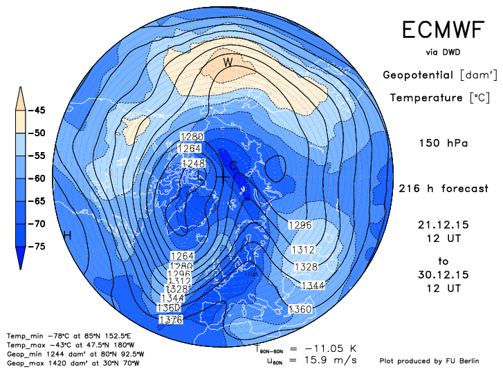
Starting with Wednesday, a sharpening shortwave trough in the strong Atlantic jet stream, as a chunk of cold air shedding off the polar vortex drops south, will drive deepening Storm Eva (currently a wave the NW Atlantic) northeast towards the Faroe Islands by Wednesday night.
Storm Eva deepens mid-Atlantic under strong jet on forward side of a sharpening short-wave trough as chunk of cold air breaks from the Polar Vortex
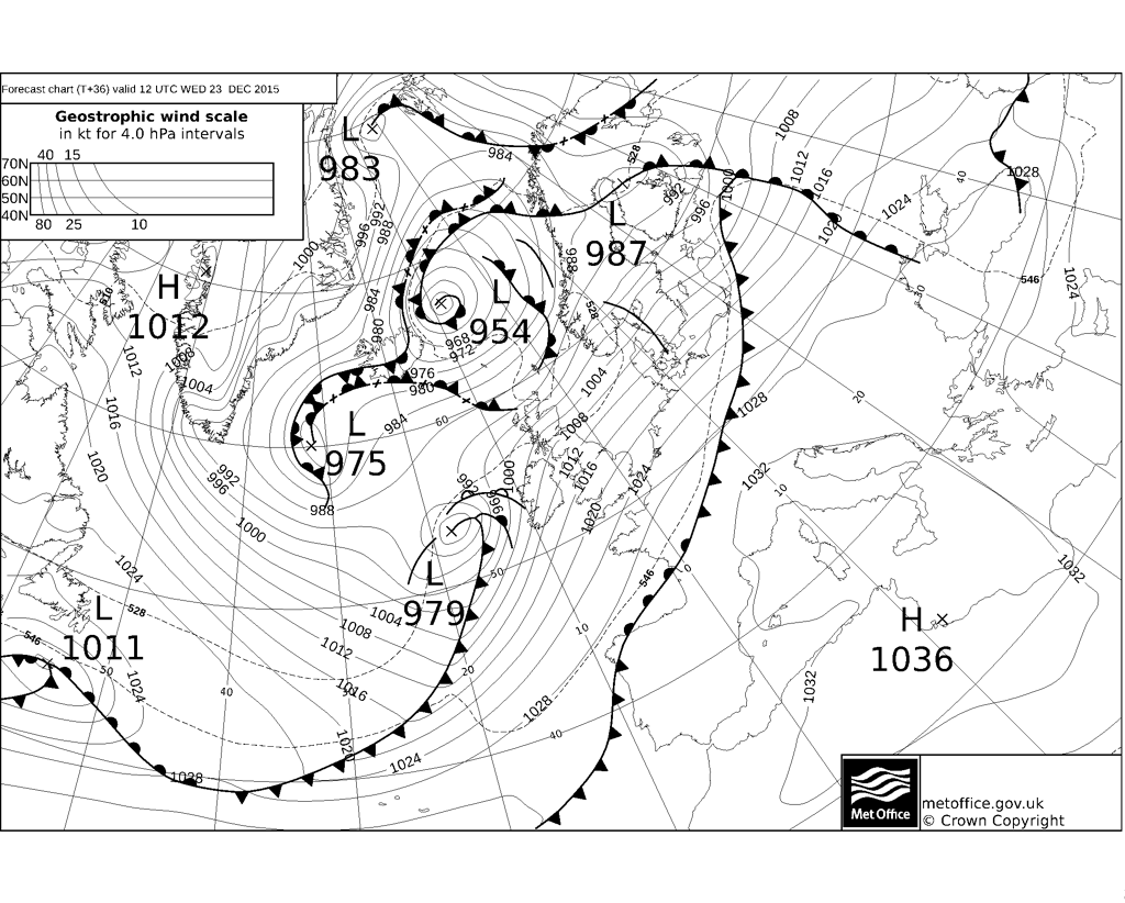
Wednesday actually looks the driest day of the week on the whole, with showers becoming confined to western Scotland and sunny spells for most, though turning increasingly windy, as deepening Storm Eva passes to the NW of Ireland by the evening. Gales or severe gales look to develop across Ireland, N. Ireland, west Wales, NW England and Scotland later in the evening and overnight – a yellow warning for strong winds has been issued by the Met Office. The strongest swathe of S/SW winds coincides with a cold front which will bring a spell of rain eastward across these same areas during the evening and overnight into Xmas Eve, a yellow warning for rain has been issued by the Met Office for risk of further flooding.
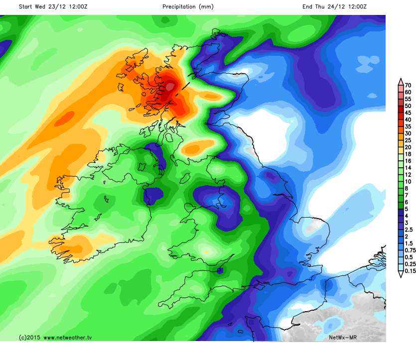
Rainfall accumulation starting Weds 12z ending Thurs 12z - western Scotland and southern uplands seeing highest totals
Christmas Eve starts wet and windy across northern and western areas, the cold front and its belt of rain transfers towards eastern England in the afternoon, the rain become less intense and winds less strong as it reaches the east. Colder, clearer but showery conditions follow from the west, cold enough across Scotland for showers to fall increasingly as snow over hills of Scotland, northern England and the highest ground of north Wales.
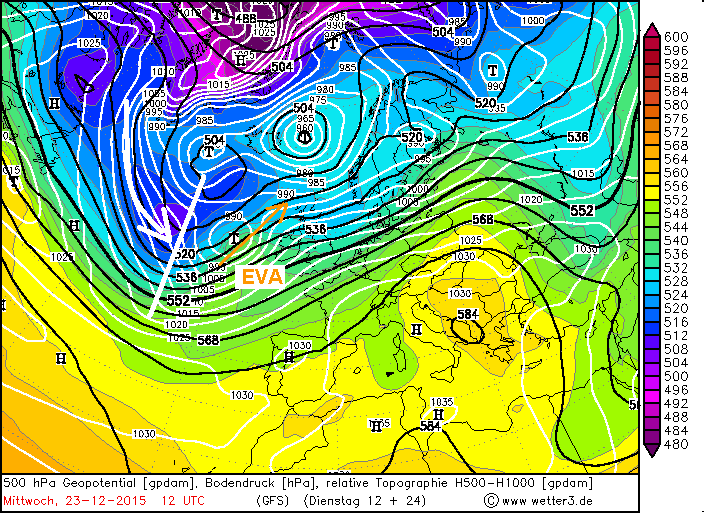
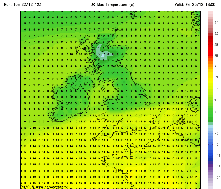
So a mostly dry, chilly and bright start likely on Christmas Day, perhaps cold enough for a touch of frost in the north and risk of snow falling from any showers in the far NW for a time in the morning. However, the weather is set to change through the day, as the next low pressure system approaches over the Atlantic, which will pull milder air with cloud and rain north across southern areas to end the day. This next depression comes out of NE Canada/New Foundland on Wednesday as a fairly innocuous low, but another sharpening shortwave trough digs into the jet stream, as deep cold breaks off the Polar Vortex over Greenland, causing the low to deepen over the Atlantic – as it moves east on the forward side of the shortwave. The low does look to weaken though as it it approaches the NE Atlantic, turns/forced northeast to the west of Ireland by the blocking ridge of high pressure over mainland Europe. This seems to be in response to a temporary amplification (buckling) of the jet stream as the jet comes up against the blocking high over Europe. Some uncertainty, then, on how quickly this low approaches the west, and therefore how far north cloud and rain along the warm front extends on Friday. 12z GFS brings rain north across much of England and Wales by late Christmas afternoon,turning heavy across northern and western areas. Also turning milder across the south too, with temps 12-14C. In contrast to the north – where highs of 5-7C are more likely.
Milder air spreads in across the south on Xmas Day - temperature contrast north to south:
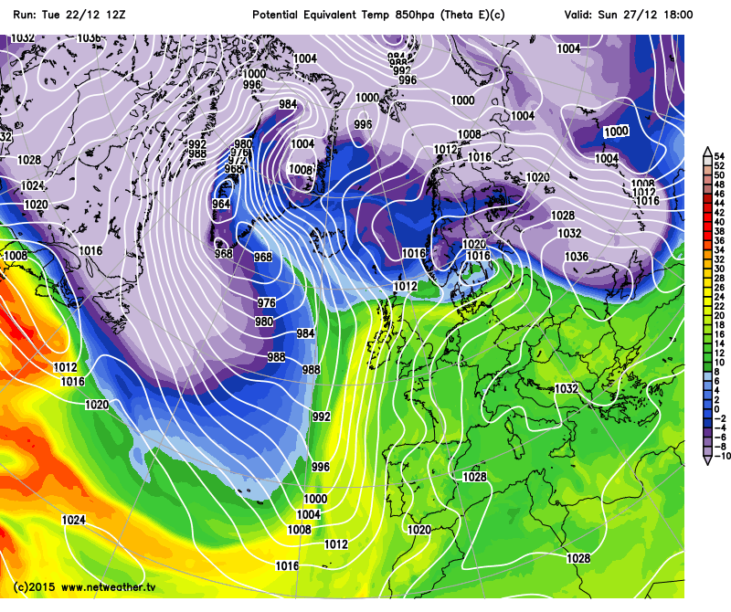
Then the weekend is looking rather mild again, as we see weather fronts retreating and becoming slow-moving across the north and west of the British Isles and a strong tropical maritime southwesterly flow covers the UK sourced way from the SW over Madeira/Canary Islands. Temperatures widely reaching 12-14C across England and Wales on 12z GFS. Heavy rain indicated across northern and western areas from Friday afternoon through Saturday before clearing north and perhaps more rain arriving across the northwest on Sunday, so no good news for areas at risk of flooding recently.
Mild and moist Tropical maritime (Tm) air drawn from way to the SW for the weekend - bringing well above average temps
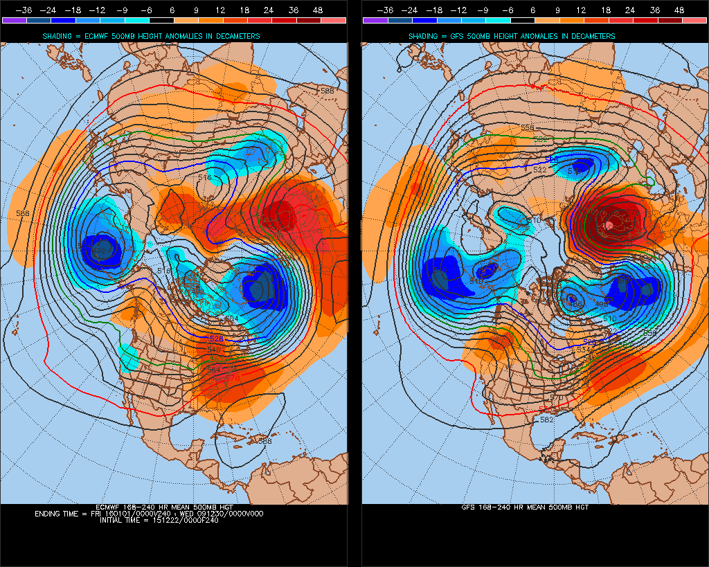
Next week, remember above I mentioned the Atlantic jet buckling as it come against the ridge of high pressure over mainland Europe? Well, as the Atlantic trough amplifies/deepens southward in response, the high pressure over Europe amplifies north across Scandinavia and we get a big north-south 'Sceuro' (Scandinavian/Euro) ridge. This Sceuro ridge may become, as per 12z GFS operational, a formidable block to Atlantic systems getting past the 0 degree Meridian, so those Atlantic lows stay close to the west and high pressure close to the east, a mild southerly or southwesterly flow across the UK. A kind of stalemate, with Atlantic fronts with their bands of rain trying to push east next week but getting no further than the North Sea before fizzling out. Sometimes the high pressure to the east retrogresses west, as the jet goes underneath the block, bringing cold air to the UK. But this scenario appears unlikely for now, given the strength of the jet stream against this blocking high and it tendency to divert north rather than SE. GFS is keen to hold a block to the east, though 12z ECM Tuesday evening has a lot more energy in the Atlantic, so the ridge collapses next week.
Next week, an amplified trough/ridge with ridging to east preventing west to east movement of Atlantic systems, 12z GFS operation has a stronger ridge to the east than 12z ECMWF (which eventually collapses the high)
So very mild, generally, all the way to end of the December. In fact this month could end up in the record books given the duration of exceptionally mild days and nights. Hints of cold and wintry weather in the New Year? No signs of from the extended range of the model output. Though some long range forecasters have hinted that a Sudden Stratospheric Warning (SSW) may occur later in January, which could displace or even split the Polar Vortex, bringing an increased likelihood of cold and wintry weather to Europe and the UK and/or USA. The polar vortex is currently getting a few knocks from wave activity caused by ridges, such as the one building north in the troposphere across Scandinavia next week. Continued attacks from these waves make weaken and displace the vortex in the New Year, though there is no guarantee, given the strength of the stratosphere Polar Vortex this winter. The troposphere pattern has and can change in favour of more sustained cold and wintry weather for the UK before any SSW, though there are no signs from the models of this occurring for now.
Ridge building north over Scandinavia next week shows it effects in the lower stratosphere next week