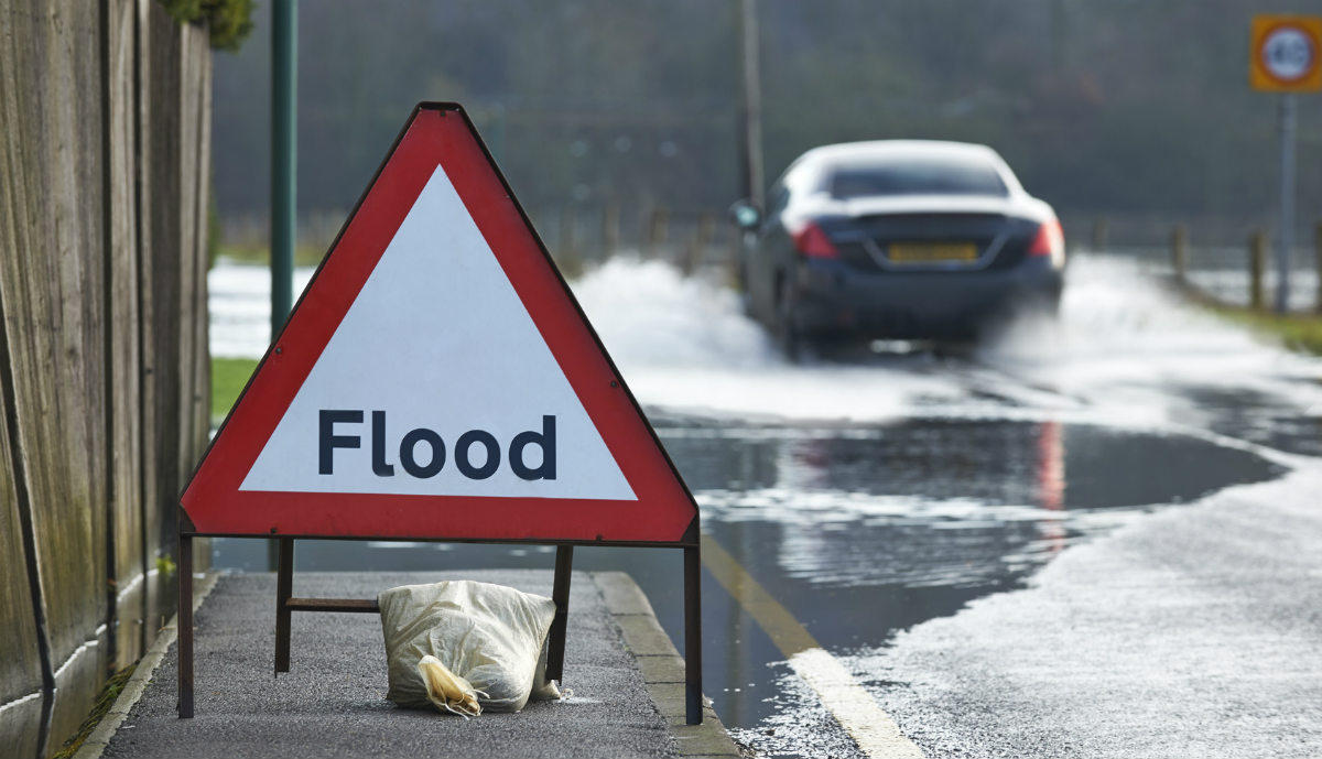
After the torrential rains of the weekend, what does this weeks weather have in store for the flood hit areas?
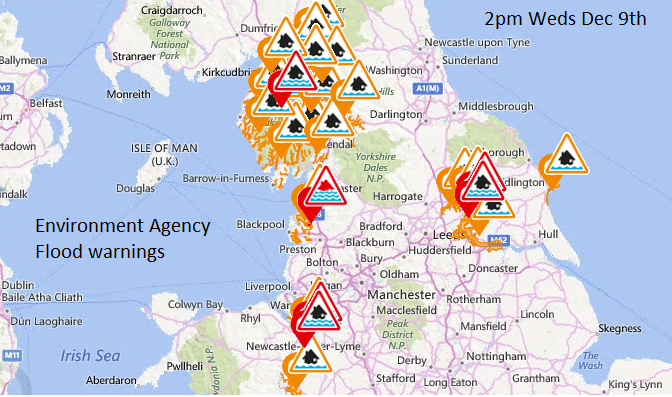
This is the picture of Flood warnings and Flood Alerts as issued by the Environment Agency for England and Wales at 2pm on Wednesday. So 5 days after Storm Desmond first brought wet and windy weather to the UK. There is still one Severe Flood warning, just north of Preston on the River Wyre, which means there is still a danger to life from the situation in that area.
The flood hit areas could do with a length dry, settled spell to recover from the huge amounts of water which swept throguh their towns and to enable homes/businesses, pitches/fields and roads/railways to dry out. However, the weather is set to stay unsettled with further spells of wet and windy hurling themselves in from the Atlantic.
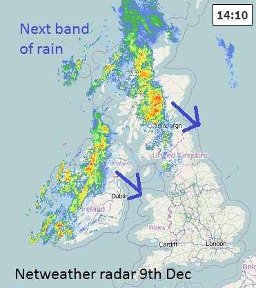
Wednesday into Thursday, a cold front from a low to the NW of UK will bring just over an inch to a central swathe of the UK, with 60-80mm of rain possible for the hills, again of Cumbria, S.Uplands and Snowdonia. Western Scotland is in for a very wet few days with over 50mm (2" ) for Weds and Thurs and nearer 20mm by Friday from lingering showers. There are still many Flood alerts from SEPA for central Scotland, in Tayside and reports on Wednedsay evening of flooding affecting the A84 near Callander. N.Ireland sees moderate rain today in the west but avoids much of the heavy rain this week.
The Environment Agency 3 days flood warning page keeps a LOW risk of flooding for Cumbria with re-flooding possible and further travel disruption. Lancashire, Wales and N.Yorkshire are also at risk. For the next three days, there is an ongoing risk of river flooding for the River Dee in Cheshire and the River Ouse in the City of York.
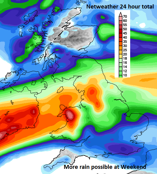
There is a slight lull on Friday but the weeekend sees rain arriving from the SW. Milder air after a chilly Thurs/Friday. Friday brings a slight lull. Then rain begins to feed in from the Altantic, Wales looks to be in the firing line, the Midlands into N.England. There is some uncertainty about where exactly the path of the heavy rain will go or if it will meander about, avoiding very high totals for just one place.
Keep an eye on the actual rainfall with Netweather Radar here