


An El Nino event has been established in the Pacific, does that mean the UK will definitely have loads of snow this winter?
Meteorological organisations around the world have been announcing the onset of an El Niño event this week, part of the ENSO , El Niño Southern Oscillation. El Niño was supposed to have been first identified by Peruvian fishermen who noticed warm waters off the west coast of South America around Christmas time. The name of Little Boy child, Christ coming from that time of year.
Most of our UK weather forecasts look at Synoptic patterns over Europe and the Atlantic for the next 5 days, sometimes trends out to 10days. There are larger longer term patterns which affect climate forecasts around the world over 6 months to several years. The one in the news this week is the El Niño as it has been linked to extreme weather around the world previously. Identifiable differences in sea temperatures occur west to east across the Pacific Ocean and alter the circulations in the atmosphere above. This pattern across the Pacific has 3 stages on a sliding scale, the opposing La Nina (girl), Neutral and El Niño and generally the oscillation takes a few years to move about and back again. Sometimes it falters and there maybe a weak La Nina, or a longer neutral time with no real El Niño, or like now signs of a strong El Niño event. It doesn’t fit tidily into equal segments.
El Niño is a disruption of the ocean-atmosphere system in the Tropical Pacific having important consequences for weather and climate around the globe (NOAA)
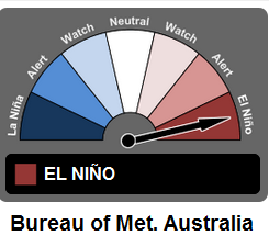
The Australian bureau of Meteorology issue their ENSO wrap-up each fortnight as the effects are more pronounced and researched around the Pacific basin. Still language used is “El Niño is often associated with…” These are not definite predictions
“El Nino to bring harsh winter to UK”
“Britain to be battered by snowstorms and freezing temperatures next winter as first El Nino cycle begins for 5 years”
The Indie did well:
“El Nino has arrived in Pacific Ocean and its effects could be ‘substantial’”
“El Niño could give Britain a cold, wet summer”
We could have a cold wet summer; some people would say that is more likely than not anyway us being in the UK. We could have another harsh cold winter, like 2009/10 which did coincide with the last El Niño event but it is a complex picture with no direct route from El Niño to the UK weather.
This oscillation, a climatic variation should be seen as a change of the odds. Events maybe more or less likely in a certain year. More storms, less drought, higher rainfall and so risk of flooding, lower temperature etc. It doesn’t mean it will be a white Christmas this year in Barnsley. There are signs that an El Niño event can be linked to changes in the NAO, North Atlantic oscillation and cause a higher likelihood of blocking patterns. So to get a proper winter over the UK with lengthy cold spells and the chance of a beast from the east bringing heavy snow from Siberia, we need a decent blocking High pressure.
In the US, there have been drought conditions in the southern plains, fewer than usual tornados in March.
From the US NOAA forecasters “At this time, there is also considerable uncertainty as to how strong this event may become. In summary, there is an approximately 70% chance that El Niño will continue through the Northern Hemisphere summer 2015, and a greater than 60% chance that it Will last through autumn” The earlier forecast from March has just showed a weak event, so this is comparative upping of the status.
This El Nino is now being treated with the potential to be a strong event as it has started so early in the year. But this is still just a forecast.
Climatological studies of El Nino have shown: In Europe Iberia (Spain and Portugal) and south/west France have been highlighted as being more likely to see wetter weather in an El Nino year, during Aug-November. Temperatures over central/southern Europe could be higher for October/November time. But sometimes El Niño has a 'none result' and these variations don’t occur. It’s not straight forward
The effects around the Pacific have perhaps been easier to identify due to it being a huge ocean mass. The warming of the seas, will cause more clouds to form and then rain, the cooler side will see the opposite. In the northern hemisphere, there is a whole lot of land, bringing in other factors to lie over and around any El Niño influences
A strong El Niño event would suggest more extreme weather events around the world, with Europe perhaps feeling these effects most early 2016. We all remember the wet UK summers when the jet stream just got stuck in the wrong place and the lows and rain just kept on coming for August.


